
News
360photosurvey.com celebrating over 100 years of aerial photography in our family
Celebrating over 100 years of aerial photography in our family.
In 1918, Flt Lt Colin Radcliffe (featured in the left image, center smoking the pipe) served as an aerial photographer in 7 Squadron of the Royal Flying Corps, which later became the Royal Air Force. He flew missions in Belgium and witnessed the horrors of the trenches from above, and following the armistice serving with his squadron as part of the Army of Occupation in Germany.
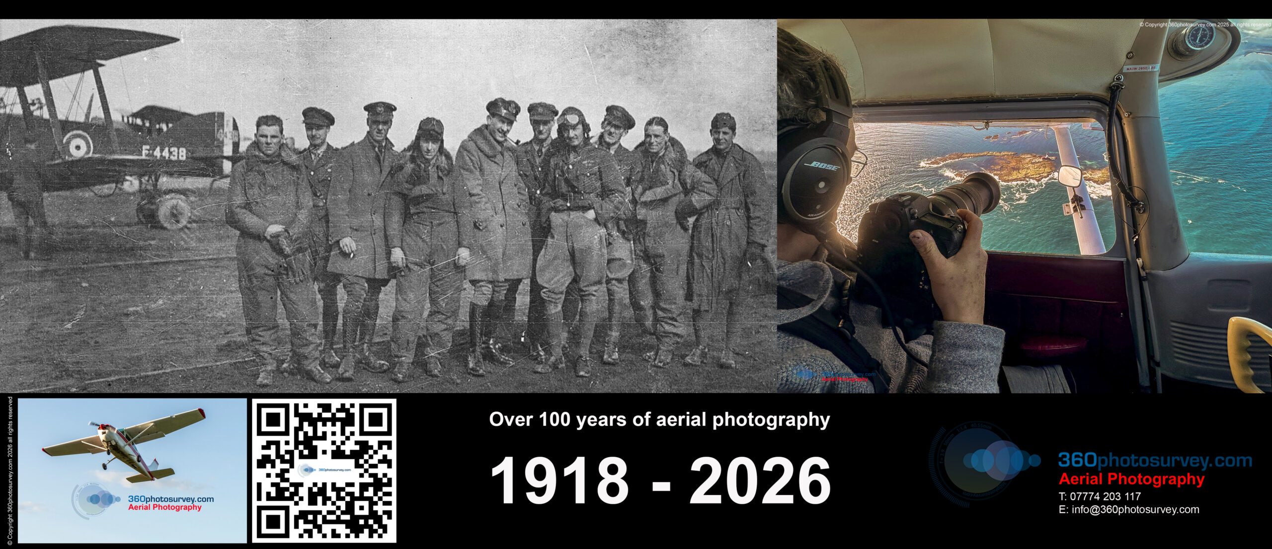
Over 100 years of aerial photography
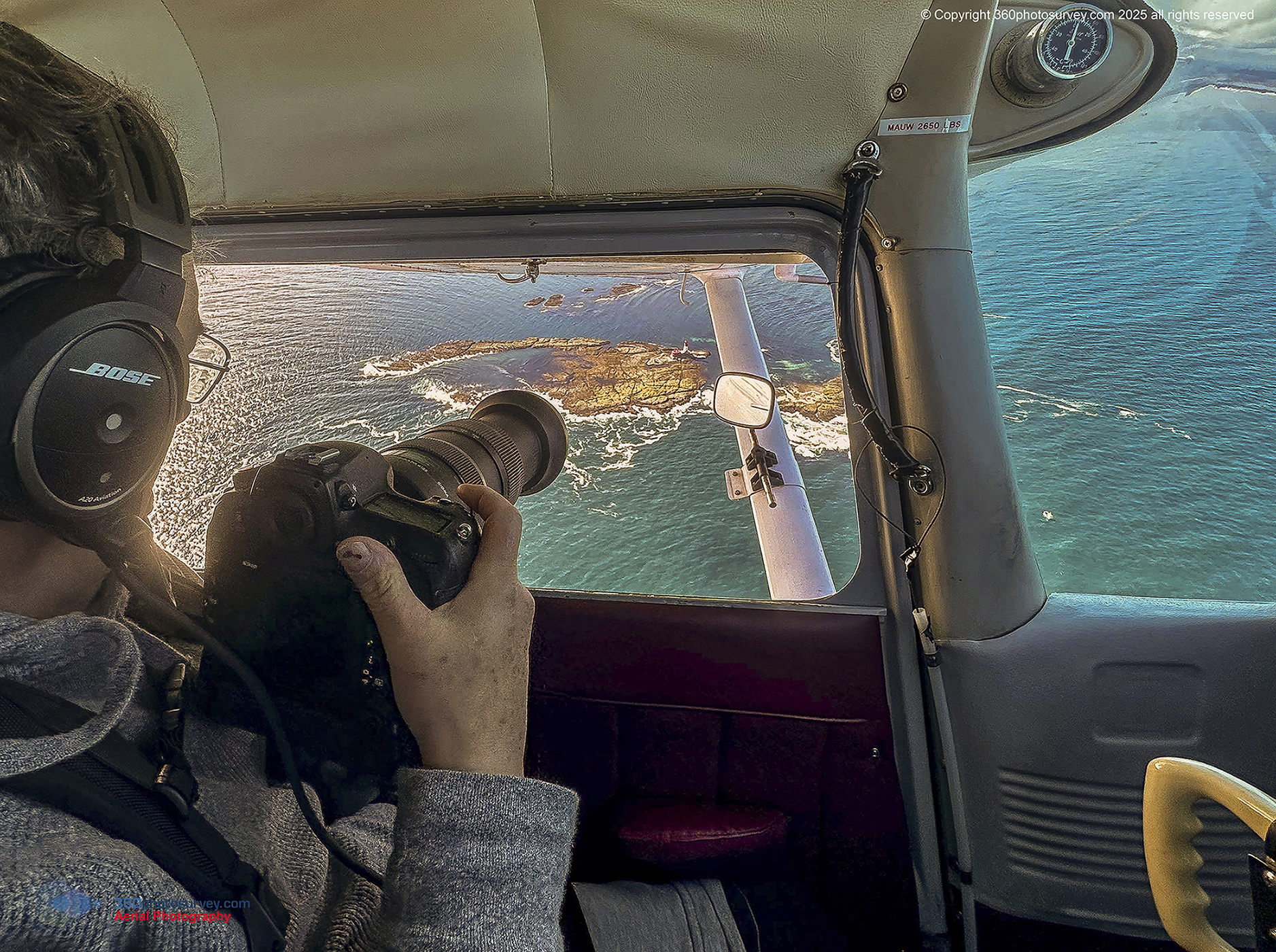
Fast forward over a century, and Colin’s grandson Chris Billington (right image) continues this legacy by providing professional aerial photography from full-size real aircraft through his company, 360photosurvey.com, shooting the more peaceful construction, infrastructure projects and commercial real estate for his customers.
The Professional`s choice for aerial photographer gets a new website
Professional Aerial photographer 360photosurvey.com new website go`s live.
Experience unmatched aerial photography with 360photosurvey.com, where innovation takes flight. Unlike drone operators limited by regulations, altitude, and technology, we specialise in capturing the world from a higher perspective, using full-size, CAA licensed aircraft piloted by highly experienced professional pilots and guided by our skilled onboard photographers.
Our unique approach means:
Aircraft and pilots – CAA licenced for commercial aerial photography operations.
Professional Pilots and Photographers – With a proven and valuable reputation for working efficiently and quickly, avoiding disruption to other air users, proving a valuable asset, particularly with our regular flight operations within controlled airspace at major airports, Air Traffic Control know we don`t hang around, avoiding any disruption to airport operations and maintaining safety as a critical requirement.
Access to More Sky – We operate within both controlled and restricted airspace — including at busy airports and other sensitive locations — enabling us to photograph subjects simply out of reach for drones.
Superior Image Quality – Every image is composed in real-time through the eyes of our onboard human photographer, ensuring precise framing and exceptional clarity that no remote screen can match. The results are stunning, high-resolution photographs that highlight your assets in their best light from a unique perspective.
The Professional`s choice for Aerial photographer UK
Discover what’s truly possible when you elevate your story. Our seamless blend of advanced aviation skills, photographic excellence, and operational precision allows us to capture unique aerial perspectives that set your project apart.
Happy New Year from professional aerial photographer 360photosurvey.com
Happy New Year from 360photosurvey.com and wishing our clients and colleagues all the very best for 2025.
We are excited to announce that we are currently accepting orders for aerial photography services for our first aerial photoshoot flight operation of 2025 in January.
At 360photosurvey.com, we pride ourselves on using full-size aircraft for all our clients aerial photography needs, ensuring high-quality results for our clients.
Whether it’s capturing stunning shots for construction projects or commercial real estate, our professional aerial photographers in the UK are ready to deliver exceptional results from a unique perspective.

Professional Aerial Photographer
Photo dilapidation surveys Nottingham

Photo dilapidation surveys Nottingham
Another successful facade photo dilapidation survey at Nottingham Trent University Halls of Residence by 360photosurvey.com for Vinci Construction prior to cladding replacement works commencing.
Photo Dilapidation Surveys Greater Manchester

Photo Dilapidation Surveys Greater Manchester
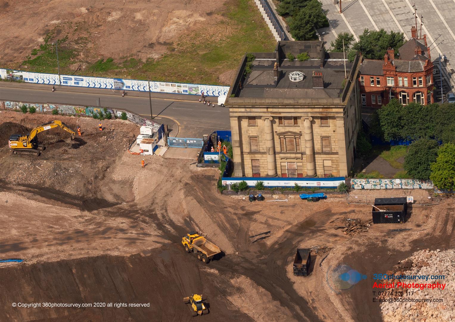
Watling Gate in Altrincham, Greater Manchester is (was) a grade II listed building (1067954). Originally built as a house circa 1910 by Newton on Bailey for Lieutenant Colonel C E Newton on the Newton family estate known as the Timperley Plark Estate in 1905.
The house was in an early twentieth century Arts and Crafts style with a plan form based on a seventeenth century hall style.
It later was used as an art gallery, museum, becoming part of the adjacent Park Road Primary School and then a nursery before falling into disuse and dereliction.
Surveyed some years back by photo dilapidation survey company 360photosurvey.com some years ago, it has steadily declined with vandalism, water ingress and collapse.
Always a pity to see such interesting buildings lost.
Latest School aerial photoshoot flight operation at completed Trinity Academy school in Barnsley
School Aerial Photographer UK
Another successful new build school project by Bowmer and Kirkland is completed at the Trinity Academy in Barnsley, Yorkshire. 360photosurvey.com were appointed to provide regular monthly aerial photoshoots of the project in our full size real aircraft with 2-man crewe comprising pilot and photographer using high specification cameras with incredibly powerful lenses. During each monthly photoshoot we undertook two circuits photographing the overall site and the buildings in close up to provide a definitive record of the project as it developed.
By using our real aircraft, rather than a drone, during each aerial photoshoot flight operation we photograph multiple sites for our clients around the UK, making it exceptionally efficient and cost effective for our clients whom include Bowmer and Kirkland, Tilbury Douglas, Kier, Balfour Beatty just to name drop 4 of our major clients.
School aerial photography – undertaken professionally – safet – efficiently and cost effectively. Call now for a fixed fee quote for your project.
NW Crewe Highways project completed with 360photosurvey providing final post completion photo dilapidation survey

Highway photo dilapidation survey UK
Two years after construction specialist photographer 360photosurvey.com undertook the pre commencement photo dilapidation survey of the proposed NW Crewe highway infrastructure project, we have just completed the post completion photo dilapidation survey of the completed project undertaken by Balfour Beatty on behalf of Cheshire East Council, including new link roads to Leighton Hospital.
Due to the high speeds of some of the roads within this project area, 360photosurvey.com used high spec cameras mounted on our Chapter 8 compliant Landrover Discovery ensuring the survey was undertaken safely, efficiently and as always professionally to provide a definitive record for the client of their completed project.
Airport Safety and Cranes
Airport Safety – crane hazards – air traffic control need to be notified + warning lights required.
360photosurvey.com is proud to uphold safety standards in aerial operations, especially near and within restricted airport airspace.
During a recent aerial photoshoot flight operation in our full size aircraft, Blackpool Air Traffic Control alerted us to an illegal crane near their airfield, visible from their Control Tower on the airfield. They sought our assistance in pinpointing its location, allowing them to address the issue promptly.
Our efficient approach and collaboration with ATC exemplify our commitment to hazard elimination in sensitive aviation environments.
Parcel delivery company Evri sold to global investor Apollo for £2.7bn.
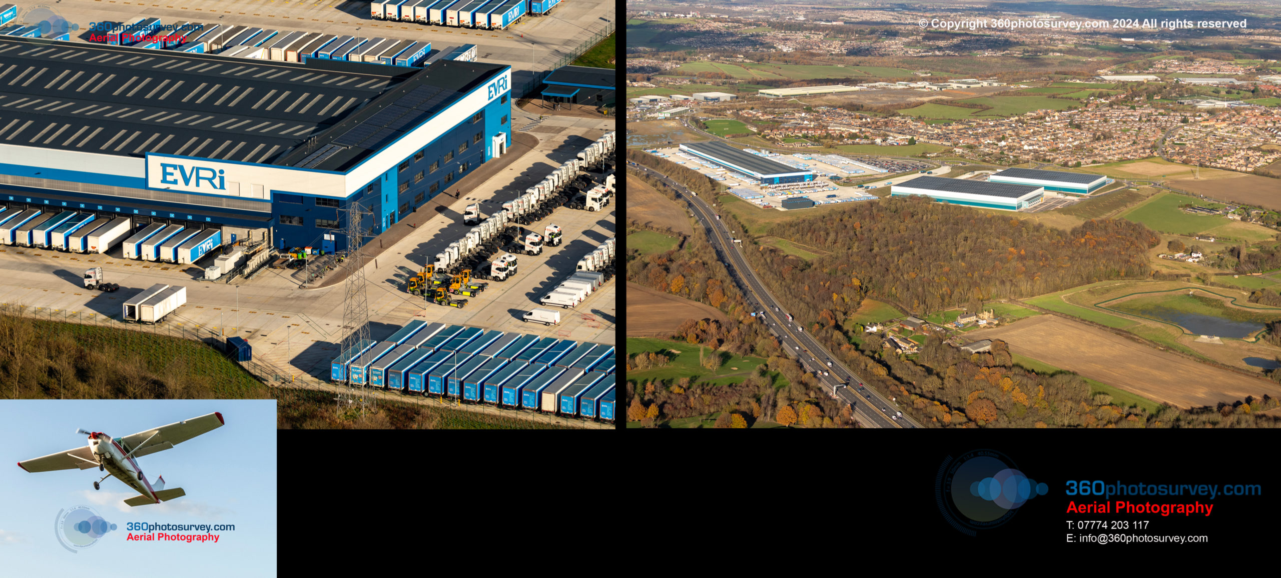
Previously known as Hermes, the Leeds headquartered Evri is a well known brand within the UK.
Aerial photos by professional aerial photographer 360photosurvey.com taken from our full size real aircraft (not a drone) at 1500 feet.
360photosurvey.com – the go to aerial photographer for commercial real estate aerial photography – professional – efficient – safe
Hapo Barges commission 360photosurvey.com for Port of Heysham aerial photoshoot
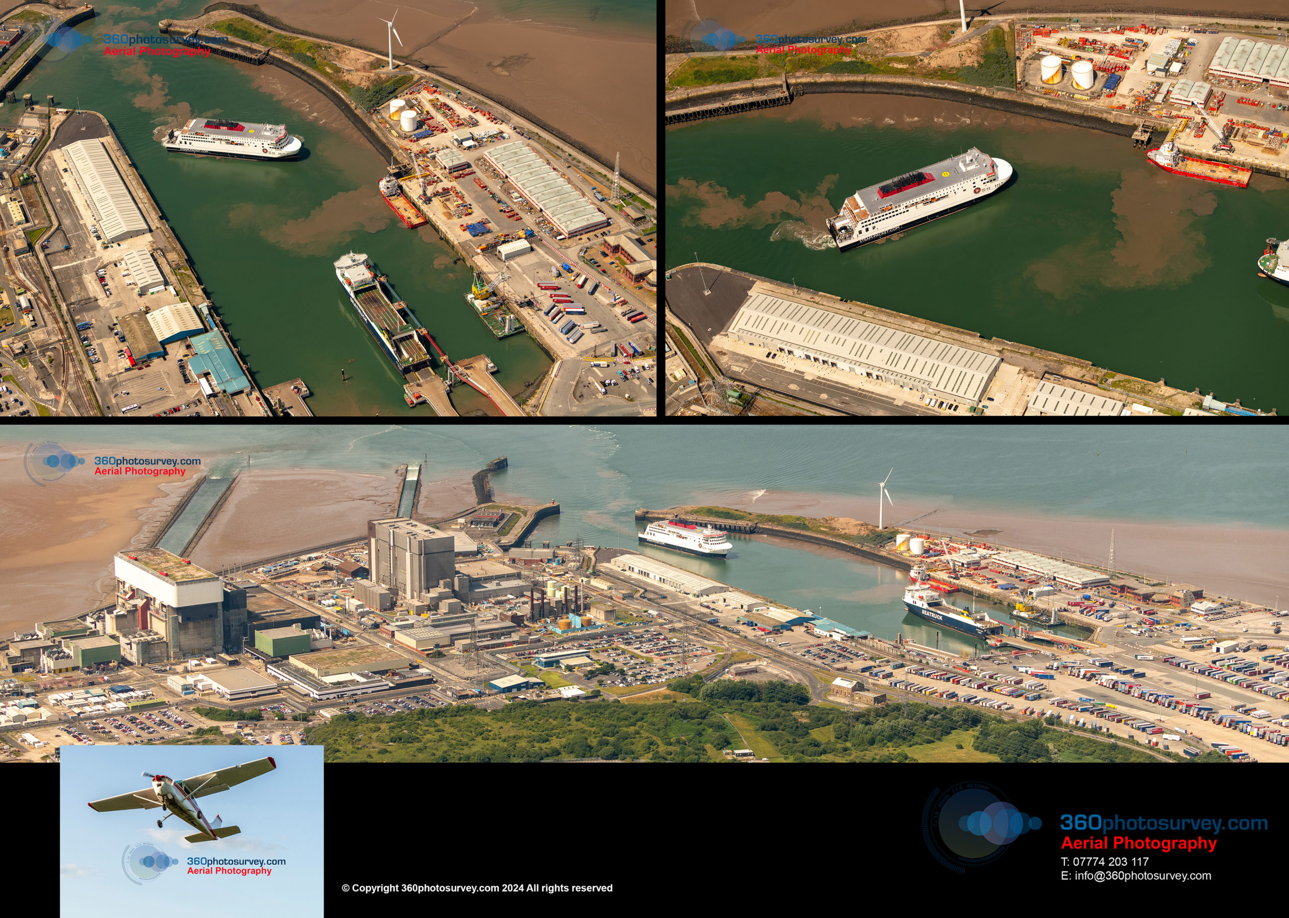
360photosurvey.com professional aerial photographer UK were commissioned by Dutch marine heavy lift specialist to undertake an aerial photoshoot of their Lara 1 250 tonne heavy lift crane ship in the Port of Heysham during our 7 hour July aerial photoshoot flight operation around the UK.
Using our full size aircraft (not a drone) and working at 2100 feet within the restricted airspace of Heysham nuclear power station we successfully provided fabulous images to Hapo from all angles around their impressive vessel. Whilst there, the Isle of Man Packet Company`s Manxman ro ro ferry from the Isle of Man arrived.
With thanks again to our colleagues at Warton Air Traffic Control.
Aerial photography undertaken – professionally, efficiently and safely.
Photo Dilapidation Surveys and Photo Condition Surveys UK
Need a photo condition/dilapidation survey?
360 photo surveys Birmingham, 360 photo surveys Liverpool, 360 photo surveys Merseyside, 360 photo surveys Derby, 360 photo surveys Wilmslow, 360 photo surveys Macclesfield, 360 photo surveys Salford, 360 photo surveys Bolton, 360 photo surveys Blackburn, 360 photo surveys York, 360 photo surveys Hull, 360 photo surveys Lancaster, 360 photo surveys Kendal, 360 photo surveys Windermere, 360 photo surveys Ambleside, 360 photo surveys Stoke, 360 photo surveys Buxton, 360 photo surveys Marple, 360 photo surveys Congleton, 360 photo surveys Sandbach, 360 photo surveys Keswick, 360 photo surveys Carlisle, 360 photo surveys Runcorn, 360 photo surveys Formby, 360 photo surveys Ormskirk, 360 photo surveys Chorley, 360 photo surveys Skelmesdale, 360 photo surveys Birkenhead, 360 photo surveys Ashton, 360 photo surveys Oldham, 360 photo surveys Rochdale, 360 photo surveys Morecambe, 360 photo surveys Fleetwood, 360 photo surveys Ellesmere Port, Photo condition surveys Birmingham, Photo condition surveys Liverpool, Photo condition surveys Merseyside, Photo condition surveys Derby, Photo condition surveys Wilmslow, Photo condition surveys Macclesfield, Photo condition surveys Salford, Photo condition surveys Bolton, Photo condition surveys Blackburn, Photo condition surveys York, Hull, Photo condition surveys Lancaster, Photo condition surveys Kendal, Photo condition surveys Windermere, Photo condition surveys Ambleside, Photo condition surveys Stoke, Photo condition surveys Buxton, Photo condition surveys Marple, Photo condition surveys Congleton, Photo condition surveys Sandbach, Photo condition surveys Keswick, Photo condition surveys Carlisle, Photo condition surveys Runcorn, Photo condition surveys Formby, Photo condition surveys Ormskirk, Photo condition surveys Chorley, Photo condition surveys Skelmesdale, Photo condition surveys Birkenhead, Photo condition surveys Ashton, Photo condition surveys Oldham, Photo condition surveys Rochdale, Photo condition surveys Morecambe, Photo condition surveys Fleetwood, Photo condition surveys Ellesmere Port, Photo dilapidation surveys Birmingham, Photo dilapidation surveys Liverpool, Photo dilapidation surveys Merseyside, Photo dilapidation surveys Derby, Photo dilapidation surveys Wilmslow, Photo dilapidation surveys Macclesfield, Photo dilapidation surveys Salford, Photo dilapidation surveys Bolton, Photo dilapidation surveys Blackburn, Photo dilapidation surveys York, Photo dilapidation surveys Hull, Photo dilapidation surveys Lancaster, Photo dilapidation surveys Kendal, Photo dilapidation surveys Windermere, Photo dilapidation surveys Ambleside, Photo dilapidation surveys Stoke, Photo dilapidation surveys Buxton, Photo dilapidation surveys Marple, Photo dilapidation surveys Congleton, Photo dilapidation surveys Sandbach, Photo dilapidation surveys Keswick, Photo dilapidation surveys Carlisle, Photo dilapidation surveys Runcorn, Photo dilapidation surveys Formby, Photo dilapidation surveys Ormskirk, Photo dilapidation surveys Chorley, Photo dilapidation surveys Skelmesdale, Photo dilapidation surveys Birkenhead, Photo dilapidation surveys Ashton, Photo dilapidation surveys Oldham, Photo dilapidation surveys Rochdale, Photo dilapidation surveys Morecambe, Photo dilapidation surveys Fleetwood, Photo dilapidation surveys Ellesmere Port, Photo condition survey, Photo condition surveys, 360 photo survey, 360 photo surveys, Photo dilapidation survey, Photo dilapidation surveys, Construction photographer, Corporate photographer, Photographer, Photo condition survey, Photo condition survey Cheshire, Photo condition survey Aberdeenshire, Photo condition survey Adur, Photo condition survey Allerdale, Photo condition survey Amber Valley, Photo condition survey Angus, Photo condition survey Argyll, Photo condition survey Arun, Photo condition survey Ashfield, Photo condition survey Ashford, Photo condition survey Ayelesbury, Photo condition survey Ayreshire, Photo condition survey Barking, Photo condition survey Barnet, Photo condition survey Barnsley, Photo condition survey Barrow, Photo condition survey Basildon, Photo condition survey Basingstoke, Photo condition survey Bassetlaw, Photo condition survey Somerset, Photo condition survey Bedford, Photo condition survey Bexley, Photo condition survey Blaby, Photo condition survey Blackburn, Photo condition survey Bradford, Photo condition survey Darwen, Photo condition survey Gwent, Photo condition survey Bolsover, Photo condition survey Bolton, Photo condition survey Boston, Photo condition survey Bournemouth, Photo condition survey Bracknell, Photo condition survey Braintree, Photo condition survey Breckland, Photo condition survey Brent, Photo condition survey Brentwood, Photo condition survey Bridgend, Photo condition survey Bromley, Photo condition survey Bromsgrove, Photo condition survey Buckinghamshire, Photo condition survey Burnley, Photo condition survey Bury, Photo condition survey Caerphilly, Photo condition survey Calderdale, Photo condition survey Camden, Photo condition survey Cannock, Photo condition survey Canterbury, Photo condition survey Cardiff, Photo condition survey Carlisle, Photo condition survey Carmarthenshire, Photo condition survey Chelmsford, Photo condition survey Chelsea, Photo condition survey Cheltenham, Photo condition survey Cheshire, Photo condition survey Cheshire East, Photo condition survey Cheshire West, Photo condition survey Chester, Photo condition survey Chichester, Photo condition survey Chiltern, Photo condition survey Chorley, Photo condition survey Christchurch, Photo condition survey Conwy, Photo condition survey Copeland, Photo condition survey Corby, Photo condition survey Cornwall, Photo condition survey Cotswold, Photo condition survey Crawley, Photo condition survey Croydon, Photo condition survey Cumbria, Photo condition survey Darlington, Photo condition survey Dartford, Photo condition survey Daventry, Photo condition survey Denbighshire, Photo condition survey Derbyshire, Photo condition survey Doncaster, Photo condition survey Dover, Photo condition survey Dudley, Photo condition survey Dundee, Photo condition survey Durham, Photo condition survey Ealing, Photo condition survey Ayreshire, Photo condition survey Cambridgeshire, Photo condition survey Devon, Photo condition survey Dorset, Photo condition survey Dunbartonshire, Photo condition survey Hampshire, Photo condition survey Hertfordshire, Photo condition survey Lanarkshire, Photo condition survey Lindsey, Photo condition survey Lincolnshire, Photo condition survey Lothian, Photo condition survey Northamptonshire, Photo condition survey Nottingham, Photo condition survey Renfrewshire, Photo condition survey East Riding of Yorkshire, Photo condition survey Staffordshire, Photo condition survey Sussex, Photo condition survey Eastbourne, Photo condition survey Eastleigh, Photo condition survey Eden, Photo condition survey Enfield, Photo condition survey Epping, Photo condition survey Epsom, Photo condition survey Essex, Photo condition survey Exeter, Photo condition survey Falkirk, Photo condition survey Fareham, Photo condition survey Fenland, Photo condition survey Fife, Photo condition survey Flintshire, Photo condition survey Forest of Dean, Photo condition survey Fylde, Photo condition survey Gateshead, Photo condition survey Gloucester, Photo condition survey Gloucestershire, Photo condition survey Gosport, Photo condition survey Gravesham, Photo condition survey Greenwich, Photo condition survey Guildford, Photo condition survey Gwynedd, Photo condition survey Hackney, Photo condition survey Halton, Photo condition survey Hambleton, Photo condition survey Hammersmith, Photo condition survey Fulham, Photo condition survey Hampshire, Photo condition survey Harringey, Photo condition survey Harlow, Photo condition survey Harrogate, Photo condition survey Harrow, Photo condition survey Harlepool, Photo condition survey Hastings, Photo condition survey Havant, Photo condition survey Havering, Photo condition survey Herefordshire, Photo condition survey Hertfordshire, Photo condition survey Hertsmere, Photo condition survey High Peak, Photo condition survey Highland, Photo condition survey Hillingdon, Photo condition survey Hinckley, Photo condition survey Bosworth, Photo condition survey Horsham, Photo condition survey Hounslow, Photo condition survey Huntindonshire, Photo condition survey Hyndburn, Photo condition survey Inverclyde, Photo condition survey Ipswich, Photo condition survey Isle of Anglesey, Photo condition survey Isle of Wight, Photo condition survey Islington, Photo condition survey Kensington, Photo condition survey Kent, Photo condition survey Kettering, Photo condition survey Kings Lynn, Photo condition survey Norfolk, Photo condition survey Kingston, Photo condition survey Kirklees, Photo condition survey Knowsley, Photo condition survey Lambeth, Photo condition survey Lancashire, Photo condition survey Leeds, Photo condition survey Leicestershire, Photo condition survey Lewes, Photo condition survey Lewisham, Photo condition survey Lichfield, Photo condition survey Lincoln, Photo condition survey Lincolnshire, Photo condition survey London, Photo condition survey City of London, Photo condition survey Luton, Photo condition survey Maidstone, Photo condition survey Maldon, Photo condition survey Malvern Hills, Photo condition survey Manchester, Photo condition survey Mansfield, Photo condition survey Medway, Photo condition survey Melton, Photo condition survey Mendip, Photo condition survey Merthyr Tydfil, Photo condition survey Merton, Photo condition survey Devon, Photo condition survey Suffolk, Photo condition survey Sussex, Photo condition survey Middlesborough, Photo condition survey Midlothian, Photo condition survey Milton Keynes, Photo condition survey Mole Valley, Photo condition survey Monmouthshire, Photo condition survey Moray, Photo condition survey Port Talbot, Photo condition survey New Forest, Photo condition survey Newark, Photo condition survey Sherwood, Photo condition survey Newcastle upon Tyne, Photo condition survey Newcastle under Lyme, Photo condition survey Newham, Photo condition survey Newport, Photo condition survey Norfolk, Photo condition survey Tyneside, Photo condition survey Warwickshire, Photo condition survey Nuneaton, Photo condition survey Nottinghamshire, Photo condition survey Oxfordshire, Photo condition survey Pembrokeshire, Photo condition survey Pendle, Photo condition survey Perth, Photo condition survey Kinross, Photo condition survey Peterborough, Photo condition survey Powys, Photo condition survey Preston, Photo condition survey Crewe, Photo condition survey Milton Keynes, Photo condition survey Holyhead, Photo condition survey Southampton, Photo condition survey Plymouth, Photo condition survey Portsmouth, Photo condition survey Cambridge, Photo condition survey Oxford, Photo condition survey Leicester, Photo condition survey Northampton, Photo condition survey Stockport, Photo condition survey Bramhall, Photo condition survey Alderley Edge, Photo condition survey Knutsford, Photo condition survey Northwich, Photo condition survey Altrincham, Photo condition survey Stretford, Photo condition survey Trafford Park, Photo condition survey Bury, Photo condition survey Oldham, Photo condition survey Derby, Photo condition survey Aberdeen, Photo condition survey Glasgow, Photo condition survey Edinburgh, Photo condition survey Burton, Photo condition survey Newcastle, Photo condition survey Sunderland, Photo condition survey Huddersfield, Photo condition survey Blackpool, Photo condition survey Southport, Photo condition survey Douglas, Photo condition survey Purbeck, Photo condition survey Reading, Photo condition survey Redbridge, Photo condition survey Redcar, Photo condition survey Cleveland, Photo condition survey Reddich, Photo condition survey Reigate, Photo condition survey Renfrewshire, Photo condition survey Rhondda, Photo condition survey Ribble, Photo condition survey Rochdale, Photo condition survey Rossendale, Photo condition survey Rotherham, Photo condition survey Rugby, Photo condition survey Runnymede, Photo condition survey Rushcliffe, Photo condition survey Rutland, Photo condition survey Ryedale, Photo condition survey Salford, Photo condition survey Sandwell, Photo condition survey Scarborough, Photo condition survey Scottish Borders, Photo condition survey Sedgemoor, Photo condition survey Sefton, Photo condition survey Selby, Photo condition survey Sevenoaks, Photo condition survey Sheffield, Photo condition survey Shepway, Photo condition survey Shetland, Photo condition survey Sough, Photo condition survey Solihull, Photo condition survey South Lakeland, Photo condition survey Lakedistrict, Photo condition survey St Helens, Photo condition survey Stafford, Photo condition survey Tameside, Photo condition survey Tamworth, Photo condition survey Telford, Photo condition survey Trafford, Photo condition survey Tunbridge Wells, Photo condition survey Tower Hamlets, Photo condition survey Glamorgan, Photo condition survey Vale of, Photo condition survey Wakefield, Photo condition survey Walsall, Photo condition survey Waltham Forest, Photo condition survey Wandsworth, Photo condition survey Warrington, Photo condition survey Warwick, Photo condition survey Warwickshire, Photo condition survey Watford, Photo condition survey Waveney, Photo condition survey Waverley, Photo condition survey Wealden, Photo condition survey Wellingborough, Photo condition survey Dunbartonshire, Photo condition survey Western Isles, Photo condition survey Westminster, Photo condition survey Weymouth, Photo condition survey Wigan, Photo condition survey Wiltshire, Photo condition survey Winchester, Photo condition survey Windsor, Photo condition survey Maidenhead, Photo condition survey Wirral, Photo condition survey Woking, Photo condition survey Woverhampton, Photo condition survey Worcester, Photo condition survey Wrexham, Photo condition survey UK, Photo condition survey Scotland, Wales, Photo condition survey Isle of Man, Photo condition survey Europe, 360 photo surveys Cheshire, 360 photo surveys Aberdeenshire, 360 photo surveys Adur, 360 photo surveys Allerdale, 360 photo surveys Amber Valley, 360 photo surveys Angus, 360 photo surveys Argyll, 360 photo surveys Arun, 360 photo surveys Ashfield, 360 photo surveys Ashford, 360 photo surveys Ayelesbury, 360 photo surveys Ayreshire, 360 photo surveys Barking, 360 photo surveys Barnet, 360 photo surveys Barnsley, 360 photo surveys Barrow, 360 photo surveys Basildon, 360 photo surveys Basingstoke, 360 photo surveys Bassetlaw, 360 photo surveys Somerset, 360 photo surveys Bedford, 360 photo surveys Bexley, 360 photo surveys Blaby, 360 photo surveys Blackburn, 360 photo surveys Bradford, 360 photo surveys Darwen, 360 photo surveys Gwent, 360 photo surveys Bolsover, 360 photo surveys Bolton, 360 photo surveys Boston, 360 photo surveys Bournemouth, 360 photo surveys Bracknell, 360 photo surveys Braintree, 360 photo surveys Breckland, 360 photo surveys Brent, 360 photo surveys Brentwood, 360 photo surveys Bridgend, 360 photo surveys Bromley, 360 photo surveys Bromsgrove, 360 photo surveys Buckinghamshire, 360 photo surveys Burnley, 360 photo surveys Bury, 360 photo surveys Caerphilly, 360 photo surveys Calderdale, 360 photo surveys Camden, 360 photo surveys Cannock, 360 photo surveys Canterbury, 360 photo surveys Cardiff, 360 photo surveys Carlisle, 360 photo surveys Carmarthenshire, 360 photo surveys Chelmsford, 360 photo surveys Chelsea, 360 photo surveys Cheltenham, 360 photo surveys Cheshire, 360 photo surveys Cheshire East, 360 photo surveys Cheshire West, 360 photo surveys Chester, 360 photo surveys Chichester, 360 photo surveys Chiltern, 360 photo surveys Chorley, 360 photo surveys Christchurch, 360 photo surveys Conwy, 360 photo surveys Copeland, 360 photo surveys Corby, 360 photo surveys Cornwall, 360 photo surveys Cotswold, 360 photo surveys Crawley, 360 photo surveys Croydon, 360 photo surveys Cumbria, 360 photo surveys Darlington, 360 photo surveys Dartford, 360 photo surveys Daventry, 360 photo surveys Denbighshire, 360 photo surveys Derbyshire, 360 photo surveys Doncaster, 360 photo surveys Dover, 360 photo surveys Dudley, 360 photo surveys Dundee, 360 photo surveys Durham, 360 photo surveys Ealing, 360 photo surveys Ayreshire, 360 photo surveys Cambridgeshire, 360 photo surveys Devon, 360 photo surveys Dorset, 360 photo surveys Dunbartonshire, 360 photo surveys Hampshire, 360 photo surveys Hertfordshire, 360 photo surveys Lanarkshire, 360 photo surveys Lindsey, 360 photo surveys Lincolnshire, 360 photo surveys Lothian, 360 photo surveys Northamptonshire, 360 photo surveys Nottingham, 360 photo surveys Renfrewshire, 360 photo surveys East Riding of Yorkshire, 360 photo surveys Staffordshire, 360 photo surveys Sussex, 360 photo surveys Eastbourne, 360 photo surveys Eastleigh, 360 photo surveys Eden, 360 photo surveys Enfield, 360 photo surveys Epping, 360 photo surveys Epsom, 360 photo surveys Essex, 360 photo surveys Exeter, 360 photo surveys Falkirk, 360 photo surveys Fareham, 360 photo surveys Fenland, 360 photo surveys Fife, 360 photo surveys Flintshire, 360 photo surveys Forest of Dean, 360 photo surveys Fylde, 360 photo surveys Gateshead, 360 photo surveys Gloucester, 360 photo surveys Gloucestershire, 360 photo surveys Gosport, 360 photo surveys Gravesham, 360 photo surveys Greenwich, 360 photo surveys Guildford, 360 photo surveys Gwynedd, 360 photo surveys Hackney, 360 photo surveys Halton, 360 photo surveys Hambleton, 360 photo surveys Hammersmith, 360 photo surveys Fulham, 360 photo surveys Hampshire, 360 photo surveys Harringey, 360 photo surveys Harlow, 360 photo surveys Harrogate, 360 photo surveys Harrow, 360 photo surveys Harlepool, 360 photo surveys Hastings, 360 photo surveys Havant, 360 photo surveys Havering, 360 photo surveys Herefordshire, 360 photo surveys Hertfordshire, 360 photo surveys Hertsmere, 360 photo surveys High Peak, 360 photo surveys Highland, 360 photo surveys Hillingdon, 360 photo surveys Hinckley, 360 photo surveys Bosworth, 360 photo surveys Horsham, 360 photo surveys Hounslow, 360 photo surveys Huntindonshire, 360 photo surveys Hyndburn, 360 photo surveys Inverclyde, 360 photo surveys Ipswich, 360 photo surveys Isle of Anglesey, 360 photo surveys Isle of Wight, 360 photo surveys Islington, 360 photo surveys Kensington, 360 photo surveys Kent, 360 photo surveys Kettering, 360 photo surveys Kings Lynn, 360 photo surveys Norfolk, 360 photo surveys Kingston, 360 photo surveys Kirklees, 360 photo surveys Knowsley, 360 photo surveys Lambeth, 360 photo surveys Lancashire, 360 photo surveys Leeds, 360 photo surveys Leicestershire, 360 photo surveys Lewes, 360 photo surveys Lewisham, 360 photo surveys Lichfield, 360 photo surveys Lincoln, 360 photo surveys Lincolnshire, 360 photo surveys London, 360 photo surveys City of London, 360 photo surveys Luton, 360 photo surveys Maidstone, 360 photo surveys Maldon, 360 photo surveys Malvern Hills, 360 photo surveys Manchester, 360 photo surveys Mansfield, 360 photo surveys Medway, 360 photo surveys Melton, 360 photo surveys Mendip, 360 photo surveys Merthyr Tydfil, 360 photo surveys Merton, 360 photo surveys Devon, 360 photo surveys Suffolk, 360 photo surveys Sussex, 360 photo surveys Middlesborough, 360 photo surveys Midlothian, 360 photo surveys Milton Keynes, 360 photo surveys Mole Valley, 360 photo surveys Monmouthshire, 360 photo surveys Moray, 360 photo surveys Port Talbot, 360 photo surveys New Forest, 360 photo surveys Newark, 360 photo surveys Sherwood, 360 photo surveys Newcastle upon Tyne, 360 photo surveys Newcastle under Lyme, 360 photo surveys Newham, 360 photo surveys Newport, 360 photo surveys Norfolk, 360 photo surveys Tyneside, 360 photo surveys Warwickshire, 360 photo surveys Nuneaton, 360 photo surveys Nottinghamshire, 360 photo surveys Oxfordshire, 360 photo surveys Pembrokeshire, 360 photo surveys Pendle, 360 photo surveys Perth, 360 photo surveys Kinross, 360 photo surveys Peterborough, 360 photo surveys Powys, 360 photo surveys Preston, 360 photo surveys Crewe, 360 photo surveys Milton Keynes, 360 photo surveys Holyhead, 360 photo surveys Southampton, 360 photo surveys Plymouth, 360 photo surveys Portsmouth, 360 photo surveys Cambridge, 360 photo surveys Oxford, 360 photo surveys Leicester, 360 photo surveys Northampton, 360 photo surveys Stockport, 360 photo surveys Bramhall, 360 photo surveys Alderley Edge, 360 photo surveys Knutsford, 360 photo surveys Northwich, 360 photo surveys Altrincham, 360 photo surveys Stretford, 360 photo surveys Trafford Park, 360 photo surveys Bury, 360 photo surveys Oldham, 360 photo surveys Derby, 360 photo surveys Aberdeen, 360 photo surveys Glasgow, 360 photo surveys Edinburgh, 360 photo surveys Burton, 360 photo surveys Newcastle, 360 photo surveys Sunderland, 360 photo surveys Huddersfield, 360 photo surveys Blackpool, 360 photo surveys Southport, 360 photo surveys Douglas, 360 photo surveys Purbeck, 360 photo surveys Reading, 360 photo surveys Redbridge, 360 photo surveys Redcar, 360 photo surveys Cleveland, 360 photo surveys Reddich, 360 photo surveys Reigate, 360 photo surveys Renfrewshire, 360 photo surveys Rhondda, 360 photo surveys Ribble, 360 photo surveys Rochdale, 360 photo surveys Rossendale, 360 photo surveys Rotherham, 360 photo surveys Rugby, 360 photo surveys Runnymede, 360 photo surveys Rushcliffe, 360 photo surveys Rutland, 360 photo surveys Ryedale, 360 photo surveys Salford, 360 photo surveys Sandwell, 360 photo surveys Scarborough, 360 photo surveys Scottish Borders, 360 photo surveys Sedgemoor, 360 photo surveys Sefton, 360 photo surveys Selby, 360 photo surveys Sevenoaks, 360 photo surveys Sheffield, 360 photo surveys Shepway, 360 photo surveys Shetland, 360 photo surveys Sough, 360 photo surveys Solihull, 360 photo surveys South Lakeland, 360 photo surveys Lakedistrict, 360 photo surveys St Helens, 360 photo surveys Stafford, 360 photo surveys Tameside, 360 photo surveys Tamworth, 360 photo surveys Telford, 360 photo surveys Trafford, 360 photo surveys Tunbridge Wells, 360 photo surveys Tower Hamlets, 360 photo surveys Glamorgan, 360 photo surveys Vale of, 360 photo surveys Wakefield, 360 photo surveys Walsall, 360 photo surveys Waltham Forest, 360 photo surveys Wandsworth, 360 photo surveys Warrington, 360 photo surveys Warwick, 360 photo surveys Warwickshire, 360 photo surveys Watford, 360 photo surveys Waveney, 360 photo surveys Waverley, 360 photo surveys Wealden, 360 photo surveys Wellingborough, 360 photo surveys Dunbartonshire, 360 photo surveys Western Isles, 360 photo surveys Westminster, 360 photo surveys Weymouth, 360 photo surveys Wigan, 360 photo surveys Wiltshire, 360 photo surveys Winchester, 360 photo surveys Windsor, 360 photo surveys Maidenhead, 360 photo surveys Wirral, 360 photo surveys Woking, 360 photo surveys Woverhampton, 360 photo surveys Worcester, 360 photo surveys Wrexham, 360 photo surveys UK, 360 photo surveys Scotland, 360 photo surveys Wales, 360 photo surveys Isle of Man, 360 photo surveys Europe, Photo dilapidation surveys Cheshire, Photo dilapidation surveys Aberdeenshire, Photo dilapidation surveys Adur, Photo dilapidation surveys Allerdale, Photo dilapidation surveys Amber Valley, Photo dilapidation surveys Angus, Photo dilapidation surveys Argyll, Photo dilapidation surveys Arun, Photo dilapidation surveys Ashfield, Photo dilapidation surveys Ashford, Photo dilapidation surveys Ayelesbury, Photo dilapidation surveys Ayreshire, Photo dilapidation surveys Barking, Photo dilapidation surveys Barnet, Photo dilapidation surveys Barnsley, Photo dilapidation surveys Barrow, Photo dilapidation surveys Basildon, Photo dilapidation surveys Basingstoke, Photo dilapidation surveys Bassetlaw, Photo dilapidation surveys Somerset, Photo dilapidation surveys Bedford, Photo dilapidation surveys Bexley, Photo dilapidation surveys Blaby, Photo dilapidation surveys Blackburn, Photo dilapidation surveys Bradford, Photo dilapidation surveys Darwen, Photo dilapidation surveys Gwent, Photo dilapidation surveys Bolsover, Photo dilapidation surveys Bolton, Photo dilapidation surveys Boston, Photo dilapidation surveys Bournemouth, Photo dilapidation surveys Bracknell, Photo dilapidation surveys Braintree, Photo dilapidation surveys Breckland, Photo dilapidation surveys Brent, Photo dilapidation surveys Brentwood, Photo dilapidation surveys Bridgend, Photo dilapidation surveys Bromley, Photo dilapidation surveys Bromsgrove, Photo dilapidation surveys Buckinghamshire, Photo dilapidation surveys Burnley, Photo dilapidation surveys Bury, Photo dilapidation surveys Caerphilly, Photo dilapidation surveys Calderdale, Photo dilapidation surveys Camden, Photo dilapidation surveys Cannock, Photo dilapidation surveys Canterbury, Photo dilapidation surveys Cardiff, Photo dilapidation surveys Carlisle, Photo dilapidation surveys Carmarthenshire, Photo dilapidation surveys Chelmsford, Photo dilapidation surveys Chelsea, Photo dilapidation surveys Cheltenham, Photo dilapidation surveys Cheshire, Photo dilapidation surveys Cheshire East, Photo dilapidation surveys Cheshire West, Photo dilapidation surveys Chester, Photo dilapidation surveys Chichester, Photo dilapidation surveys Chiltern, Photo dilapidation surveys Chorley, Photo dilapidation surveys Christchurch, Photo dilapidation surveys Conwy, Photo dilapidation surveys Copeland, Photo dilapidation surveys Corby, Photo dilapidation surveys Cornwall, Photo dilapidation surveys Cotswold, Photo dilapidation surveys Crawley, Photo dilapidation surveys Croydon, Photo dilapidation surveys Cumbria, Photo dilapidation surveys Darlington, Photo dilapidation surveys Dartford, Photo dilapidation surveys Daventry, Photo dilapidation surveys Denbighshire, Photo dilapidation surveys Derbyshire, Photo dilapidation surveys Doncaster, Photo dilapidation surveys Dover, Photo dilapidation surveys Dudley, Photo dilapidation surveys Dundee, Photo dilapidation surveys Durham, Photo dilapidation surveys Ealing, Photo dilapidation surveys Ayreshire, Photo dilapidation surveys Cambridgeshire, Photo dilapidation surveys Devon, Photo dilapidation surveys Dorset, Photo dilapidation surveys Dunbartonshire, Photo dilapidation surveys Hampshire, Photo dilapidation surveys Hertfordshire, Photo dilapidation surveys Lanarkshire, Photo dilapidation surveys Lindsey, Photo dilapidation surveys Lincolnshire, Photo dilapidation surveys Lothian, Photo dilapidation surveys Northamptonshire, Photo dilapidation surveys Nottingham, Photo dilapidation surveys Renfrewshire, Photo dilapidation surveys East Riding of Yorkshire, Photo dilapidation surveys Staffordshire, Photo dilapidation surveys Sussex, Photo dilapidation surveys Eastbourne, Photo dilapidation surveys Eastleigh, Photo dilapidation surveys Eden, Photo dilapidation surveys Enfield, Photo dilapidation surveys Epping, Photo dilapidation surveys Epsom, Photo dilapidation surveys Essex, Photo dilapidation surveys Exeter, Photo dilapidation surveys Falkirk, Photo dilapidation surveys Fareham, Photo dilapidation surveys Fenland, Photo dilapidation surveys Fife, Photo dilapidation surveys Flintshire, Photo dilapidation surveys Forest of Dean, Photo dilapidation surveys Fylde, Photo dilapidation surveys Gateshead, Photo dilapidation surveys Gloucester, Photo dilapidation surveys Gloucestershire, Photo dilapidation surveys Gosport, Photo dilapidation surveys Gravesham, Photo dilapidation surveys Greenwich, Photo dilapidation surveys Guildford, Photo dilapidation surveys Gwynedd, Photo dilapidation surveys Hackney, Photo dilapidation surveys Halton, Photo dilapidation surveys Hambleton, Photo dilapidation surveys Hammersmith, Photo dilapidation surveys Fulham, Photo dilapidation surveys Hampshire, Photo dilapidation surveys Harringey, Photo dilapidation surveys Harlow, Photo dilapidation surveys Harrogate, Photo dilapidation surveys Harrow, Photo dilapidation surveys Harlepool, Photo dilapidation surveys Hastings, Photo dilapidation surveys Havant, Photo dilapidation surveys Havering, Photo dilapidation surveys Herefordshire, Photo dilapidation surveys Hertfordshire, Photo dilapidation surveys Hertsmere, Photo dilapidation surveys High Peak, Photo dilapidation surveys Highland, Photo dilapidation surveys Hillingdon, Photo dilapidation surveys Hinckley, Photo dilapidation surveys Bosworth, Photo dilapidation surveys Horsham, Photo dilapidation surveys Hounslow, Photo dilapidation surveys Huntindonshire, Photo dilapidation surveys Hyndburn, Photo dilapidation surveys Inverclyde, Photo dilapidation surveys Ipswich, Photo dilapidation surveys Isle of Anglesey, Photo dilapidation surveys Isle of Wight, Photo dilapidation surveys Islington, Photo dilapidation surveys Kensington, Photo dilapidation surveys Kent, Photo dilapidation surveys Kettering, Photo dilapidation surveys Kings Lynn, Photo dilapidation surveys Norfolk, Photo dilapidation surveys Kingston, Photo dilapidation surveys Kirklees, Photo dilapidation surveys Knowsley, Photo dilapidation surveys Lambeth, Photo dilapidation surveys Lancashire, Photo dilapidation surveys Leeds, Photo dilapidation surveys Leicestershire, Photo dilapidation surveys Lewes, Photo dilapidation surveys Lewisham, Photo dilapidation surveys Lichfield, Photo dilapidation surveys Lincoln, Photo dilapidation surveys Lincolnshire, Photo dilapidation surveys London, Photo dilapidation surveys City of London, Photo dilapidation surveys Luton, Photo dilapidation surveys Maidstone, Photo dilapidation surveys Maldon, Photo dilapidation surveys Malvern Hills, Photo dilapidation surveys Manchester, Photo dilapidation surveys Mansfield, Photo dilapidation surveys Medway, Photo dilapidation surveys Melton, Photo dilapidation surveys Mendip, Photo dilapidation surveys Merthyr Tydfil, Photo dilapidation surveys Merton, Photo dilapidation surveys Devon, Photo dilapidation surveys Suffolk, Photo dilapidation surveys Sussex, Photo dilapidation surveys Middlesborough, Photo dilapidation surveys Midlothian, Photo dilapidation surveys Milton Keynes, Photo dilapidation surveys Mole Valley, Photo dilapidation surveys Monmouthshire, Photo dilapidation surveys Moray, Photo dilapidation surveys Port Talbot, Photo dilapidation surveys New Forest, Photo dilapidation surveys Newark, Photo dilapidation surveys Sherwood, Photo dilapidation surveys Newcastle upon Tyne, Photo dilapidation surveys Newcastle under Lyme, Photo dilapidation surveys Newham, Photo dilapidation surveys Newport, Photo dilapidation surveys Norfolk, Photo dilapidation surveys Tyneside, Photo dilapidation surveys Warwickshire, Photo dilapidation surveys Nuneaton, Photo dilapidation surveys Nottinghamshire, Photo dilapidation surveys Oxfordshire, Photo dilapidation surveys Pembrokeshire, Photo dilapidation surveys Pendle, Photo dilapidation surveys Perth, Photo dilapidation surveys Kinross, Photo dilapidation surveys Peterborough, Photo dilapidation surveys Powys, Photo dilapidation surveys Preston, Photo dilapidation surveys Crewe, Photo dilapidation surveys Milton Keynes, Photo dilapidation surveys Holyhead, Photo dilapidation surveys Southampton, Photo dilapidation surveys Plymouth, Photo dilapidation surveys Portsmouth, Photo dilapidation surveys Cambridge, Photo dilapidation surveys Oxford, Photo dilapidation surveys Leicester, Photo dilapidation surveys Northampton, Photo dilapidation surveys Stockport, Photo dilapidation surveys Bramhall, Photo dilapidation surveys Alderley Edge, Photo dilapidation surveys Knutsford, Photo dilapidation surveys Northwich, Photo dilapidation surveys Altrincham, Photo dilapidation surveys Stretford, Photo dilapidation surveys Trafford Park, Photo dilapidation surveys Bury, Photo dilapidation surveys Oldham, Photo dilapidation surveys Derby, Photo dilapidation surveys Aberdeen, Photo dilapidation surveys Glasgow, Photo dilapidation surveys Edinburgh, Photo dilapidation surveys Burton, Photo dilapidation surveys Newcastle, Photo dilapidation surveys Sunderland, Photo dilapidation surveys Huddersfield, Photo dilapidation surveys Blackpool, Photo dilapidation surveys Southport, Photo dilapidation surveys Douglas, Photo dilapidation surveys Purbeck, Photo dilapidation surveys Reading, Photo dilapidation surveys Redbridge, Photo dilapidation surveys Redcar, Photo dilapidation surveys Cleveland, Photo dilapidation surveys Reddich, Photo dilapidation surveys Reigate, Photo dilapidation surveys Renfrewshire, Photo dilapidation surveys Rhondda, Photo dilapidation surveys Ribble, Photo dilapidation surveys Rochdale, Photo dilapidation surveys Rossendale, Photo dilapidation surveys Rotherham, Photo dilapidation surveys Rugby, Photo dilapidation surveys Runnymede, Photo dilapidation surveys Rushcliffe, Photo dilapidation surveys Rutland, Photo dilapidation surveys Ryedale, Photo dilapidation surveys Salford, Photo dilapidation surveys Sandwell, Photo dilapidation surveys Scarborough, Photo dilapidation surveys Scottish Borders, Photo dilapidation surveys Sedgemoor, Photo dilapidation surveys Sefton, Photo dilapidation surveys Selby, Photo dilapidation surveys Sevenoaks, Photo dilapidation surveys Sheffield, Photo dilapidation surveys Shepway, Photo dilapidation surveys Shetland, Photo dilapidation surveys Sough, Photo dilapidation surveys Solihull, Photo dilapidation surveys South Lakeland, Photo dilapidation surveys Lakedistrict, Photo dilapidation surveys St Helens, Photo dilapidation surveys Stafford, Photo dilapidation surveys Tameside, Photo dilapidation surveys Tamworth, Photo dilapidation surveys Telford, Photo dilapidation surveys Trafford, Photo dilapidation surveys Tunbridge Wells, Photo dilapidation surveys Tower Hamlets, Photo dilapidation surveys Glamorgan, Photo dilapidation surveys Vale of, Photo dilapidation surveys Wakefield, Photo dilapidation surveys Walsall, Photo dilapidation surveys Waltham Forest, Photo dilapidation surveys Wandsworth, Photo dilapidation surveys Warrington, Photo dilapidation surveys Warwick, Photo dilapidation surveys Warwickshire, Photo dilapidation surveys Watford, Photo dilapidation surveys Waveney, Photo dilapidation surveys Waverley, Photo dilapidation surveys Wealden, Photo dilapidation surveys Wellingborough, Photo dilapidation surveys Dunbartonshire, Photo dilapidation surveys Western Isles, Photo dilapidation surveys Westminster, Photo dilapidation surveys Weymouth, Photo dilapidation surveys Wigan, Photo dilapidation surveys Wiltshire, Photo dilapidation surveys Winchester, Photo dilapidation surveys Windsor, Photo dilapidation surveys Maidenhead, Photo dilapidation surveys Wirral, Photo dilapidation surveys Woking, Photo dilapidation surveys Woverhampton, Photo dilapidation surveys Worcester, Photo dilapidation surveys Wrexham, Photo dilapidation surveys UK, Photo dilapidation surveys Scotland, Photo dilapidation surveys Wales, Photo dilapidation surveys Isle of Man, Photo dilapidation surveys Europe

The Construction Professional`s Choice for photo dilapidation surveys
#photoconditionsurveysUK #photodilapidationsurveysUK #highwayconditionsurveysUK #photodilapidationsurveys #photoconditionsurveys #dilapidationsurveys #conditionsurveys
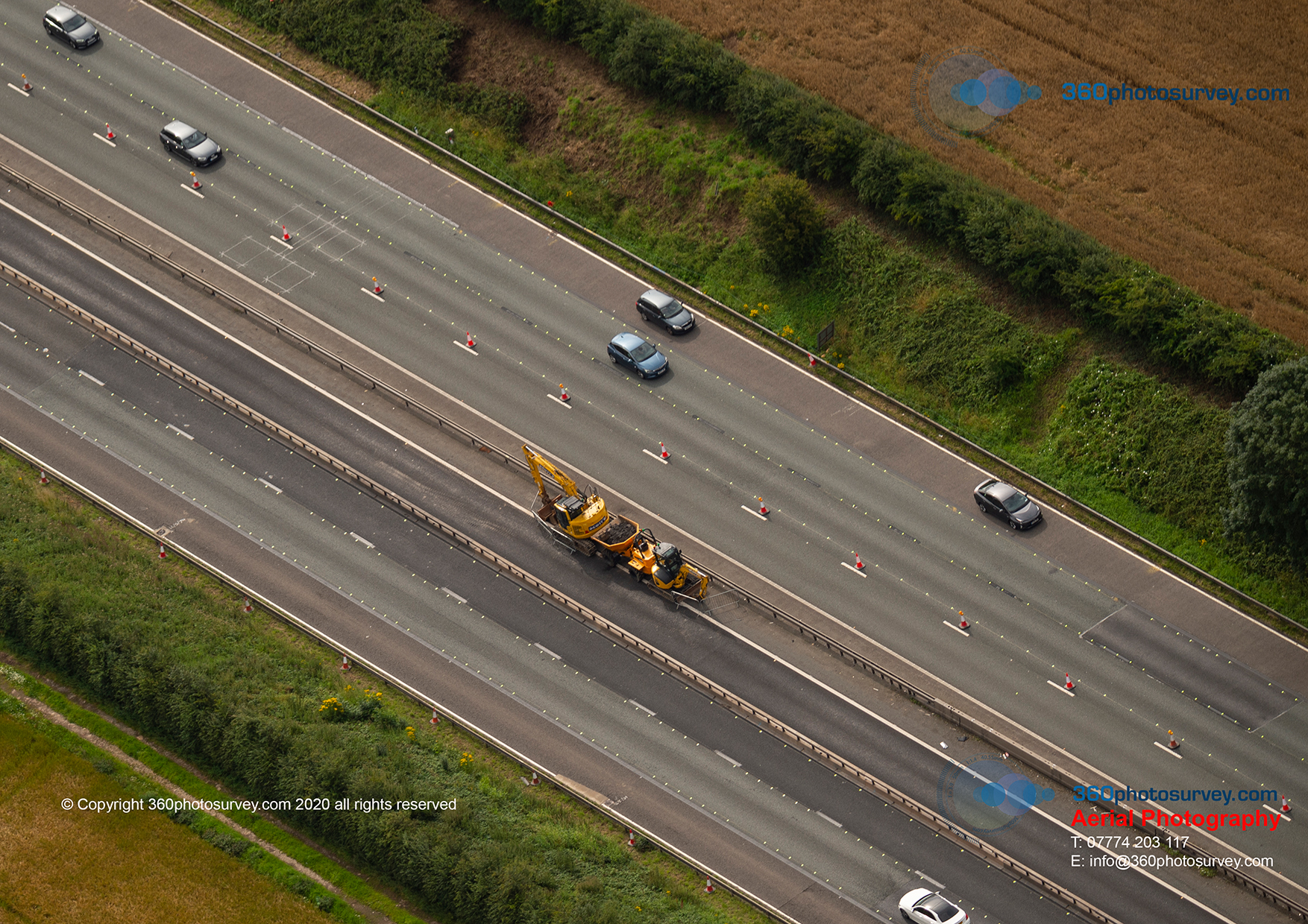
Latest progress photos of M56 project
Latest progress photos of M56 upgrade project taken by professional aerial photographer 360photosurvey.com. This short video shows an extract from our latest photoshoot, with high resolution photos taken at regular 25-50m intervals along both sides of the project in under 5 minutes (800 individual photos), providing the project team with an invaluable progress record of the project each month.
We`ve been undertaking regular monthly aerial progress photos of this project for Galliford Try and National Highways from our full size fixed wing real aircraft (not a drone) with 2-man crew on board (pro pilot + photographer with high powered cameras). During each flight, we fly in two legs, first Westbound (North of the M56) from junction 6 (Manchester Airport) to junction 7 (Lymm/Altrincham), and then return Eastbound (South of the M56). Providing the project team with very high resolution images along the full length of their project.
Being right next to Manchester Airport runway, we have the necessary permit to operate our aircraft in such close proximity, and are in constant direct communications with Air Traffic Control throughout the operation whom know we`re professional and efficient and safe ensuring no disruption to airport commercial operations. On completion back at junction 6, we`re cleared to cross the airport and onto our next site – the Poynton Bypass project for Graham Construction and Cheshire East Council.
Why do we use full size real aircraft rather than drones? Under CAA drone regs it`s illegal to operate a drone over a live motorway, and as the route also passes over a live railway too (CAA drone regs + Network Rail regulations), that`s illegal too. With the length of the project, would mean that under the CAA drone regs, a drone can not be flown more than 500m from the ground based pilot, which means the pilot has to repeatedly relocate position, with all the costs and time associated. Whilst drones are a great asset, drone operators would be pushed to photograph more than 1-2 sites in a day – prior to getting to the M56 project, we`d already photographed a dozen projects for clients, and then onto more projects, including further highway and railway projects in addition to lots of construction projects and commercial sites for our estate customers.
AERIAL PHOTOGRAPHY UNDERTAKEN PROPERLY – PROFESSIONAL – EFFICIENT – SAFE
360photosurvey.com undertakes aerial photoshoot for Channel 4 TV
Channel 4 TV – Another satisfied customer of aerial photographer 360photosurvey.com – kind praise indeed:

360photosurvey.com aerial photographer praise from Channel 4 TV
“Thanks Chris, Just to note to say thanks you for your work on this shoot – your shots looked great. The Creative team are super happy with everything – great work! Danny C4”
Classic Jet Provost photoshoot
Classic aerial photoshoot – Jet Provost coming into land at Nottingham Airport during our September aerial photoshoot flight operation.
Photos by professional aerial photographer 360photosurvey.com. More images available on our stock aerial photo shop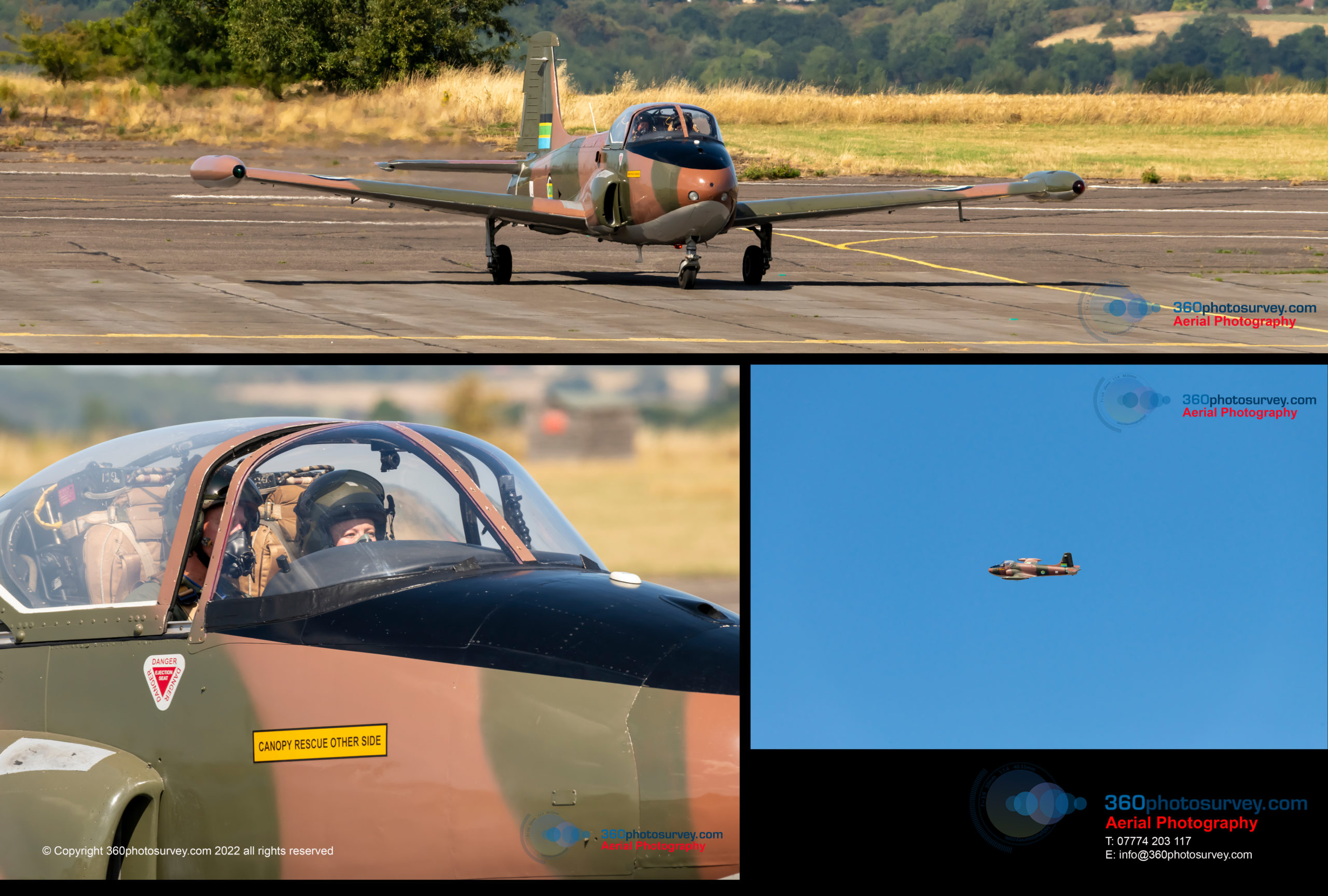 page
page
Latest Hunter Killer Submarine HMS Anson waiting for its commissioning ceremony
Latest Hunter Killer Submarine HMS Anson waiting for its commissioning ceremony.
The marquee set up on the opposite quay is for the visiting dignitaries including Prime Minister Boris Johnson and Australian Defence Minister later in the week.
Aerial photos by professional aerial photographer 360photosurvey.com from our full-size aircraft (not a drone) with two man crew, pro pilot and photographer using pro Nikon camera with high powered lens from outside the air exclusion zone.
360photosurvey.com – aerial photography where iconic comes as standard.

New submarine HMS Astute at Barrow in Furness docked and waiting for the commissioning ceremony later in the week
Specialist Aerial photographer – impressive array of clients
As a specialist construction photography company 360photosurvey.com has built up an enviable reputation for incredible aerial images, photo dilapidation surveys and timelapse videos – with an ever increasing and fabulous customer base with some huge and not so huge names amongst them.
A huge thanks to all our customers and their teams for the priviledge of letting us photograph your fabulous projects.
#aerialphotography #photodilapidationsurveys #timelapse
Sustainable aerial photography for construction and infrastructure projects
Sustainable aerial photography for construction and infrastructure projects:-

Aerial photographer to the construction industry UK
.
During each 7 hour monthly aerial photoshoot flight operation we photograph multiple projects (see map). It`s probably unfeasible for a drone operator to do more than two projects in a day travelling by car, with all the expense & polution caused by road traffic, hold ups, breakdowns, accidents etc whereas we travel directly to each site `as the crow flys` and not having to follow curvy roads.
Time on site? with a drone there`s induction time, you`ll be on site for say 1-3 hours perhaps, with a maximum flying time of between 15-60 mins. We typically do 2 circuits of each project & typically on scene at each for 2-3 mins photographing the project fully from all angles with incredibly powerful cameras to provide our clients with 30+ very high resolution photos.
As we don`t enter sites, there`s no disruption to site operations nor safety issues either.
There are many locations where it`s illegal for drones to operate such as airports, prisons, nuclear installations, within 50 metres of railways, over live motorways etc, and all the issues associated with flying in city centres too, which don`t apply to us – what`s not to like?
Why not give us a try, I`m sure you`ll be really impressed not only with the service, but also the incredible high quality and resolution of our photos.
360photosurvey.com – the professional aerial photographer of choice for the construction industry
EFFICIENT – PROFESSIONAL – SUSTAINABLE – SAFE
#theprofessionalaerialphotographerUK #professionalaerialphotographeratitsbest #aerialphotographerUK #sustainableaerialphotography
The professional aerial photographer of choice for construction and infrastructure projects
Professional aerial photographer 360photosurvey.com is the go to company for construction and infrastructure aerial photography.
Using our full size real aircraft (not drones) we photograph multiple projects during our 7-hour aerial photoshoot flight operations. Each site is photographed in detail using our high powered pro camera systems to provide clients with incredibly detailed and high quality images of their projects.
Unlike drones, we have CAA(NATS) and Air Traffic Control permits to enter controlled and restricted airspace where access to drones is prohibited. As our pilot and photographer are physically located within the aircraft, we`re not restricted to the 500m maximum distance from the pilot as with a drone.
Christie Hospital Macclesfield – latest aerial photos

Aerial photographer Macclesfield
Russian Sub moored in UK waters
It`s not everyday as professional aerial photographers using our full size aircraft that we get to photograph a Soviet Foxtrot class submarine moored in UK Waters.
We were on route to our Brighton aerial photoshoot when we passed over the River Medway and spotted this retired Russian submarine U-475 “Black Widow”.
If you`d like to see more images of this – take a look at our stock image shop https://shop.360photosurvey.com/ where these and other images are available for sale (including framed prints if required)
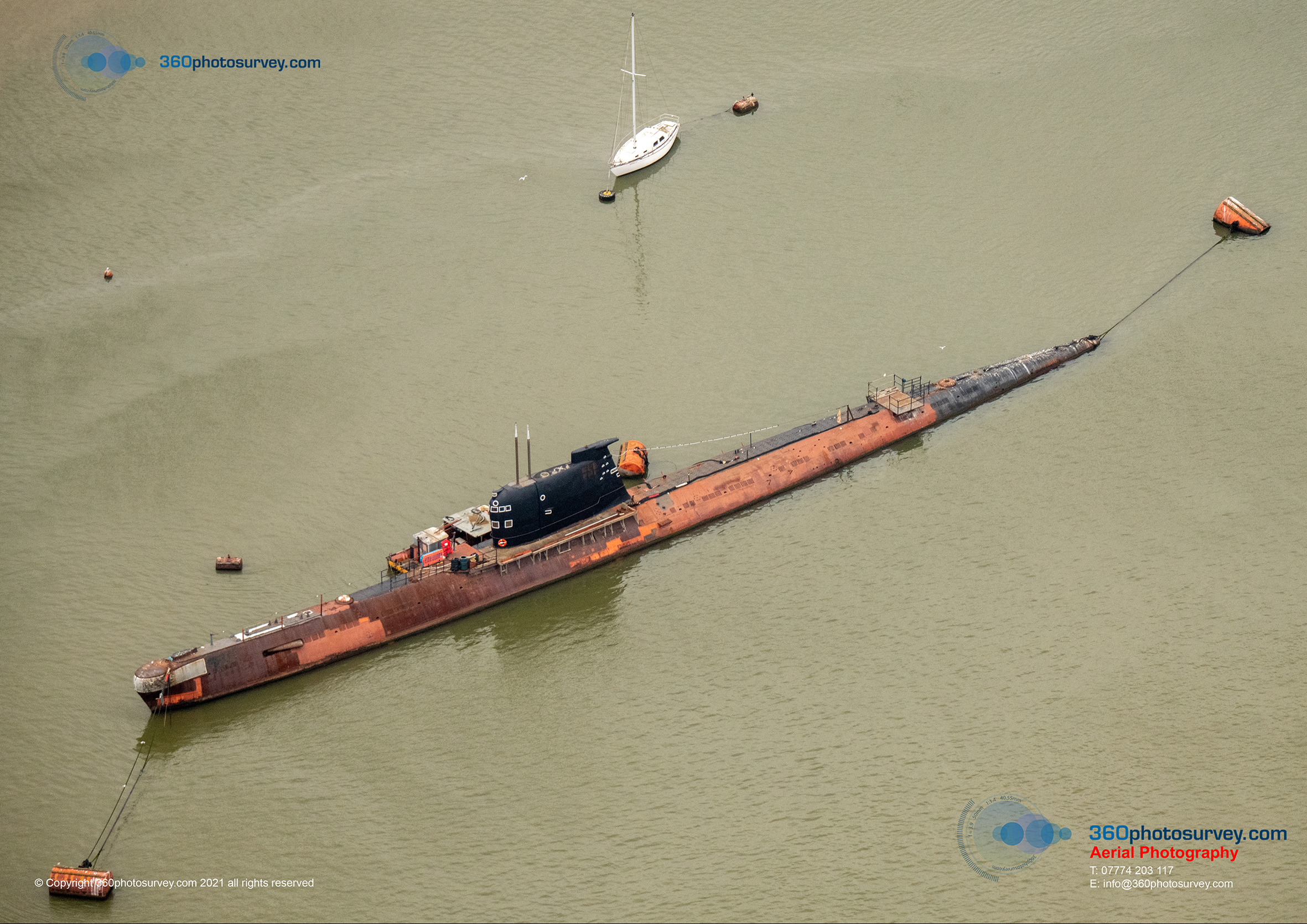
Professional aerial photographer Kent 211016 44
Helicopter photo bombs aerial photoshoot
Helicopter photo bombs aerial photoshoot!
During 360photosurvey.com`s aerial photoshoot flight operation on 16th October 2021, we were quite happily photographing our clients project in Woodford from our full size aircraft at 1500 feet when this rather expensive and slick helicopter kindly photo bombed our shoot. Thankfully it was just passing through. It`s always interesting photographing from the air, not only a unique perspective on the world, but one where we have to keep an extra eye out for that extra hazard.
360photosurvey.com is a professional aerial photography company specialising in construction/infrastructure and property aerial photography using full size aircraft and the very latest his spec Nikon cameras.
Professional aerial photography – Efficient, Professional and Safely undertaken
Professional Aerial photographer UK
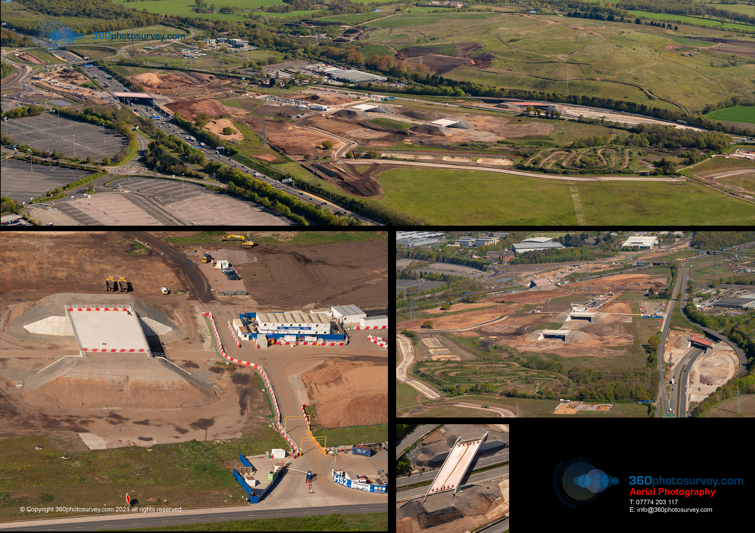
HS2 works commence on Crewe to Manchester line – latest aerial photos
HS2 works have commenced on the Manchester link – along the M56 in Cheshire adjacent to the M56 with ground investigation works underway.
Aerial photos taken by professional aerial photographer 360photosurvey.com on 16th October 2021 during our flight operation at 1500 feet from our full size aircraft. Due to very close proximity to Manchester Airport we had the necessary permit to enter the ATZ – thanks again to Manchester ATC team.
Proffesional aerial photography undertaken EFFICIENTLY, PROMPTLY AND SAFELY
HS2 Crewe to Manchester aerial photo 211016 15
Maiden flight of brand new replica WW2 North American Mustang in Kent on 16th October 2021
Photos capture the maiden flight of replica WW2 North American Mustang at Rochester Airport on Saturday 16th October. It took 14 years for owner Chris Firth to build. A perfect first test flight flown on the day by RAF Test pilot (retired) Dan Griffiths.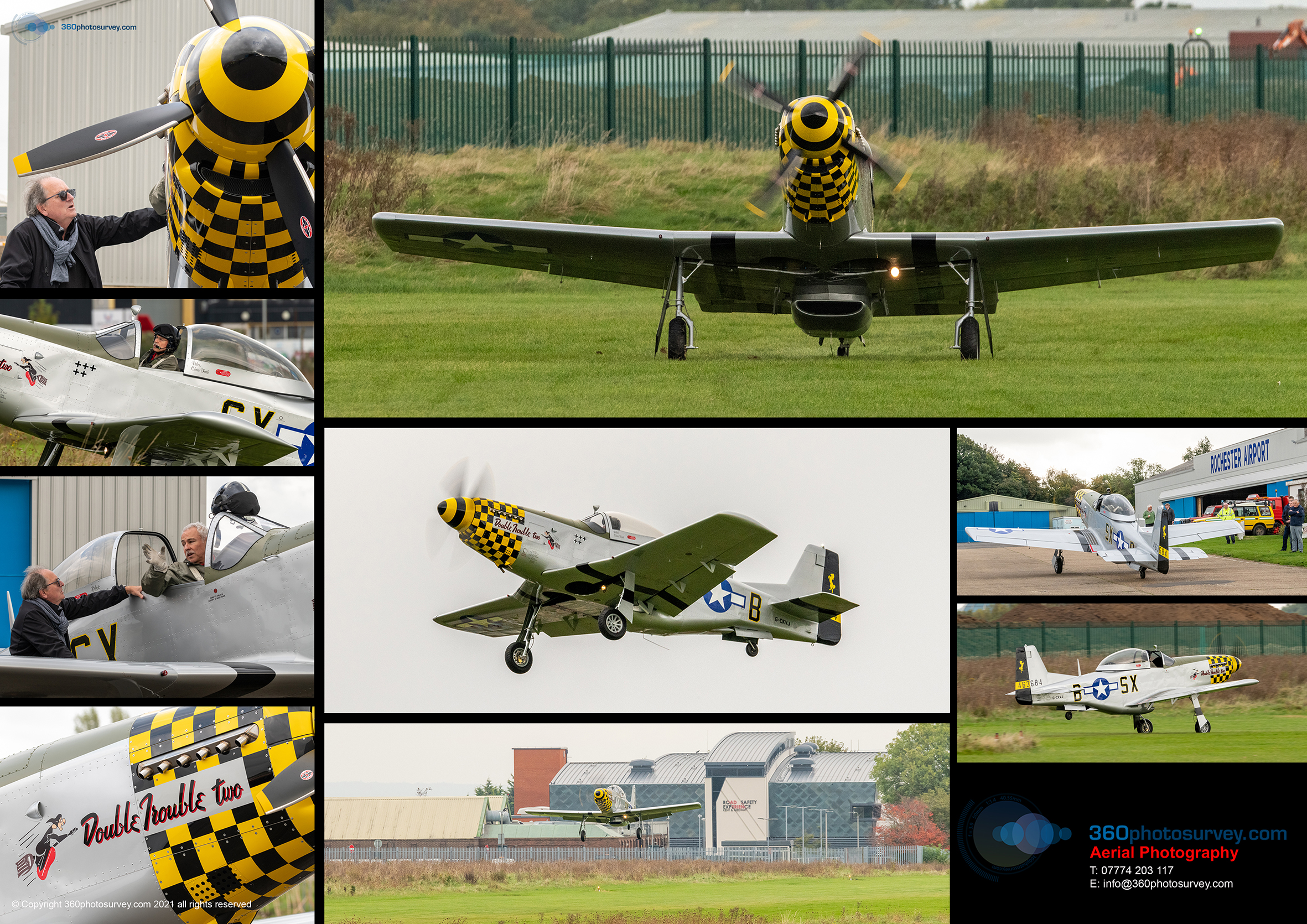
Aerial photos by 360photosurvey.com
One of our Tanks is missing – aerial photo Lincolnshire

Aerial photographer Lincolnshire
360photosurvey.com uses full size aircraft rather than drones, enabling us to photograph multiple sites for our clients.
Perry Barr railway station development – latest aerial photos
M6 Junction 10 improvements latest aerial photos
Latest aerial photos of the M6 junction 10 improvements taken by 360photosurvey.com at 1500 feet from our full size aircraft showing the progress of the project.
Using our full size air
Aerial Photographer Wolverhampton
craft we`re able to efficiently photograph multiple construction and infrastructure projects in different locations all during one single flight operation
UK Real Estate photographer does it in full size aircraft
Aerial photographer 360photosurvey.com uses full size aircraft to photograph our Real Estate clients properties and sites. Unlike with drones, we`re not restricted to a single site, nor the constraints imposed by the CAA on drone operations limiting drones to remaining in visual line of site and not more than 500m from the pilot.
During our 7 hour monthly flight operations we fly to multiple sites and properties for our clients and with our pro Nikon DSLR cameras and high powered lenses are able to provide high quality detailed images, in addition to longer distance views setting the property/site in context with its surroundings or nearby landmarks such as City Centres, airports or Motorway junctions.
Aerial Photographer
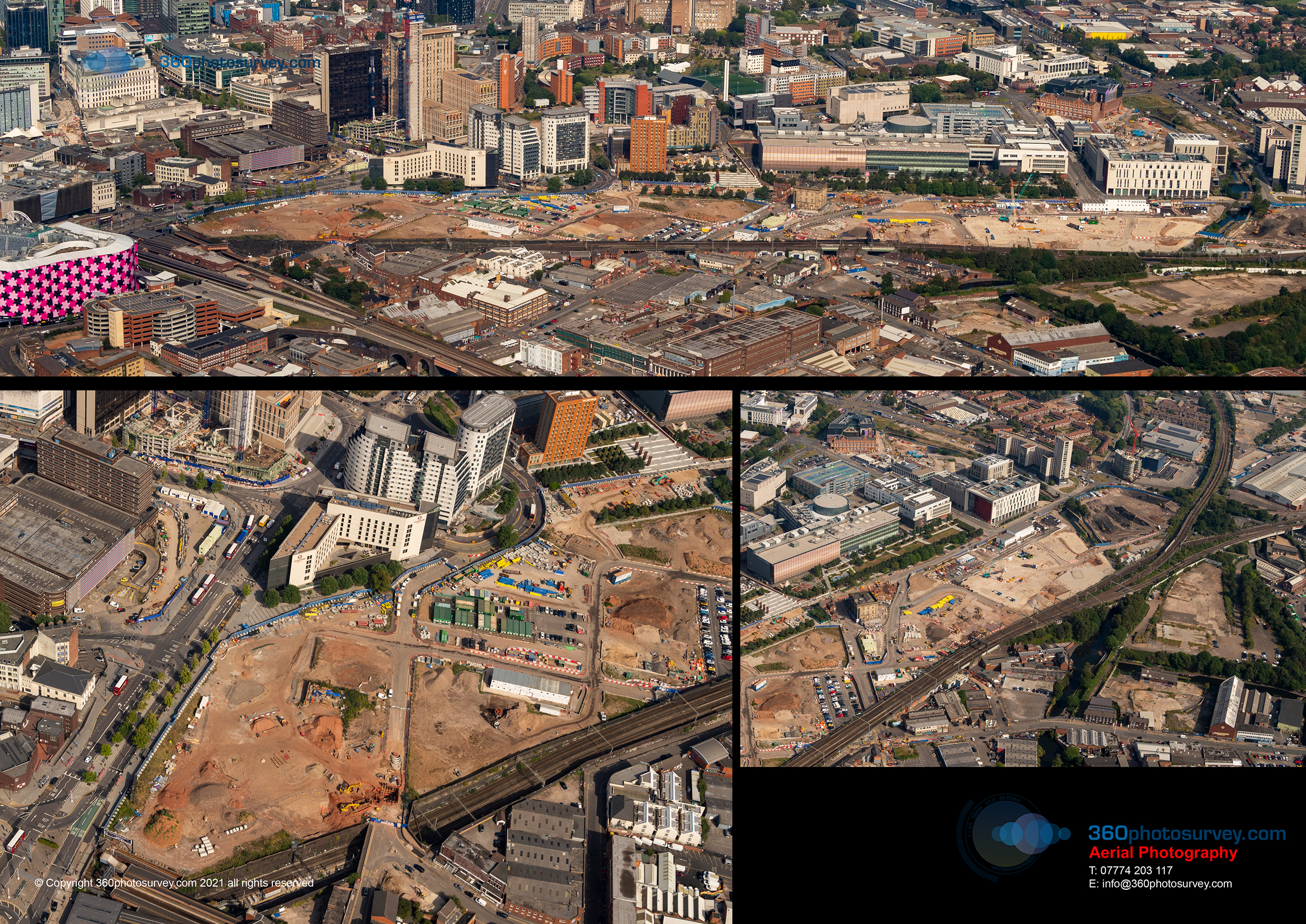
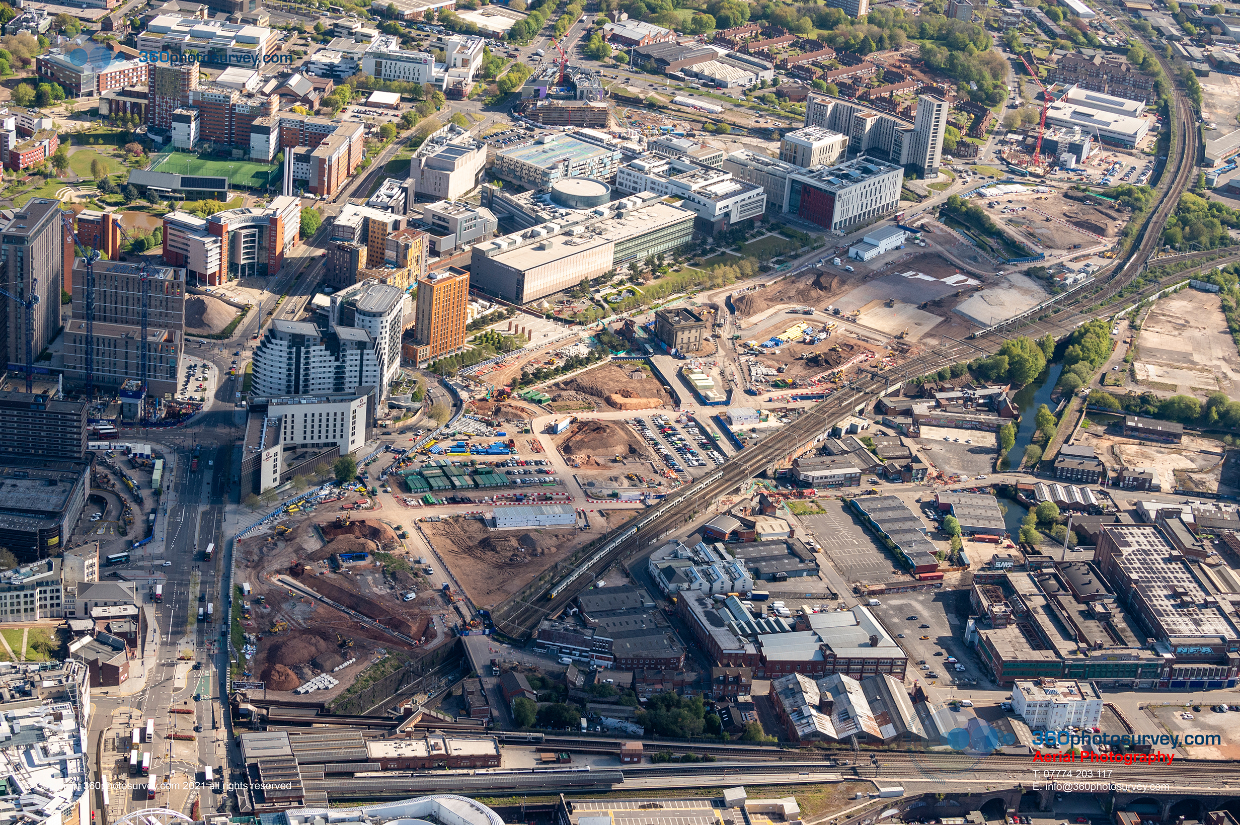
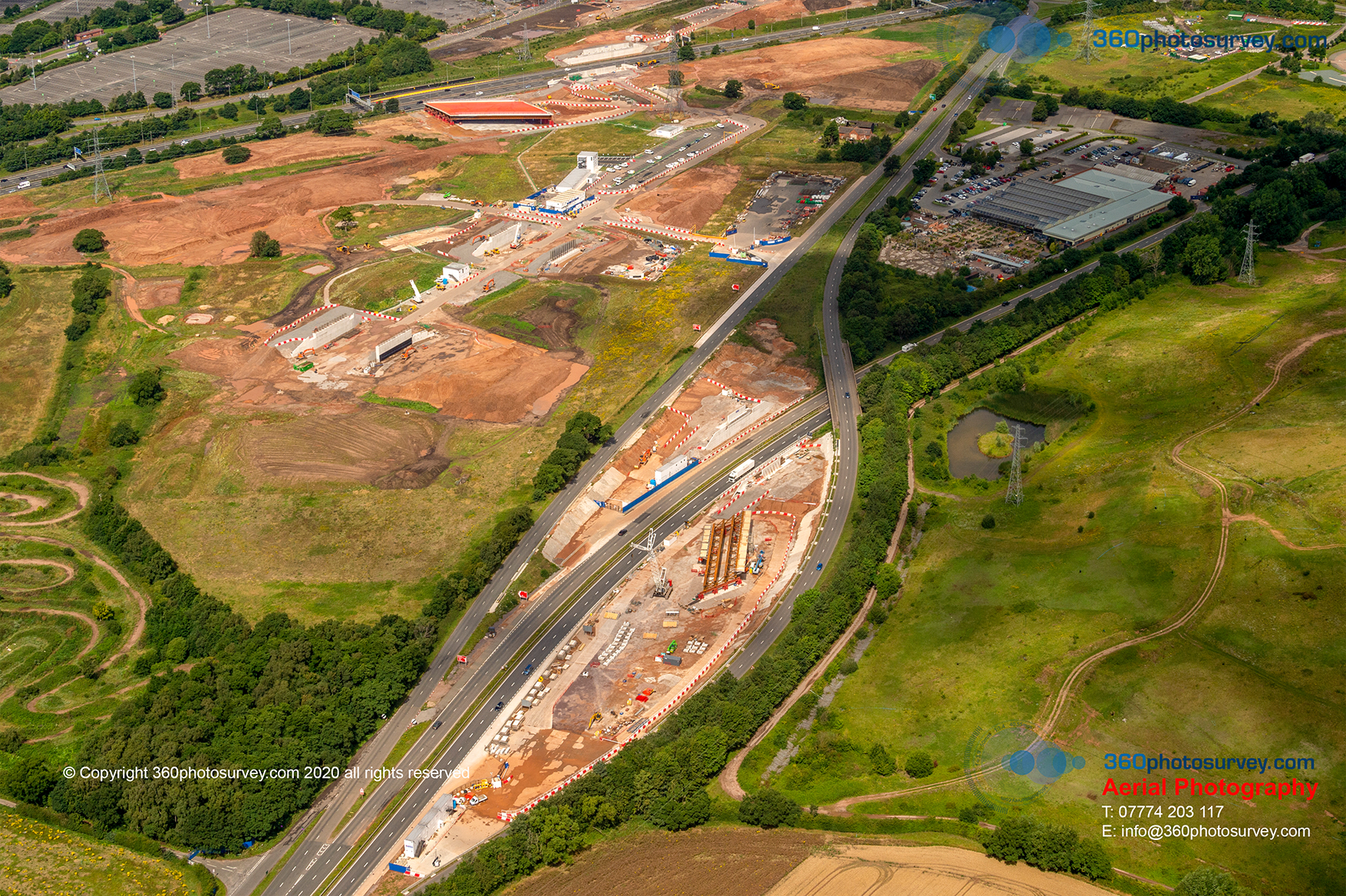
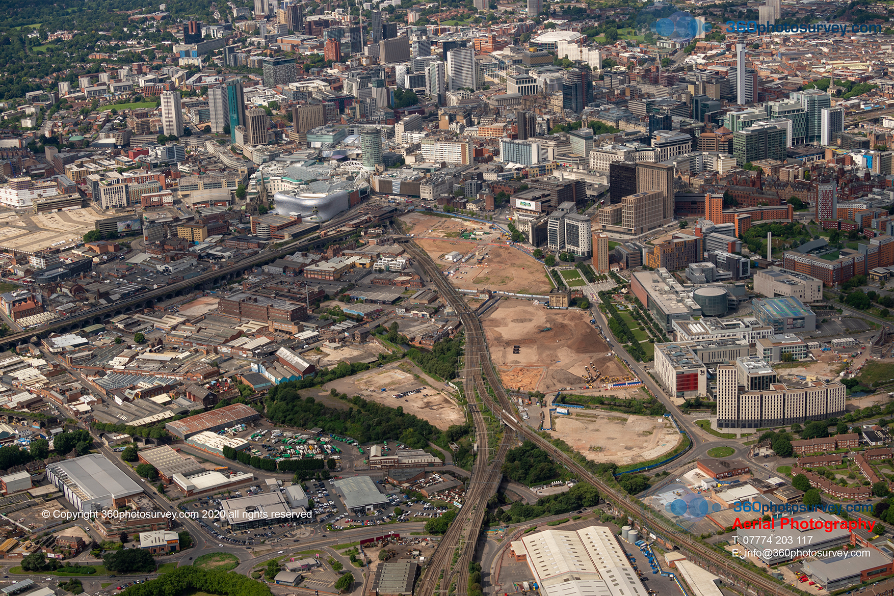
Latest aerial photos of HS2 Curzon Street station
Latest aerial photos of HS2 Curzon Street Station in Birmingham by aerial photographer 360photosurvey.com from our full size aircraft at 2000 feet taken during our September flight operation and showing the latest progress of this impressive project.
During our 7 hour flight operation we photographed circa 250 individual sites throughout the North, Midlands and East of the UK, ranging from major infrastructure projects such as HS2, highway and construction projects including various properties/sites for our real estate clients.
Aerial Photographer Birmingham
Gedling Link Road in Nottingham – latest aerial photos
Gedling Link Road project in Nottingham – latest aerial photos taken by construction and infrastructure aerial photographer 360photosurvey.com during our May aerial flight photoshoot.
The photos were taken from our full size high-wing aircraft from circa 1500 feet with our high powered camera systems.

Aerial photographer Nottingham
Castle Mead Academy project in Leicester – latest aerial photos
Castle Mead Academy Leicester – latest aerial photos by construction and infrastructure project aerial photographer. Aerial photos by 360photosurvey.com during our May aerial photoshoot flight operation from our full size aircraft at 1500 feet. Contractor Bam Construction
Aerial photographer Leicester
Aerial photo of the impressive collection of aircraft at the Coventry Aviation Museum
Coventry Airport aerial photo showing the impressive collection of historical aircraft within their aviation museum.
Aerial photo by specialist aerial photographer 360photosurvey.com from our full size high-wing aircraft at 1500 feet and taken with high powered cameras during our May 2021 aerial photoshoot flight operation.

Coventry aerial 210507 23
Latest aerial photos of HS2 Solihull Station project
Aerial photographer 360photosurvey.com specialises in photographing construction and infrastructure projects for our clients. Our latest aerial photos of HS2 Solihull station aerial photos from 2000 feet during our May 2021 aerial photoshoot flight operation in our full size high-wing aircraft and high powered cameras show the progress of this impressive feat of engineering.
Aerial photographer Birmingham
HS2 Curzon Street latest aerial photos
Aerial photographer 360photosurvey.com specialises in photographing construction and infrastructure projects for our clients. Our latest aerial photos of HS2 Curzon Street station aerial photos from 2000 feet during our May 2021 aerial photoshoot flight operation in our full size high-wing aircraft and high powered cameras show the progress of this astounding project in the heart of Birmingham City Centre, with close ups of the ground works including the foundations for the main station facade.
Birmingham aerial photo 210507 HS2

Birmingham aerial photo 210507 HS2

Birmingham aerial photo 210507 HS2

Birmingham aerial photo 210507 HS2
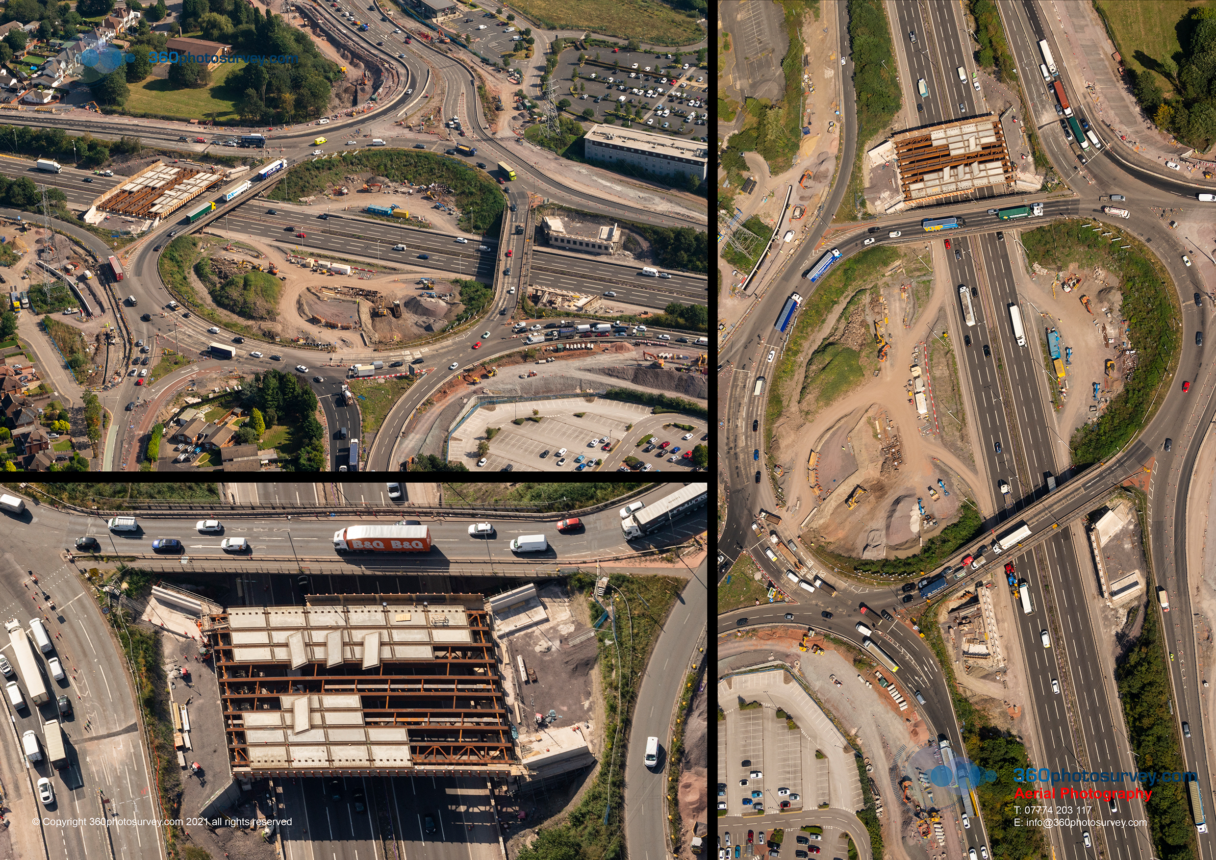
Aerial photographer appointed to M56 Smart Motorway project in Greater Manchester
360photosurvey.com has been appointed by Galliford Try on behalf of Highways England to undertake regular monthly aerial progress photography along the full length of the M56 Smart Motorway project in Greater Manchester – regular monthly aerial photoshoot along both sides of the motorway which is immediately adjacent to Manchester International Airport. 360photosurvey.com use a full size high-wing aircraft with two man team comprising professional pilot and aerial photographer with high powered cameras recording the project from 1500 feet with incredible detail.
Due to the proximity right next to Manchester International Airport we needed careful planning with Air Traffic Control to enable us to fly our full size aircraft along both sides of the Motorway at 1500 feet – thanks again to the professional Manchester ATC team.
360photosurvey.com specialises in providing high quality aerial photography for construction and infrastructure projects. Our projects include the M56 Smart Motorway, M6 Junction 19 improvements, A34 Perry Barr Highway improvements, Congleton Link Road project and the Poynton Link Road project to name but a few.

Aerial photographer Manchester
Photo Dilapidation and Condition Surveys UK
Photo Dilapidation Surveys – Watson Homes appointed specialist construction and infrastructure photographer 360photosurvey.com to undertake a stills photo dilapidation survey of their latest project in Salford, Greater Manchester.
The instruction came through Friday 14th May, 360photosurvey.com undertook the stills photo survey Monday 17th May prior to site hoardings being erected, 48 hours later USB hard drive containing circa 4000 high res + low res JPEG images + plan identifying the locations of the photos handed to the client Wednesday 19th May.
Prompt – Professional – Photo Dilapidation and Condition Surveys throughout the UK – 360photosurvey.com your one stop shop for construction and infrastructure project photography
Photo Dilapidation Surveys UK
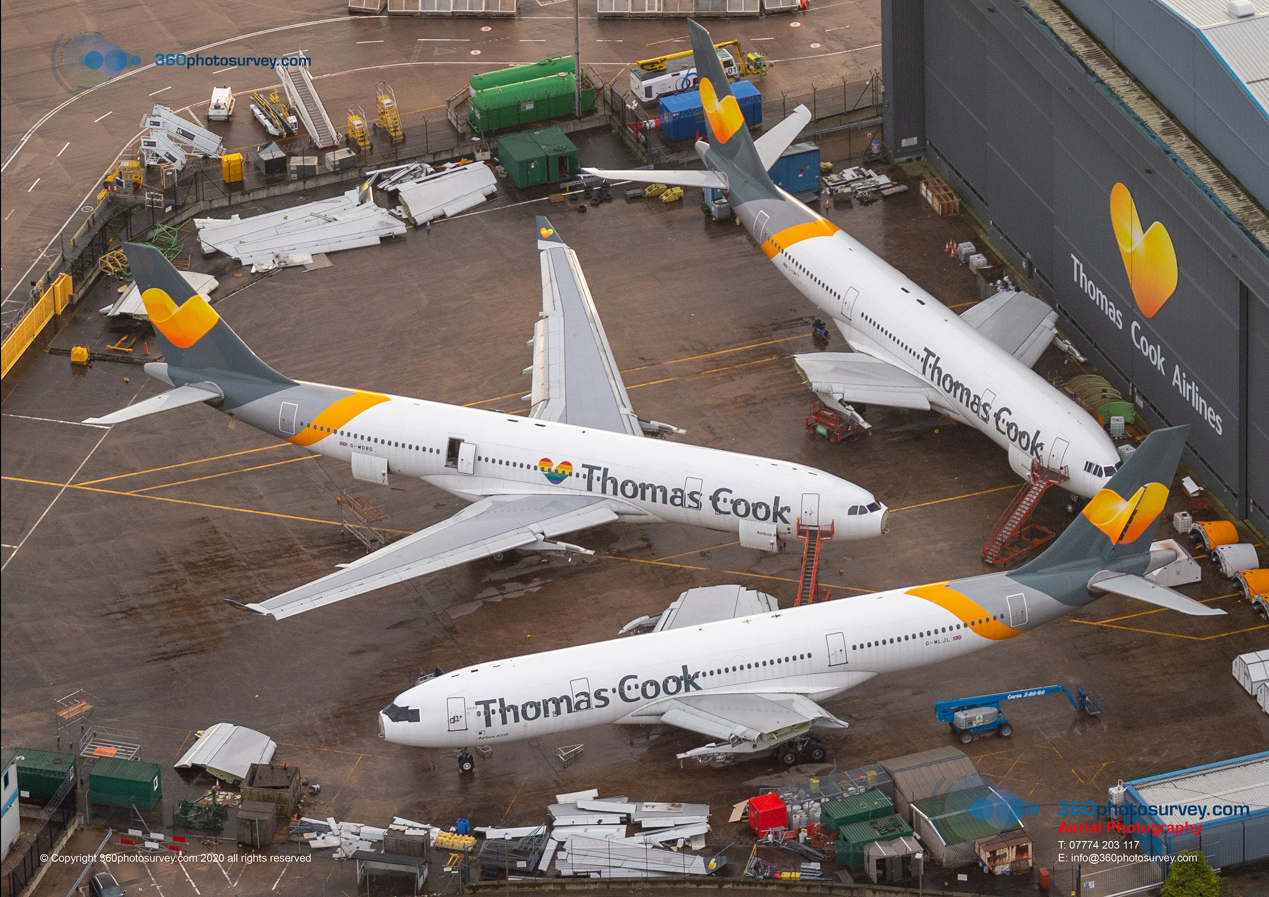
The wings really have now come off Thomas Cook`s aircraft at Manchester Airport
Thomas Cook`s wings now really have come off in more ways than one!
Photo by aerial photographer 360photosurvey.com at 1500 feet from our full size aircraft during 20th December aerial photoshoot at Manchester Airport.
Aerial Photographer UK
With thanks again to Manchester Air Traffic Control
#aerialphotographerMANCHESTER #aerialphotographerUK
What value does a photo condition survey undertaken prior to construction/demolition work commencing bring to a project?
What value does a photo condition survey undertaken prior to construction/demolition work commencing bring to a project?
It provides a definitive photographic record of the conditions including existing visible damage/defects, not only of the building/site, but also and of equal importance, of the adjacent external public realm not only of the immediate area adjacent to the works, but also at site vehicular entrances and routes to/from the site (including pavements, highway, street furniture and neighbouring premises).
A detailed photo condition survey can avoid costly and extremely time consuming disputes over what was, or was not damaged prior to work commencing.
360 degree photographic surveys provide an even more effective solution, enabling project teams to virtually walk around the whole of surveyed area and look around in true 360 degrees on their computers remote from site – quicker and easier than having to scroll through a long condition survey video where you may have hours of recording to find what you`re looking for, or still photos where what you`re looking for is….just out of shot!
#photoconditionsurveysUK #photoconditionsurveys #conditionsurveys #dilapidationsurveys
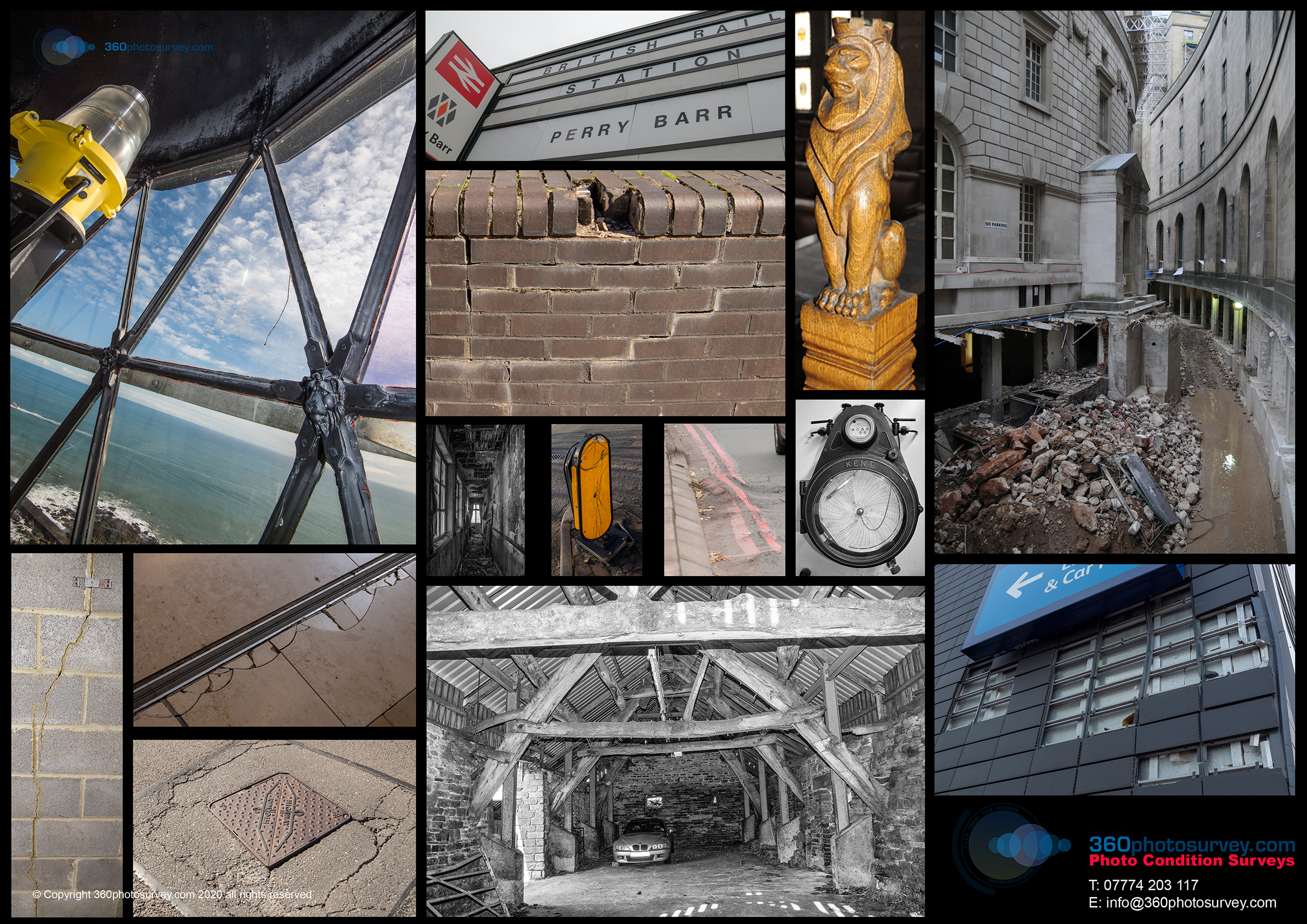
Photo Condition Surveys UK
Network Rail Perry Barr station in Birmingham photo condition survey prior to demolition
Network Rail`s Perry Barr Station in Birmingham is a rather run down and forlorn station complex and now has plans for a fabulous transformation. 360photosurvey.com has undertaken a detailed 360 degree photo dilapidation survey of the building and its surroundings, including public realm and highways prior to demolition works commencing. Our photos show the run down nature of the station and its surroundings compared to the proposed visual.
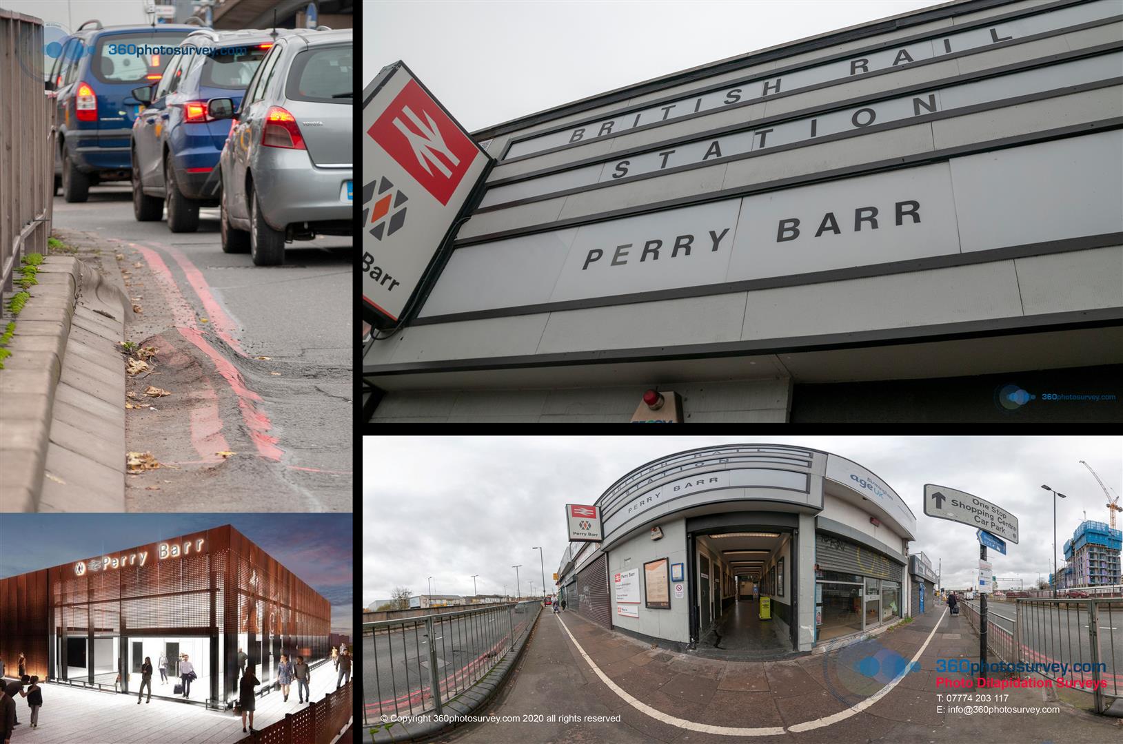
Photo Dilapidation Surveys UK
#photodilapidationsurveys #photoconditionsurveys #360photodilapidationsurveys #360photoconditionsurveys
(Visual reproduced by kind permission)
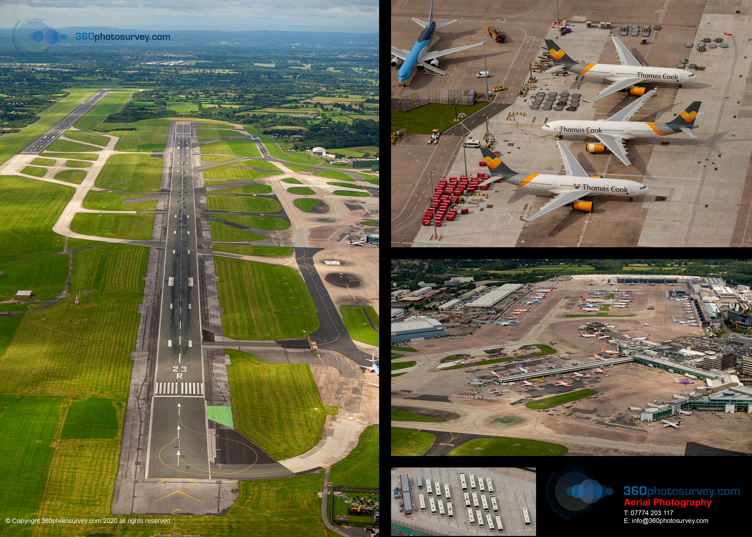
Aerial photographer gets International world beating airport all to itself
It`s not often we get an International World beating airport to ourselves. Manchester Airport eerily quiet during our recent monthly aerial photoshoot at the airfield.
Aerial photo by 360photosurvey.com at 1500 feet from our full size aircraft (not a drone) during our long July flight operation.
Thanks again to Manchester Tower/Air Traffic Control as always professional and helpful during our regular monthly progress photoshoot of construction works at the airport.
#aerialphotographerMANCHESTER #aerialphotographerNORTHWEST #aerialphotographerUK
360photosurvey.com aerial photographer
Aerial Photography legend Harold Nuttall of Aerviews Photography
One of the most famous and indeed, a true character of Aerial Photography, Harold Nuttall of Airviews Photography was both widely known in the construction industry for his oustanding aerial photography of construction projects and for being a true gentleman.
With his increasing poor health, and sadly eventually having to retire completely from aerial photography, Chris Billington of 360photosurvey.com, an established aerial photographer in his own right gradually took over the reigns. Airviews Photography is now fully incorporated into 360photosurvey.com providing high quality aerial photography for construction and property professionals and is looking forward to the next 30 years.
Park Hill Flats development Sheffield – latest aerial photos
Park Hill Flats Sheffield undergoing major refurbishment from 2000 feet by aerial photographer 360photosurvey.com – using our full size aircraft (not a drone)
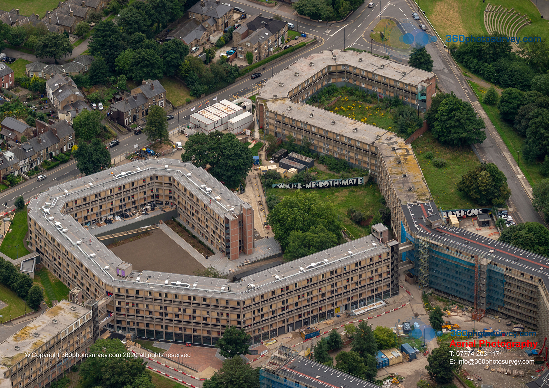
Sheffield aerial photographer
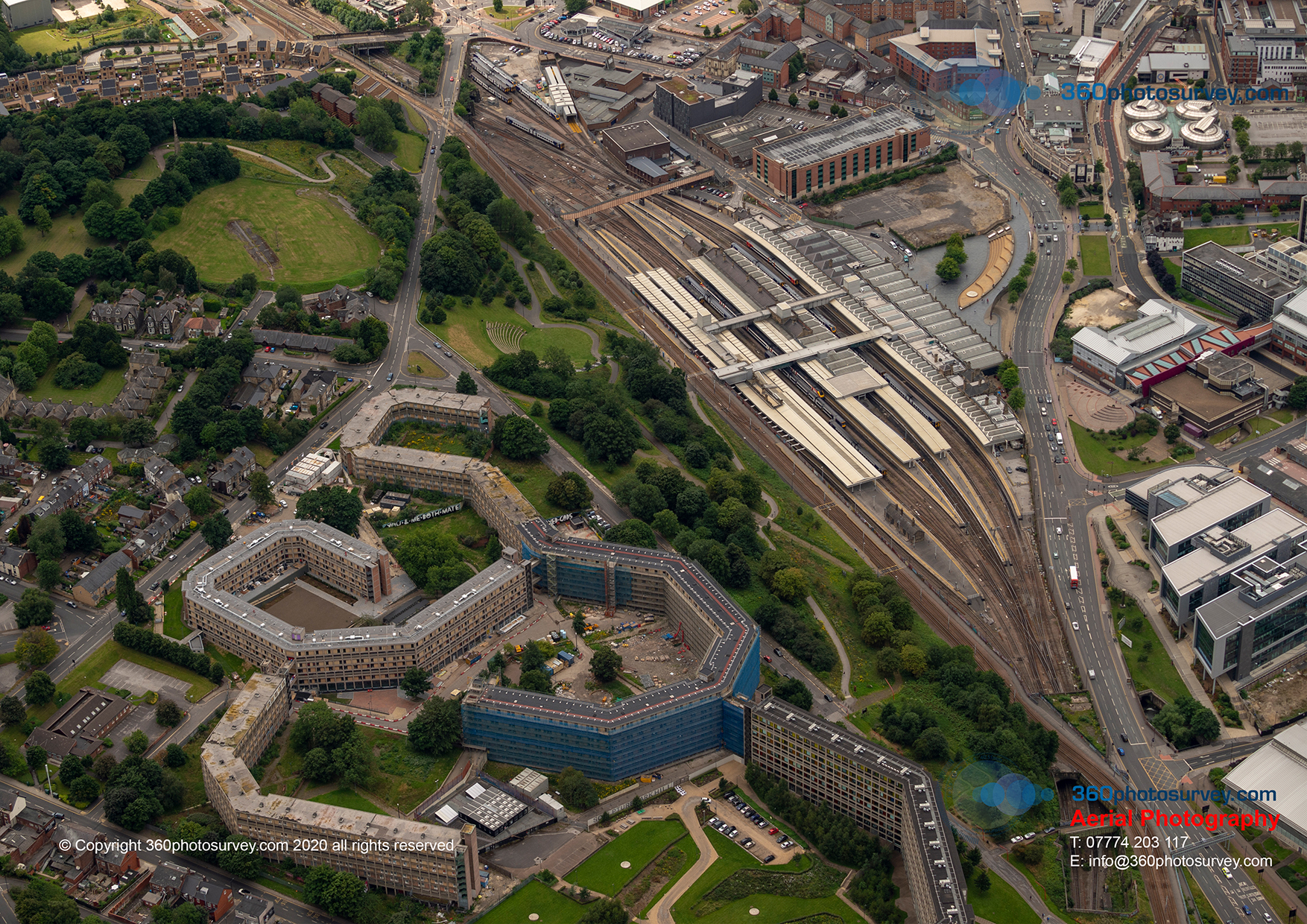
Sheffield aerial photographer
Manchester Town Hall all wrapped up – latest aerial photo
Manchester Town Hall all wrapped up – aerial photo by 360photosurvey.com from 2000 feet using our full size aircraft (not a drone) + pro Nikon camera fitted with powerful lens during our 26th July aerial photoshoot flight operation
By using full size aircraft during our aerial photoshoot flight operations we photograph multiple sites during one flight operation not just over Manchester but on this flight sites in Yorkshire, Lancashire, Cheshire, West Midlands, East Midlands, Derbyshire, Staffordshire, Lincolnshire, Merseyside…by being able to undertake so many sites in one flight makes the cost per site so cost effective for our clients (generally cheaper than hiring a drone) quicker and more efficient too.
#aerialphotographerUK #aerialphotographerYORKSHIRE #aerialphotographerLANCASHIRE #aerialphotographerWESTMIDLANDS #aerialphotographerEASTMIDLANDS #aerialphotographerDERBYSHIRE #aerialphotographerSTAFFORDSHIRE #aerialphotographerLINCOLNSHIRE #aerialphotographerLEICESTERSHIRE #aerialphotographerMERSEYSIDE
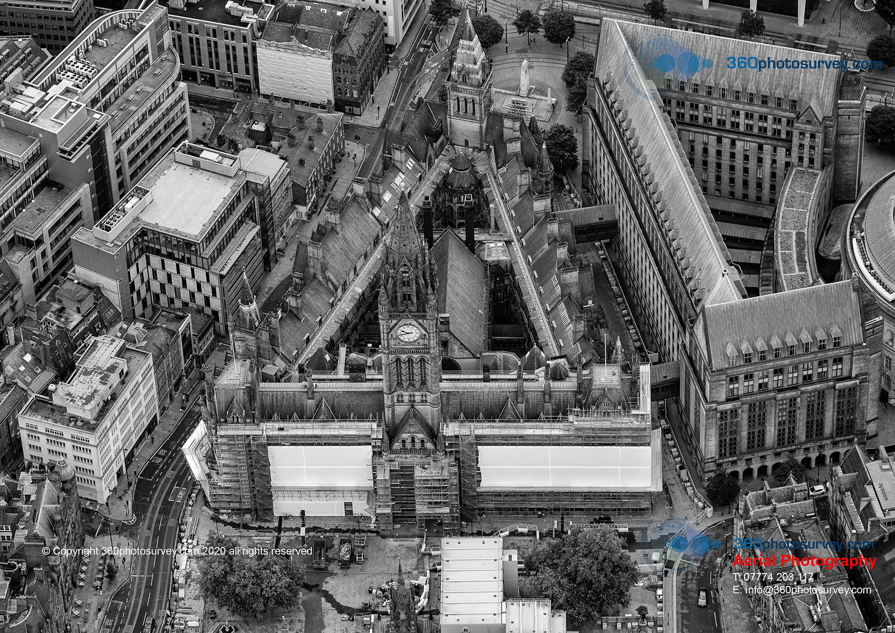
Manchester aerial photographer
Latest aerial photo of Jodrell Bank First Light project
Aerial photographer 360photosurvey.com latest aerial photo of Jodrell Bank`s First Light project taken during our 26th July aerial photoshoot flight operation. Work on this impressive and prestigous project is being undertaken by Kier Constrution.
Aerial photo by Construction and Infrastructure project aerial photographer 360photosurvey.com from our full size aircraft (not a drone) at 1500 feet and taken with pro Nikon camera and high powered lens. We could have taken this shot using a drone, however had we done so we would not have been able to undertake multiple aerial photoshoots at our clients projects as dispersed as Sheffield, Preston, Leamington Spa, Birmingham, Coventry, Leicester, Manchester, Manchester Airport to name but a few…all in one continuous flight operation.
SAFE – EFFICIENT – COST EFFECTIVE – PROFESSIONAL AERIAL PHOTOGRAPHERS
Aerial photographer Cheshire
Works commence on M56 Smart Motorway between junctions 6 and 8
Construction works have commenced on the M56 junctions 6 to 8 (Bowdon to Manchester Airport) to create a smart motorway which will hopefully aleviate the morning congestion along this stretch of motorway leading into Manchester.
Aerial photo by Construction and Infrastructure project aerial photographer 360photosurvey.com from our full size aircraft (not a drone) at 1500 feet and taken with pro Nikon camera and high powered lens. We could have taken this shot using a drone, however had we done so we would not have been able to undertake multiple aerial photoshoots at our clients projects as dispersed as Sheffield, Preston, Leamington Spa, Birmingham, Coventry, Leicester, Manchester, Manchester Airport to name but a few…all in one continuous flight operation.
SAFE – EFFICIENT – COST EFFECTIVE – PROFESSIONAL AERIAL PHOTOGRAPHERS
Highway project aerial photographer
HS2 Solihull Interchange latest aerial photo
The latest aerial photo of HS2 Solihull interchange project taken by construction project specialist aerial photographer 360photosurvey.com at 2000 feet from our full size aircraft and pro Nikon cameras with powerful lens during our 26th July photoshoot flight operation.
Many thanks to Birmingham Air Traffic Control for assistance in the operation as we needed to fly around the site necesitating flying directly alongside the airfield during this photoshoot.
Aerial photographer HS2 Solihull
HS2 Curson Street aerial photo
Construction project aerial photographer 360photosurvey.com has been commissioned to undertake aerial photos of the HS2 Curzon Street project. This photo taken on our July 2020 aerial photoshoot flight operation at 2000 feet from our full size aircraft (we don`t use drones) showing the extent of the project and its proximity to Birmingham City Centre and forthcoming Commonwealth Games venue (on the left).
By using our full size high-wing aircraft together with pro Nikon cameras with very high powered lenses we can obtain extremely highly detailed high quality images for our clients from heights and locations not permitted to drone operators.
Aerial photographer HS2
Aerial Photographer and photo dilapidation surveys UK wide
We`ve been busy – locations where we`ve undertaken #photodilapidationsurveys (red dots) and #aerialphotoshoots (yellow dots) for our clients construction projects.
#photodilapidationsurvey #photoconditionsurvey #aerialphotographer #aerialphotography #constructionprojectphotographer
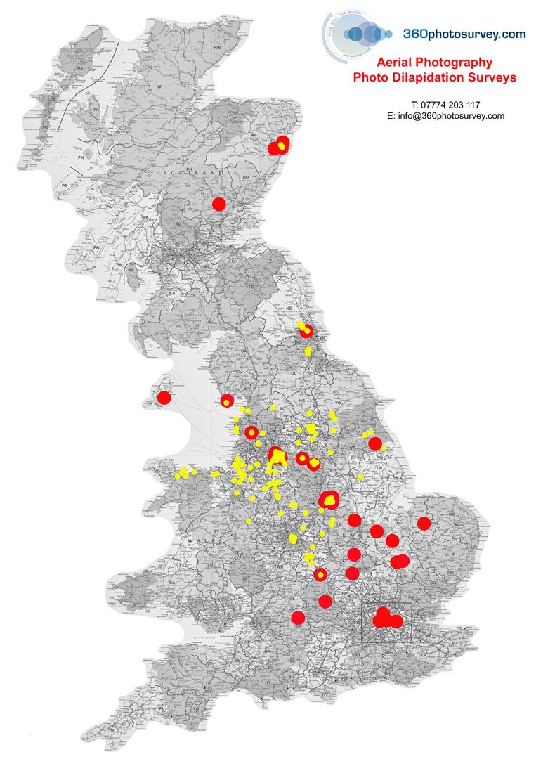
360 photo survey photo dilapidation survey photo condition survey aerial photographer
Aerial photographer MANCHESTER AIRPORT review
Aerial photographer NORTH WEST
Aerial photographer MANCHESTER
Former Boddington`s Brewery site now being developed. From 2000 feet up.
Taken during our 22nd June aerial photoshoot flight operation using our full size high-wing aircraft and pro Nikon cameras with very high powered lenses. Why use a drone when you can only fly upto a maximum of 400 feet?
#youcantdothatwithadrone #aerialphotographertotheconstructionindustry #aerialphotographerMANCHESTER #aerialphotographerNORTHWEST #aerialphotographerUK
Construction Project aerial photographer
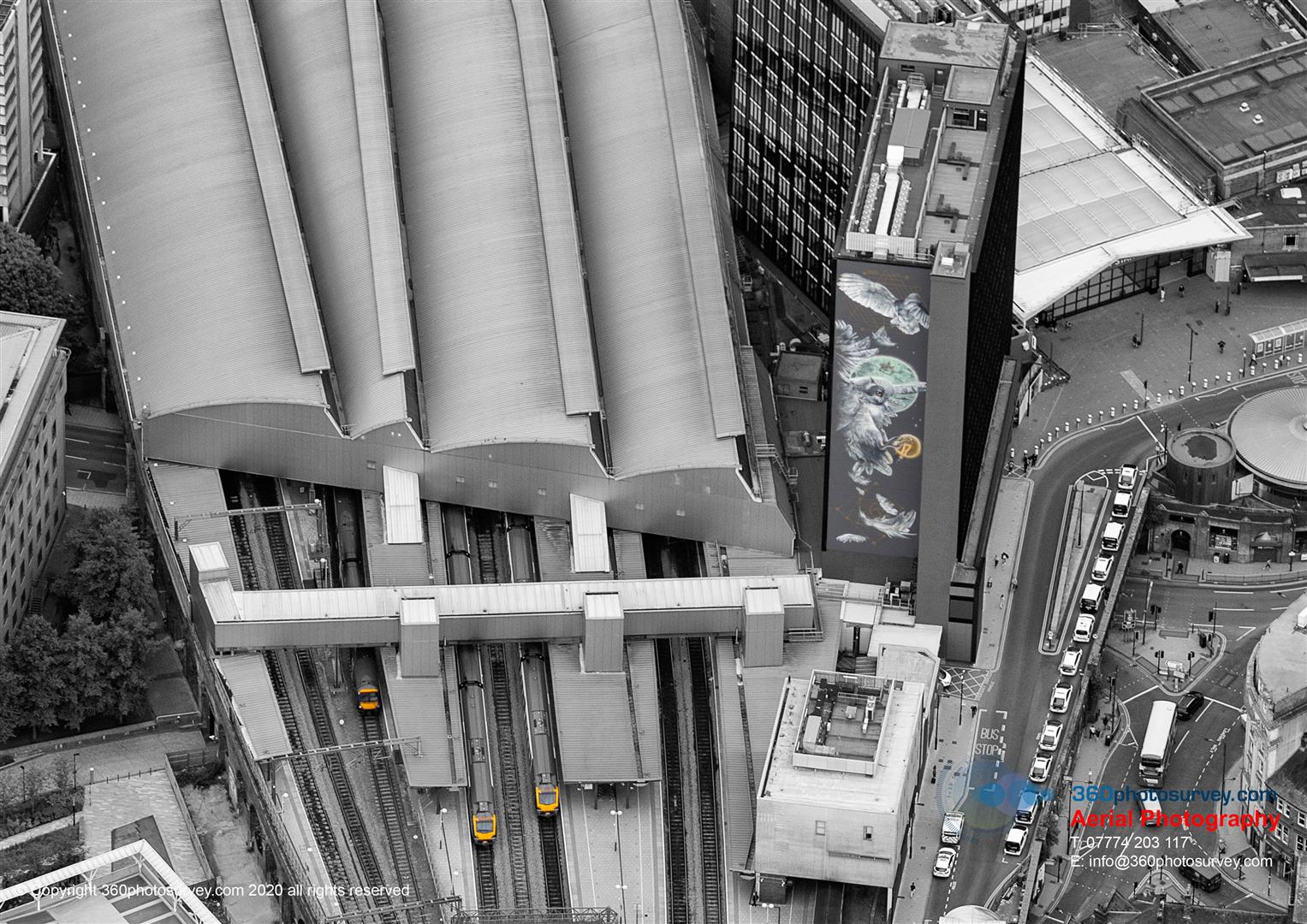
Aerial photographer LEEDS
Leeds Station Mural aerial photo from 1500 feet whilst getting into position for our aerial photoshoot of a nearby site for a client during our 22nd June aerial photoshoot flight op`.
Taken from our full sized fixed wing aircraft and pro Nikon cameras with high powered lenses.
You couldn`t do that with a drone as Network Rail take a dim view of drones flying over their railway (or closer than 50m) + CAA restrict drones to a maximum height of 400 feet + very heavy restrictions whilst flying within built up areas.
#aerialphotographerLEEDS #aerialphotographerYORKSHIRE #aerialphotographerUK #youcantdothatwithadrone
Construction Project aerial photographer
Aerial photographer MANCHESTER
These are why we fly at 2000 feet over the amazing city of Manchester
Taken during our 22nd June aerial photoshoot flight op, whilst getting in position to photograph Kier Construction Birley Fields project from our full size high-wing aircraft and pro Nikon cameras + high powered lenses to obtain incrredibly detailed high quality images for our clients.
A shot that couldn`t be obtained using a drone (they`re limited by the CAA to maximum 400 feet and serious restrictions within Cities/Towns and other built up areas.
AND, drones can only do one site at a time (as the Pilot needs to be in visual line of site of it at all times), whereas we photograph many clients sites within the city quickly, efficiently and safely before moving onto the next location.
PROFESSIONAL – SAFE – EFFICIENT aerial photography
Construction Project aerial photographer
Aerial photographer NORTH EAST
Drone v Full Size Aircraft for photography?
DRONE v FULL SIZE AIRCRAFT what do you think?
This image hasn`t been enlarged or manipulated – it was taken from 1500 feet above HS2 Curzon Street Station project from our FULL SIZE AIRCRAFT
Drones are a great tool, but as with every tool in the photographers arsenal they have their limitations:
1. HEIGHT:
DRONE – MAX 400 feet
FULL SIZE AIRCRAFT – Typically 1000-2000+feet subject to Air Traffic Control/CAA requirements, enabling wider panoramic images of complete/large sites
2. EXTENT OF OPERATION ON SITE
DRONES – MUST NOT BE flown over land/property without owners consent + major restrictions within built up areas (towns/cities) + pilot must maintain visual sight of drone at all times
FIXED WING AIRCRAFT – NO LIMIT – we can fly directly over + with high powered lenses obtain incredibly detailed images + at ANY distance from the site to get required images/angles that can not be obtained by drone.
3. EXTENT OF OPERATION OUTSIDE SITE AREA
DRONES – CAA regs – drones must remain within the confines of the site within built up areas
FIXED WING AIRCRAFT – NO LIMITATION – we can obtain distant shots of the site taking in wider location such as a city background to show the site in context to its surroundings + we cover MULTIPLE CITIES/LOCATIONS during a SINGLE FLIGHT operation
Construction Project aerial photographer
Aerial photos of HS2 Curzon Street Station project
HS2 Curzon Street – aerial photos 22 June 2020 from 1500 feet
Aerial photos by 360photosurvey.com using our full size aircraft during our June aerial photoshoot flight operation
#youcantdothatwithadrone #aerialphotographerINFRASTRUCTUREPROJECTS #aerialphotographerUK HS2 (High Speed Two) Ltd #HS2 #HS2CURZONSTREETSTATION

Aerial photographer CONSTRUCTION PROJECTS
Specialist Construction Project aerial photographer receives fantastic review from Kier Construction
Kier Construction whom 360photosurvey.com provide regular aerial photoshoots of their projects has received a fantastic review:

Aerial photographer CONSTRUCTION PROJECTS UK
Photo dilapidation survey prior to construction of new school
DID YOU BREAK THIS?
The answer for our client Spatial Initiative is NO, it was already broke! As they had appointed 360photosurvey.com to undertake a detailed photo dilapidation survey of their site and adjacent roads before they commenced work on their new school project in Preston and as a result they can prove beyond a shadow of doubt it was already in this condition.
They now have an extremely detailed photographic record of the conditions of items such as this damaged street furniture, in addition to picking up the condition of kerbs, road/pavements, boundary/neighbouring walls, trees etc, etc. The survey is supplied with a key plan identifying the location of each photograph, and doesn`t just concentrate on damage, but items without defect too.
The cost of the survey at this stage before the project will save a great deal of time, effort and cost trying to resolve potential claims for damage at a later date and will prove an invaluable resource.
360photosurvey.com undertakes photo dilapidation and condition surveys throughout the UK
#photoDILAPIDATIONsurveysUK #photoDILAPIDATIONSURVEYS #photoCONDITIONsurveysUK
Photo Dilapidation Surveys UK
Photo dilapidation surveys prior to construction work commencing
YOUR CONSTRUCTION VEHICLES CAUSED THIS!!!!
The answer for our client Bowmer and Kirkland is NO, this kerbing was already broke! As they had appointed 360photosurvey.com to undertake a detailed photo dilapidation survey of their site and adjacent roads before they commenced work on their Milton Keynes project and as a result they can prove beyond a shadow of doubt it was already in this condition.
The cost of the survey at this stage before the project will save a great deal of time, effort and cost trying to resolve potential claims for damage at a later date and will prove an invaluable resource particularly for example if a Local Authority Highways Department were claiming your vehicles caused it.
360photosurvey.com undertakes photo dilapidation and condition surveys throughout the UK and always come supplied with a location plan identifying the position of all the photographs (we even do 360 degree photo surveys too)
#photoDILAPIDATIONsurveysUK #photoDILAPIDATIONSURVEYS #photoCONDITIONsurveysUK
Photo Dilapidation Surveys UK
Photo Dilapidation Surveys England
OUR CLIENT WON`T BE PAYING FOR THIS!!!!!
McLaren Construction appointed 360photosurvey.com to undertake a huge photo dilapidation survey prior to their commencing the Queensgate Shopping Centre project in Peterborough. We undertook an extensive stills photos + 360 degree photo dilapidation surveys both within the Shopping Centre public and back of house areas to record polished stone floors, balustrades, shopfronts, ceilings etc and externally including highways, pavements, street furniture and even the adjacent bus station + the nearby car park which was to be used for their site compound.
They now have an incredibly detailed photo record of all these areas, such as this example of extensively damaged paving. Our surveys don`t just show the damaged elements, we photograph it all, proving to be sound and impartial evidence for both Main Contractor and Client.
The cost of the survey at this stage before the project will save a great deal of time, effort and cost trying to resolve potential claims for damage at a later date and will prove an invaluable resource.
360photosurvey.com undertakes photo dilapidation and condition surveys throughout the UK
#photoDILAPIDATIONsurveysUK #photoDILAPIDATIONSURVEYS #photoCONDITIONsurveysUK
Photo Dilapidation Surveys UK
Photo Dilapidation Surveys Scotland
SO YOU WANT TO COMMENCE BLASTING OPERATIONS WHERE?….NEXT TO A GRADE 1 LISTED LIGHTHOUSE – YOU`VE GOT TO BE KIDDING!!!!
Yes really! 360photosurvey.com were called in by Main Contractor Dragados UK to undertake a major photo dilapidation survey of the area and buildings surrounding the proposed site of the new Aberdeen Harbour expansion project. This included the iconic Listed 1833 Girdle Ness Lighthouse – an amazing structure with incredibly fine details including these lion details at the junctions of the glass light enclosure. The skill and quality of the work is astounding.
We undertook both 360 degree and still images for the surveys to provide a huge definitive record prior to works commencing.
#photodilapidationsurveysUK #photodilapidationsurveysSCOTLAND #photodilapidationsurveys
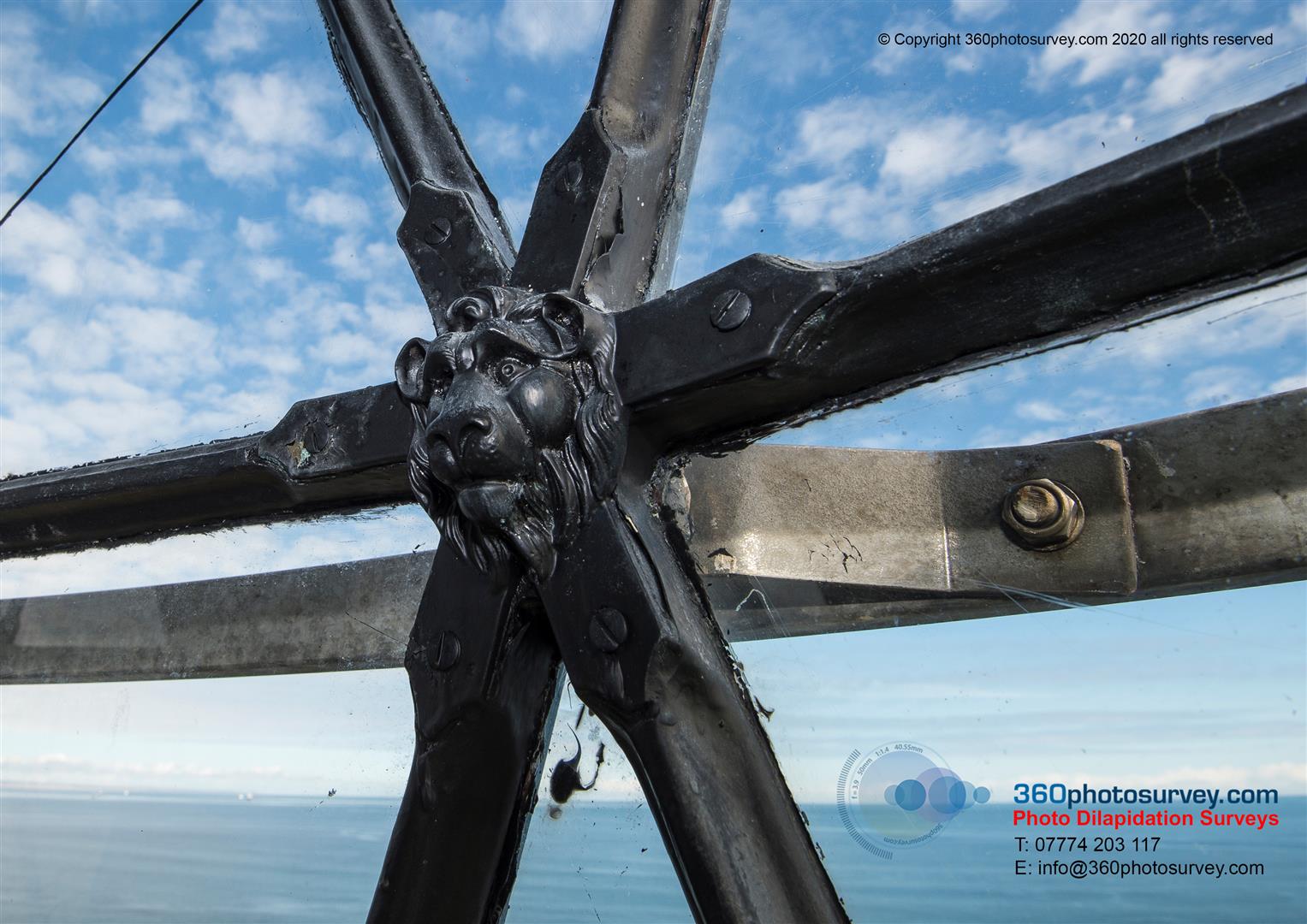
Photo Dilapidation Surveys UK
360photosurvey.com `Northern Run` aerial photoshoot flight operation
Specialist construction and infrastructure project aerial photographer 360photosurvey.com undertakes regular monthly aerial photoshoots covers in ONE continuous flight in our full size aircraft covering all these post code areas.
If you have a construction/infrastructure project (whether as a one off, or on a regular monthly basis) within these post code areas, and would like aerial photos of it – call now.
Nb – we also provide aerial photography for Real Estate professionals during our photoshoot flight operations too.
Providing high quality, high resolution JPEG images for our clients projects.
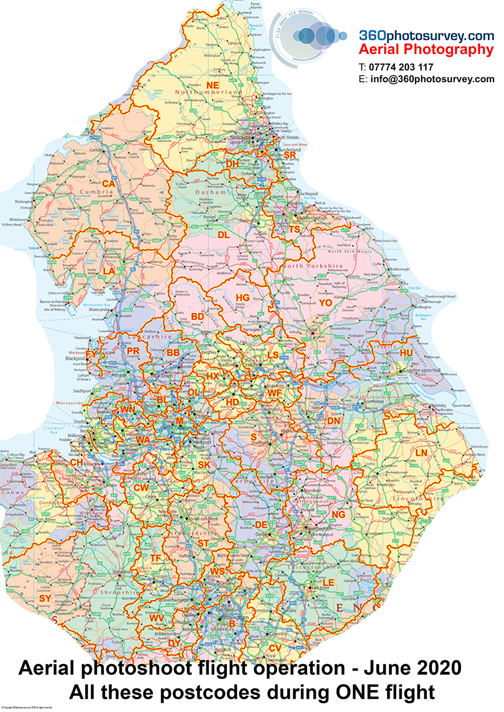
Aerial photographer UK
You can`t do that with a drone!
360photosurvey.com is now CHAPTER 8 compliant
Our Landrover Discovery can get to pretty well any where to undertake photography of our clients projects, and with our newly applied Chapter 8 compliant livery and strobe beacons we`re now able to drive our own vehicle on our clients highway projects.
Upto now we`ve been reliant on our very helpful clients to provide their Chapter 8 vehicles when we undertake photography on their highway projects.
SAFE – PROFESSIONAL – CAN DO ATTITUDE

Construction project photographer
M6 major improvement works start at Junction 19
Specialist Construction and Infrastructure aerial photographer 360photosurvey.com are delighted to announce having been appointed by the Amey Sir Robert McAlpine Joint Venture working on behalf of Highways England to undertake the aerial photography of the M6 jcn 19 improvements, using our full size high-wing aircraft.
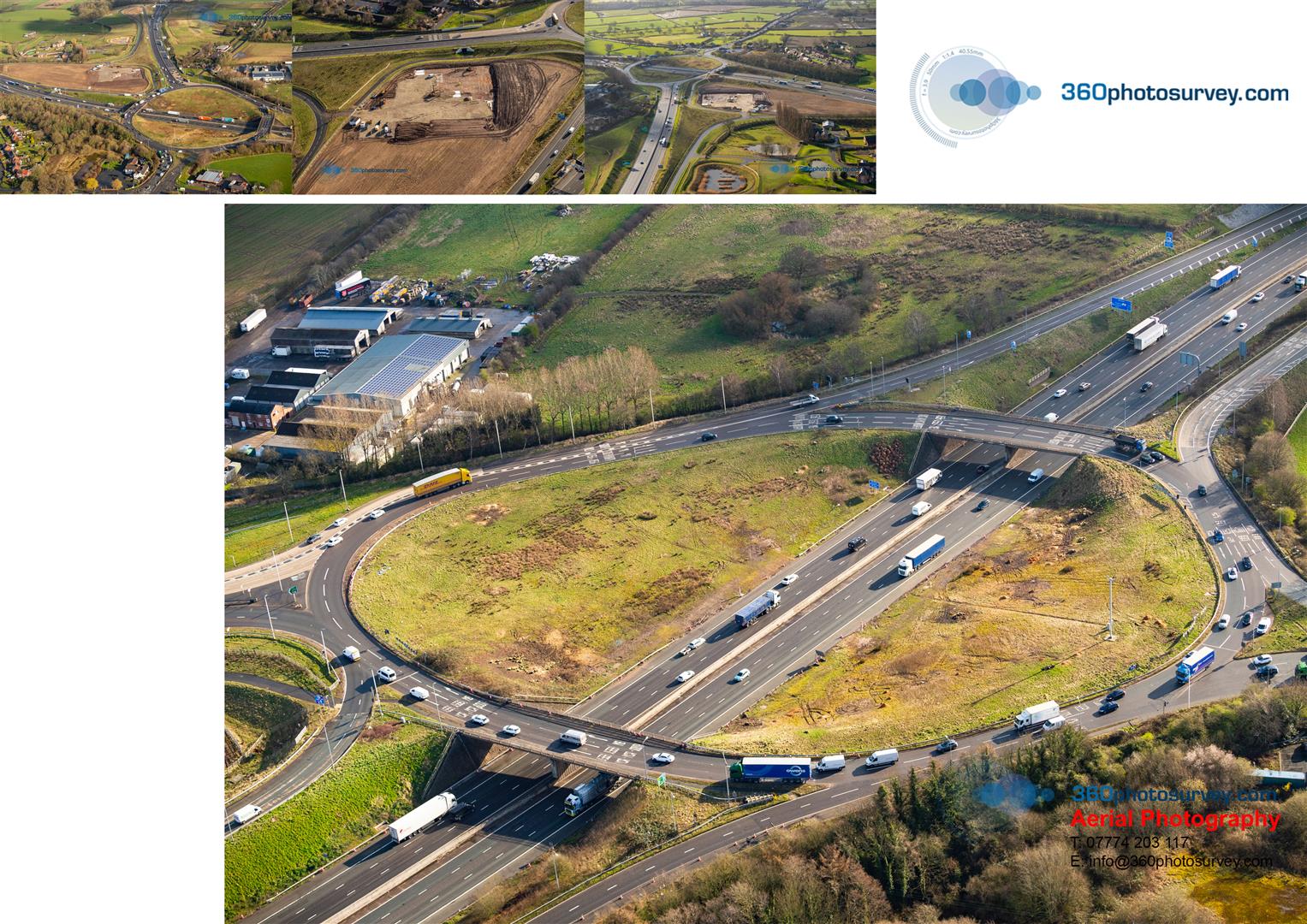
Aerial photographer Highway Projects
Jodrell Bank Lovell Telescope aerial photo now available to purchase
360photosurvey.com`s Hi-Res Jodrell Bank Lovell Telescope aerial photo, looking vertically down at this impressive and iconic structure, is now available to purhcase on our Stock Image Shop as a framed print, canvas or in digital (without the logos).
To view, please visit our website, click on `Stock Image Shop` (top right) and then when the Stock Image Shop opens, click on the Magnifying Glass icon (top right) and enter the text “Jodrell Bank aerial photo”.
This image is one of our ongoing uploading of our back catalogue of our aerial photos, which includes Manchester, Liverpool, Nottingham, Birmingham, Lincoln, Leeds, Sheffield……to name but a few of the extensive locations we cover.
Please do have a browse through our Stock Image library – we hope you`ll find something of interest. If you have a particular requirement please drop us a line.

Aerial Photographer UK
Jodrell Bank `First Light Project` commences
Jodrell Bank`s prestigious First Light Project has been commenced by Kier Construction, close to the famous and awe inspiring Lovell Telescope.
Photos by aerial photographer 360photosurvey.com from 1500 feet in our full size fixed wing aircraft during our February aerial photoshoot flight operation.

Aerial photographer CHESHIRE
Harper Adams University – aerial photos of their new Veterinary Education Centre Building
Harper Adams University in the beautiful Shropshire Countryside is getting a brand new Veterinary Education Centre Building on their campus near Newport.
This fabulous new building is being constructed by McPhillips Construction.

Aerial Photographer SHROPSHIRE
Photos by aerial photographer 360photosurvey.com from 1500 feet in our (real) full size fixed wing aircraft during 360photosurvey.com`s February aerial photoshoot flight operation.
Air to Air Military Aircraft Photographer
So you`ve just arrived on scene & about to undertake the required turn to get the right position for your site project aerial photoshoot when two Military training helicopters drive straight across your planned route?
So what do you do? Answer –
Don`t turn but keep straight on and let them fly past whilst shooting them (photographically of course!) – very photogenic.
These distinctive black and yellow helicopters and their crews are always interesting to see and even better for air to air photography, and having worked with a number of RAF Helicopter pilots I have the highest respect for these dedicated and professional pilots.
Nb, 360photosurvey.com uses full size aircraft with crew of two (our senior pro pilot + photographer) flying at 1500 feet – If we`d been using a drone we`d have been in trouble with the CAA not only for being above the permitted flying height (400ft) of drones but also in close proximity to an aircraft…you can`t do that with a drone!

Aerial Photographer UK
Steel Frame started on Lincoln University Project
The steel frame has commenced on Lincoln University`s latest project in centre of Lincoln City.
Aerial photos taken from 1500 feet by 360photosurvey.com in our full size fixed wing aircraft (not a drone)
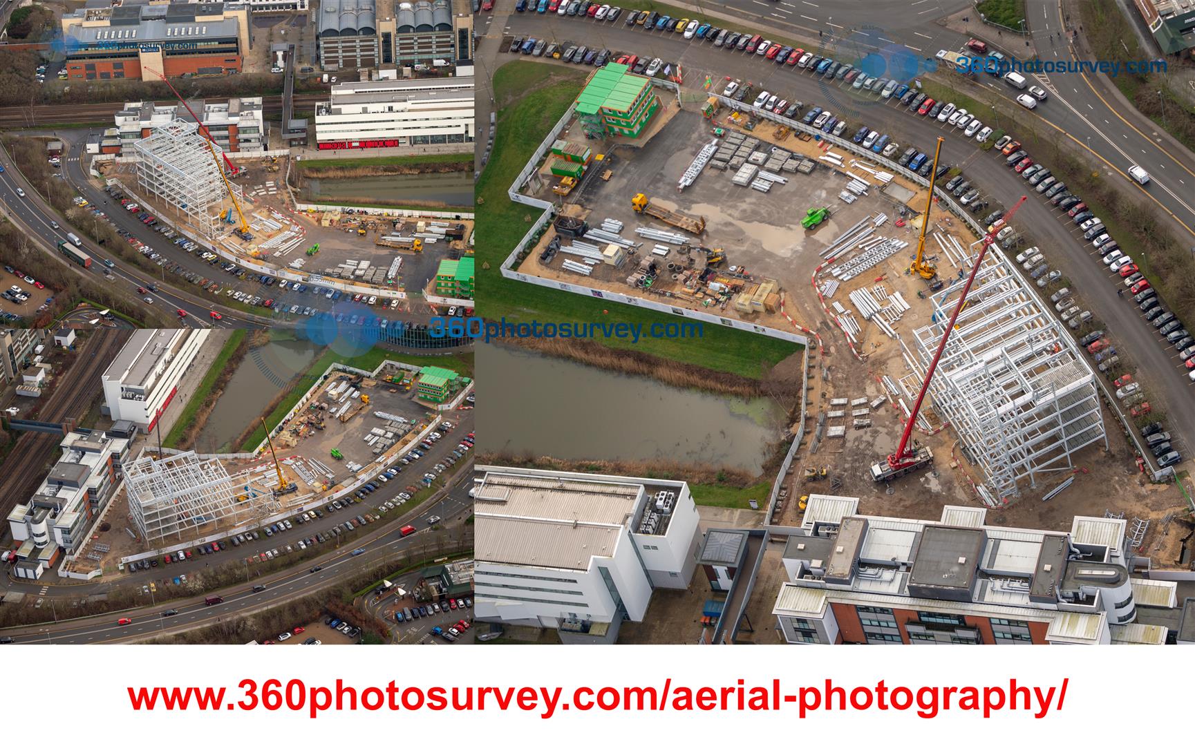
Aerial Photographer Lincoln
during our 4 hour long February photoshoot flight operation.
Royal Fleet Auxiliary Ship `Wave Ruler` moored alongside expanding Peel Ports Liverpool
Royal Fleet Auxiliary ship `Wave Ruler` moored alonside the expanding Peel Ports Liverpool Deep Water Port.
Photos by construction project photographer at 1500 feet from our high wing full size aircraft (not a drone) and recorded using our high spec Nikon Camera systems.
The Port of Liverpool was on our four hour flight to record construction projects for our clients.
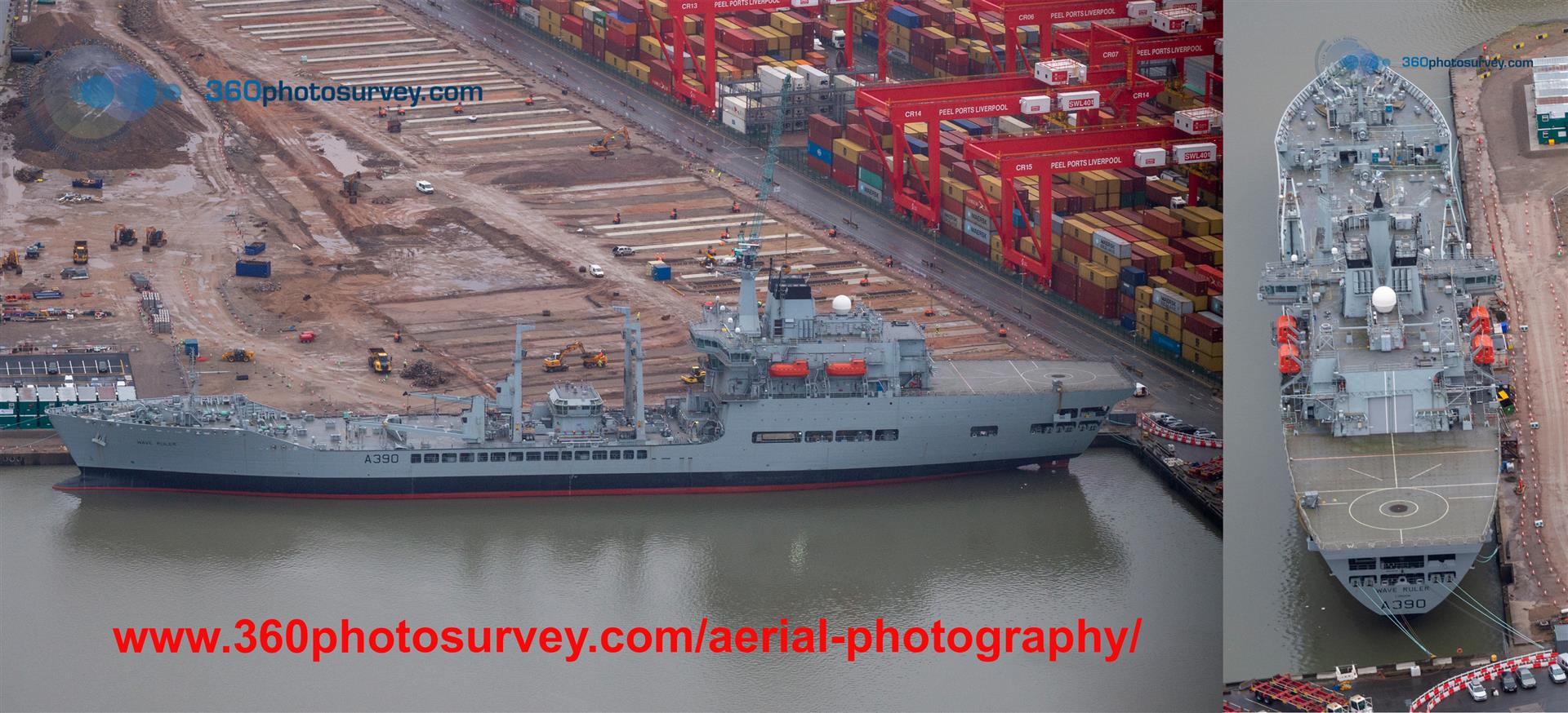
Aerial Photographer LIVERPOOL
Nottingam aerial photographer
Many of 360photosurvey.com newer clients thought we only undertook aerial photography of infrastructure and major construction projects, but we are regularly called into photograph smaller residential developments, such as this student accommodation project in Nottingham for the Cassidy Group.
Flying in our full size high wing aircraft for between 3 and 6 hours, we cover a huge area of the UK from the Scottish border down to Birmingham, with the result that we have developed an enviable record for producing high quality images of our clients projects, whether under construction, or having been completed as this example at Dagfa Court, Nottingham and at extremely reasonable prices from £175+vat per site for which you`ll receive circa 30 high resolution JPEG photos of your project from various angles.
#youcantdothatwithadrone #aerialphotographerNottingham #aerialphotographerNottinghamshire #aerialphotographerUK
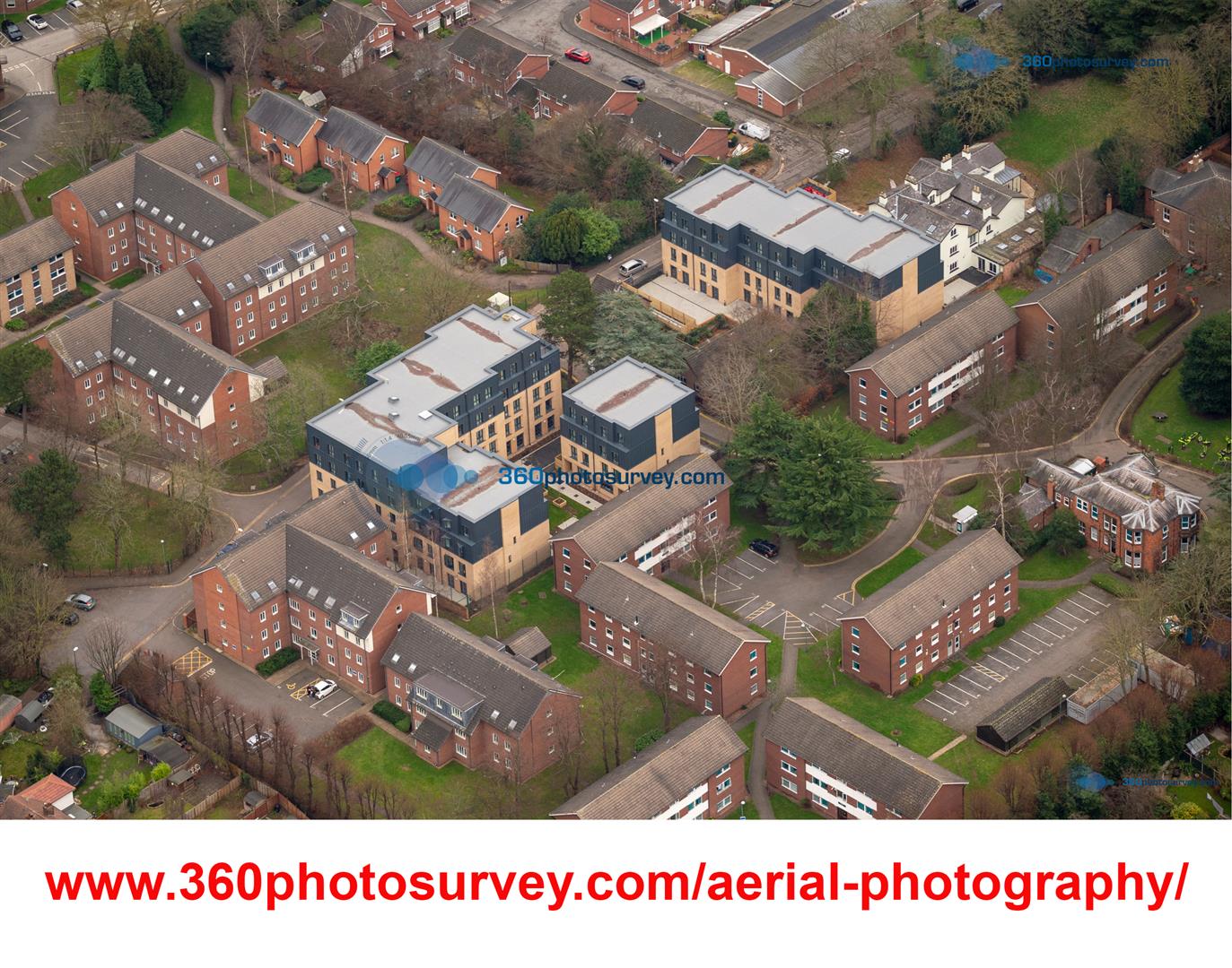
Aerial photographer Nottingham
London photo dilapidation survey – what a transformation
What a transformation! – London Southbank Centre
It`s not often 360photosurvey.com go`s back to a completed project that we had undertaken a detailed and huge 360 photo dilapidation survey some time ago before #BamConstruction commenced major construction works on the buildings.
Recently, having finished early around the corner, 360photosurvey.com bobbed in to the London Southbank Centre and what a fabulous transformation as these quick snaps illustrate to the dilapidation photos taken during our survey.
From recollection, we took circa 50,000+ images of the two buildings (Hayward Gallery & Queen Elizabeth Hall + Purcell Room) providing a difinitive record of the building conditions before major works on these Grade 2 listed buildings.
#photodilapidationsurveys #360photodilapidationsurveys #photoconditionsurveys #dilapidationsurveysLondon #conditionsurveysLondon
ps thanks to the Southbank Centre for permission to take the photos.

Photo dilapidation surveys UK
A little thought that could save main contractors a small fortune and less headaches
A little thought that could save main contractors a small fortune & less headaches.
Unfortunately many contractors don`t give it a thought at the start of their project. Indeed photography is probably well off their radar with so much to consider at the start of a project.
However by undertaking a detailed 360 photo dilapidation/condition survey BEFORE you commence works, INCLUDING the adjacent highways/pavements will identify existing defects/damages which you can use to prove you didn`t cause them, & therefore avoid spurious, time consuming/expensive claims against you when you have better and more important things to do with your time.
The principle is therefore if the defect is on our photos – it wasn`t caused by you or your sub contractors…..Its that simple! 360photosurvey.com specializes in producing extremely detailed photo dilapidation surveys for contractors quickly, efficiently & cost effectively. We provide you with a USB hard drive containing a complete record of the site/highway areas enabling you & your team to `virtually` walk around the site and quickly view and identify issues.
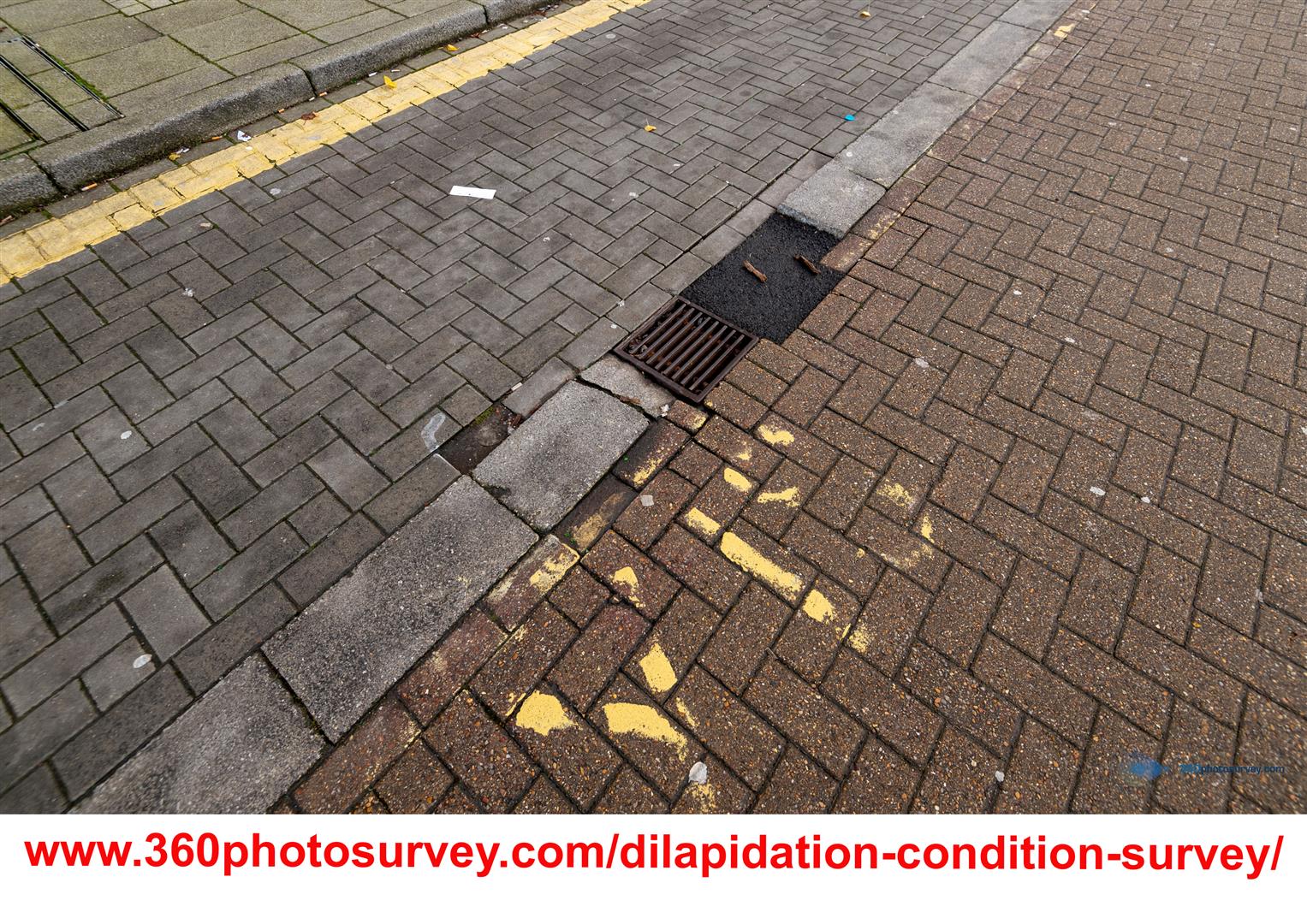
Photo Dilapidation Surveys UK
Please do have a look at our website photo dilapidations page (see link in photo) where we`ve provided some video cast studies of some of our projects.
360photosurvey.com expands to provide monthly aerial photoshoots of London construction projects
As one of the UK`s leading construction project aerial photographers, 360photosurvey.com has built an enviable record for high quality aerial photography of construction and infrastructure projects and is expanding its regular monthly aerial photoshoot flights to now include London.
With the success of our regional aerial photoshoot flights, and already working on the ground in London with our 360 photo dilapidation surveys in the Capital it seemed the logical thing to do.
Our London specific monthly flights will commence from mid January 2020. We`ll be flying our twin engine Squirrel helicopter over construction projects in London, using our pro Nikon cameras and high powered lenses to record unique images for our clients, many of whom already use our services elsewhere in the UK.
London which has some spectacular construction projects, also has, quite understandably a moritorium on drone operations with the city. Flying at typically 2000 feet (which drones can`t legally fly at) 360photosurvey.com is able to obtain phenominally detailed and high quality images from a unique perspective.
Unlike some aerial photographers, we only use aircraft/helicopters and professional pilots certified for commercial photography by the CAA/NATS.
If you have a construction project within London, and would like aerial photos of it, call Chris on FREEphone 0800 716 703 or email your site address to info@360photosurvey.com
What do you get? Circa 30 high resolution stunning images of your projects, supplied on a USB memory stick.
Examples of our work: http://www.360photosurvey.com/aerial-photography/
One big hole from the air
#AggregateIndustries #BardonHillQuarry is one of three huge “big hole” quarries near Leicester. From the ground you wouldn`t necessarily know they were there, nor how deep they are, whereas from the air a whole new perspective with an almost surreal landscape.
Aerial photos by construction project aerial photographer 360photosurvey.com during our flight through the region 16th May 2019 using high wing aircraft (fabulous uninterupted views) and very high powered cameras. You can get an idea of the amount of detail we pick up with the view of the vehicles which are tiny specs in the bottom left photo.
To order copies of these photos, or to arrange an aerial photoshoot of your site – call 360photosurvey.com
#aerialphotographerUK #aerialphotographerEastMidlands #aerialphotographerMidlands #aerialphotographerWestMidlands #aerialphotographerNorthWest #aerialphotographerYorkshire
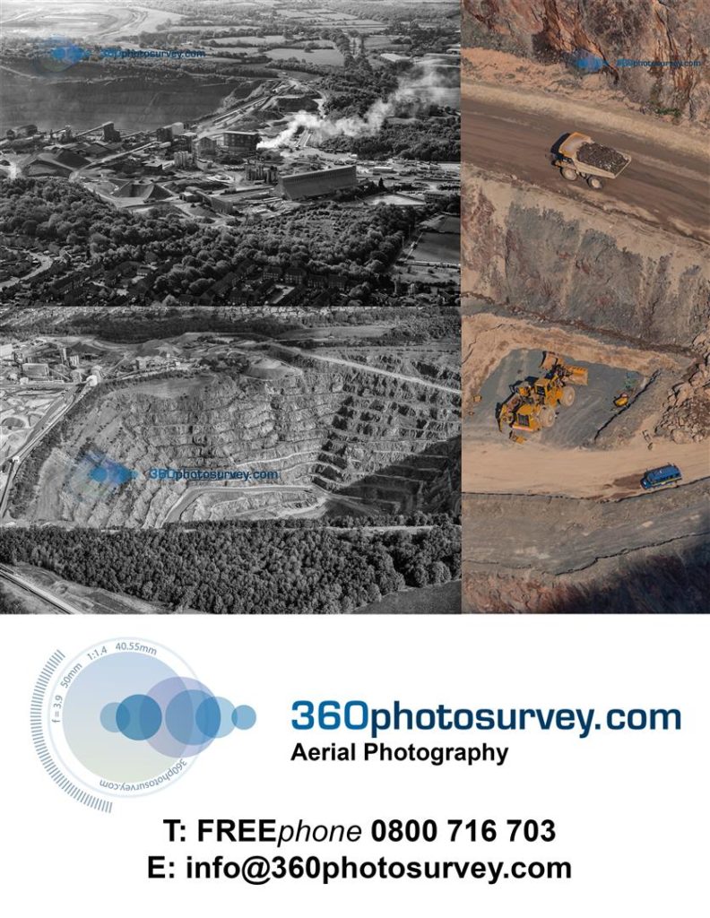
Former Barnes Hospital gets new lease of life
The former Barnes Hospital in Cheadle, Stockport has lanquished for many years in dereliction.
Now, brought back to life as part of the Barnes Village development by Henley Homes, the grade II listed building has been transformed in the conversion to residential in conjunction with new build housing.
Aerial photos by specialist construction project aerial photographer 360photosurvey.com using our high wing aircraft and powerful DSLR lenses.
Due to the proximity of this site on the Manchester Airport final approach flight path required very close communications with Air Traffic Control at all times, enabling us to undertake the photoshoot very quickly without disruption to the airport operations, something that would have been impossible (and illegal using a drone).
Thanks again to Manchester ATC….great dealing with the pro`s.
#BarnesHospital #BarnesVillage #HenleyHomes #aerialphotographerUK #aerialphotographerStockport #aerialphotographerCheshire #aerialphotographerManchester #aerialphotographerNorthWest #constructionprojectaerialphotographer
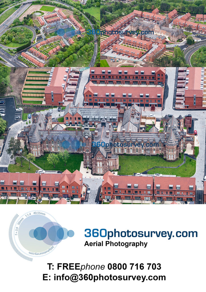
Construction project Time Lapse – Case Study – Tesco “Jack`s” fit out
360photosurvey.com were invited by #ISGconstruction and #TescoStores to produce time lapse videos of their first two #Jacks store roll out at Immingham and Chatteris.
This video is from the Immingham project showing the conversion of the base shell to the completed opening of the store by ISG Construction.
#Timelapsevideos, #Constructionprojecttimelapsevideos #retailfitouttimelapsevideos
Always interesting – Mersey Estuary and Liverpool Bay
Construction project aerial photographer
360photosurvey.com aerial photography specialises in photographing construction and infrastructure projects. With over thirty years of experience 360photosurvey.com is the UK`s foremost specialists in this sector.
Based in Cheshire, our “Monthly Flight Operation” covers construction and infrastructure projects throughout:
- North West (including Cumbria)
- Wales
- Midlands (including East & West Midlands)
- Lincolnshire
- Leicestershire
- Yorkshire
360photosurvey.com undertakes commissions which require the highest quality images, with an attention to detail and composition whether on our “Monthly Flight Operation” for regular monthly progress photography or as a “one-off” throughout the UK for:
- Main Contractors
- Design & Build Companies
- Highway Authorities
- Marine Authorities
- Local Authorities
- Architects
- Real Estate Agents
- Corporate clients
- Marketing
360photosurvey.com aircraft are licenced to operate within Controlled Airspace and Restricted Flight Zones throughout the UK. Subject to approval by NATS and local Air Traffic Control we can undertake difficult commissions including major airports with example commissions undertaken at Manchester and East Midlands Airports.
360photosurvey.com high-wing fixed wing aircraft and helicopters, ensure the most stable platforms with uninterrupted clear views for our photographers using pro-Nikon DSLR cameras and high-powered lenses, the quality of our aerial photography is without comparison in the UK, allowing us to create images of a truly stunning quality, with unbelievable clarity and definition – and at exceptionally competitively rates.
Our Pilots, and are CAA Commercially licenced specifically to fly on aerial photography flight operations, with our Senior pilot having held his licence for over 25 years.
As professional aerial photographers 360photosurvey.com specialises in monthly “progress” photography of construction and infrastructure projects including:
- City Centre projects
- Airport projects
- Marine/infrastructure projects
- Highway/infrastructure projects
- Railway/infrastructure projects
- Water Treatment and associated projects
- Aerial Surveys
On our standard “Monthly Flight Operation” we provide circa 30+ high resolution JPEG images of your site from various angles, supplied on a USB memory stick.
Examples of our aerial photography can be viewed on the `stills portfolio` and `news` pages of our website at www.360photosurvey.com
Call Chris on FREEphone 0800 716 703 now to discuss your requirements – you could get a free sample aerial photoshoot of your project.
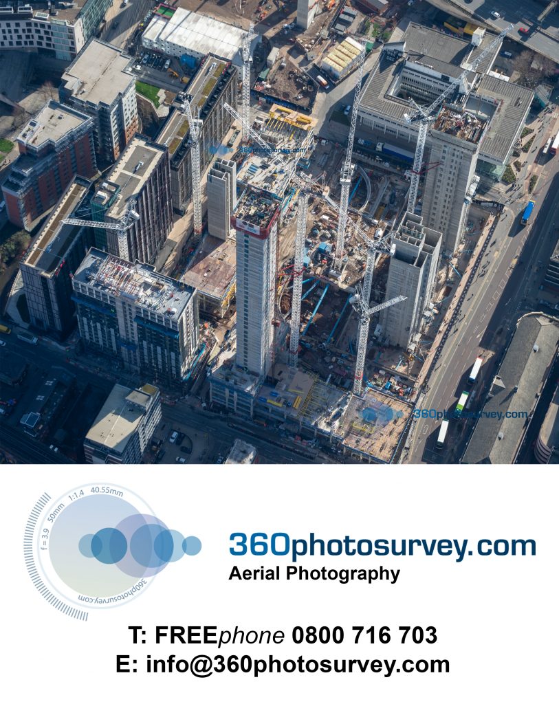
Nottingham Wildcats Arena
#NottinghamWildcatsArena built as the sports hall for Jesse Boot Primary School and to be the home of the #NottinghamWildcats basketball team – whom since moving into the has gone from strenth to strength necesitating extending the building to provide additional basketball halls and associated facilities.
Built by sports hall design & build specialist #RelkinConstruction, whom also built the peforming arts centre which also remains on the site. #JesseBootschool dated from circa 1930`s has now been demolished replaced by a the new bounded by the Arena and Performing Arts Centre. #NottinghamAcademy #GreenwoodCampus
Aerial photos by 360photosurvey.com #aerialphotographerNottingham #aerialphotographerNottinghamshire #aerialphotographerEastMidlands
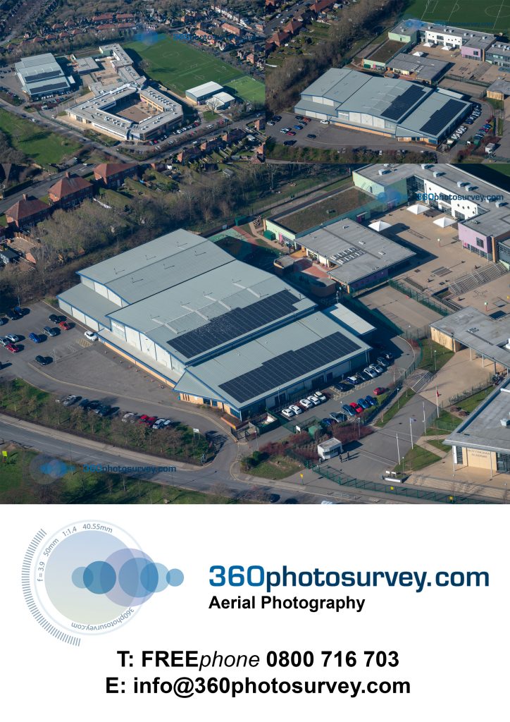
Magnificent Lichfield Cathedral from the air
When such a fabulous building just happens to be around the corner from one of our construction project aerial photoshoots – how can one not bob over to take some photos
….no apologies for black and white (colour available on request though!)
Lichfield Cathedral by aerial photographer 360photosurvey.com
#aerialphotographerLichfield #aerialphotographerStaffordshire #aerialphotographerMidlands #aerialphotographerNorthWest #constructionprojectaerialphotographer #LichfieldCathedral #Lichfield #Staffordshire #Cathedralaerialphoto
Highways England and Staffordshire County Council – A50 Highway improvements Uttoxeter
A50 Growth Corridor at Uttoxeter, Staffordshire – Staffordshire County Council on behalf of Highways England Project A `Western Junction` undertaken as part of an Infrastructure and Strategic Partnership with main contractor Tarmac and managed by Amey provides improved access to new housing and employment sites in addition to improving the access to the nearby JCB factories.
Aerial photos by Highways and Infrastructure aerial photographer 360photosurvey.com
#highwayprojectphotographer #aerialphotographerhighwayprojects #aerialphotographerStaffordshire #aerialphotographerinfrastructureprojects #A50Uttoxeter #HighwaysEngland #StaffordshireCountyCouncil #Amey #Tarmac #infrastructureandstrategicpartnership #JCB
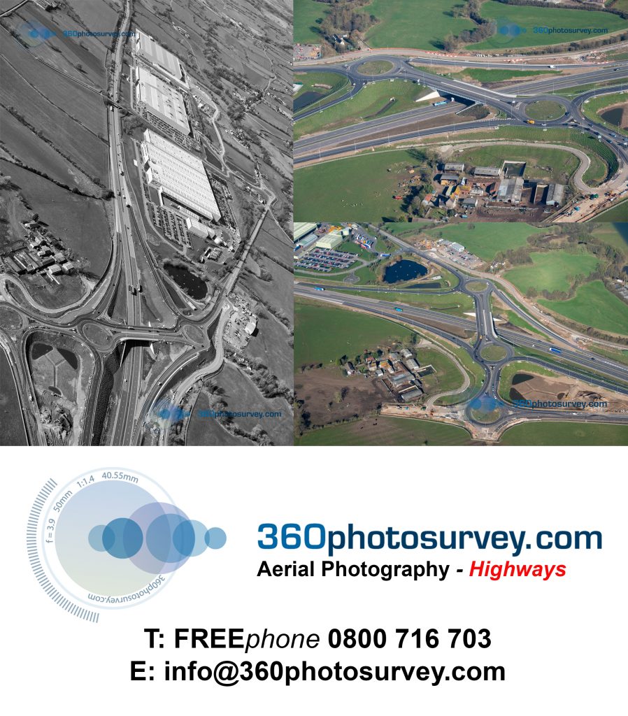
Bloor Homes development Bluebell Green, Brereton near Holmes Chapel – latest aerial photos
Bloor Homes development Blue Bell Green at Brereton on the A50 near Holmes Chapel – latest aerial photos by construction project aerial photographer taken on 25th February 2019 during our photo shoot flight of construction projects in the region.
#aerialphotographerCheshire #aerialphotographerHolmesChapel #aerialphotographerNorthWest #constructionphotographer #aerialphotographer #BloorHomes #BluebellGreen #Brereton #HolmesChapel #newhomesCheshire
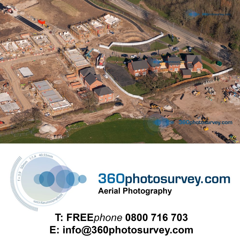
Russell Homes development Saltersford Gardens, Holmes Chapel – latest aerial photos
Russell Homes development Saltersford Gardens at Holmes Chapel in Cheshire is progressing well.
Construction project Aerial photographer 360photosurvey.com photographed the project during it`s February photo shoot of construction projects within the North West.
#aerialphotographerHolmesChapel #aerialphotographerCheshire #aerialphotographerNorthWest #constructionphotographer #RussellHomes #SaltersfordGardens #HolmesChapel #Cheshire #360photosurvey
Former BBC Manchester studios site development
Main contractor John Sisk and Son development on the former BBC Manchester Studios on Oxford Road, Manchester rising out of the ground with slip form specialist MPB Slipform creating the concrete towers
Construction Aerial Photo specialist 360photosurvey.com image recorded during our aerial photoshoot of a large number of ongoing developments within the City and surrounding regions during our February `19 photoshoot.
#aerialphotographerManchester #aerialphotographerNorthWest #constructionprojectphotographer #360photosurvey #BBCManchester #OxfordRoadManchester #JohnSiskandSon #MPBslipform
Lend Lease Whitworth Street Manchester project
Main Contractor, Lend Lease Whitworth Street, Manchester project progressing well – Aerial photo by 360photosurvey.com taken during our aerial photoshoot of construction projects on 25th February 2019.
#aerialphotographer #aerialphotographerManchester #aerialphotographerNorthWest #constructionprojectaerialphotographer #constructionprojectphotographer #360photosurvey #LendLease #WhitworthStreetManchester #Manchester
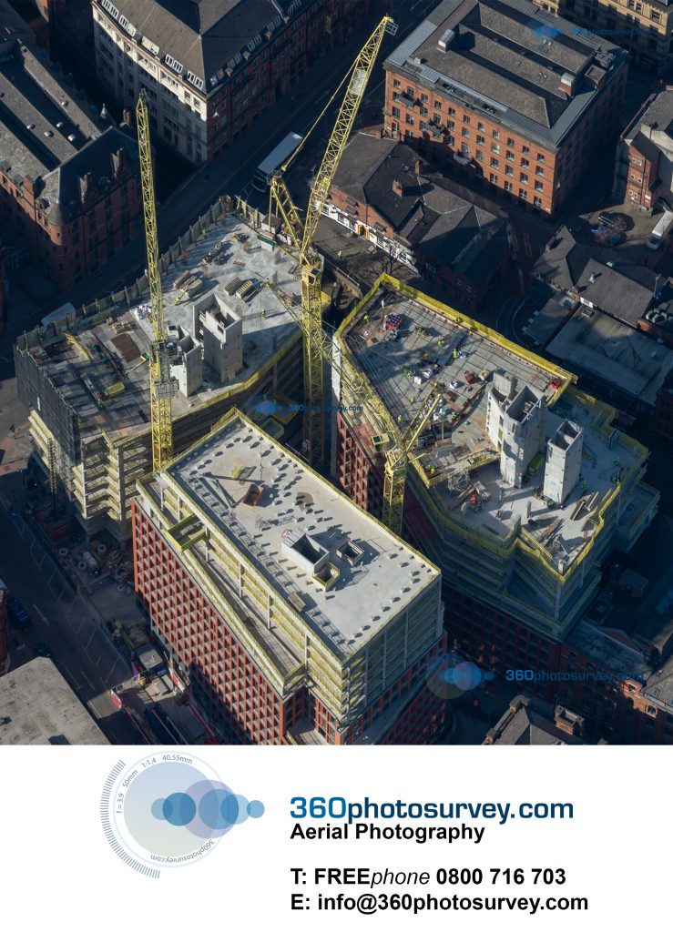
Liverpool`s Baltic Triangle development
Much of Liverpool`s #BalticTriangle has lain waste since WW2 Blitz and at long last the area is beginning to be rejuvenated.
#aerialphotographer 360photosurvey.com aerial photo of #CrossfieldConstruction #BrickLane project designed by architects #BrockCarmichael
#aerialphotographerLiverpool #aerialphotographerMerseyside #aerialphotographerNorthWest
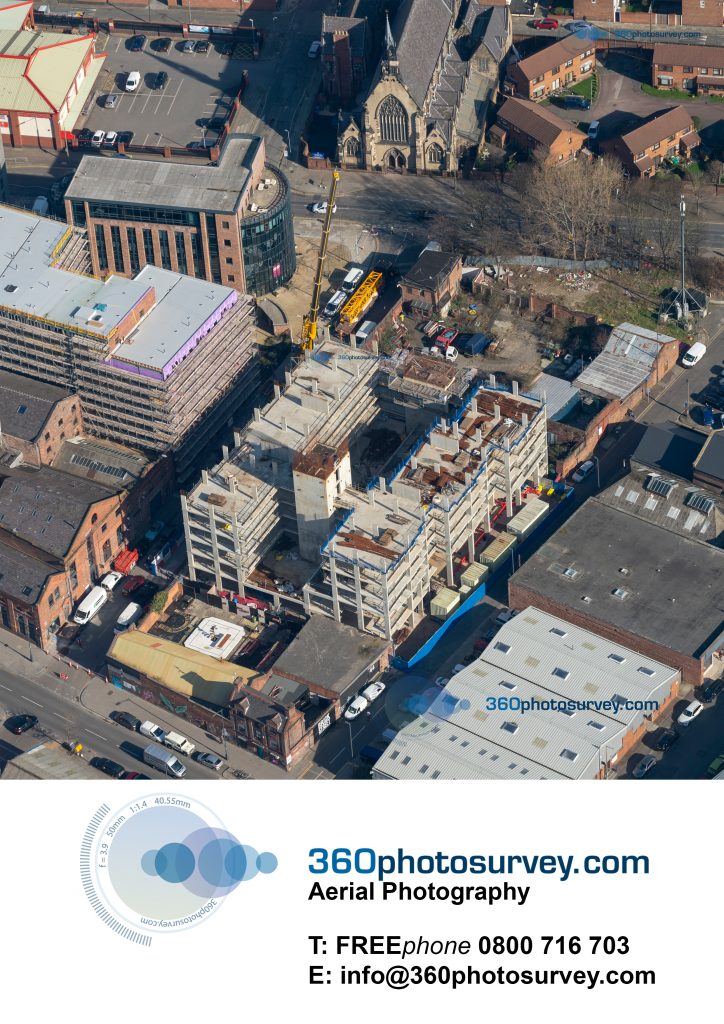
No more landings at Woodford Aerodrome
No more landings at Woodford Aerodrome.
The runway has now been neatly sliced in half, sold by British Aerospace for a new Redrow Homes development – some really nice houses too.
There are only two hangars left at the back of the airfield awaiting their demolition fate.
The Vulcan on the other hand as always looks superb standing proudly outside the new Avro Museum…well worth a visit.
Will have to have a separate post for the aerial photos of the Redrow project!
Aerial photos by construction project aerial photographer 360photosurvey.com
#aerialphotographer #aerialphotographerNorthWest #aerialphotographerStockport #constructionprojectphotographer #RedrowHomes #Vulcan #AvroMuseum #Woodfordairfield #BritishAerospace #Woodford #Cheshire #Aviationhistory
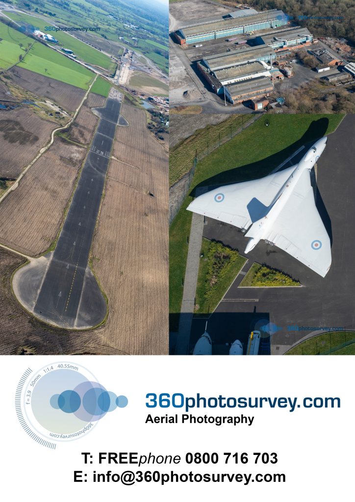
JCB gets a new (3rd) huge shed at its Uttoxeter plant
Another (3rd) huge shed for JCB under construction at their Uttoxeter plant adjacent to the A50 in Staffordshire.
Great to see a fantastic British company doing well with fabulous products for the construction industry.
Aerial photography by 360photosurvey.com
#aerialphotographerNorthWest #aerialphotographerMidlands #aerialphotographerStaffordshire #constructionprojectphotographer #JCB #Uttoxeter #Staffordshire
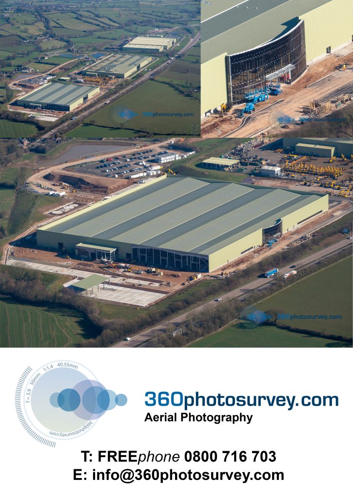
East Midlands airport success
Another huge new shed going up at East Midlands Airport – great to see this airport going from strength to strength – Aerial photos by 360photosurvey.com during our February 2019 aerial photoshoot of clients construction projects – Many thanks to East Midlands Air Traffic Control Tower staff enabling us to get these shots.
#Aerialphotographer #aerialphotographerEastMidlands #aerialphotographerMidlands #aerialphotographerNottinghamshire #aerialphotographerDerbyshire #aerialphotographerStaffordshire #constructionphotographer #EastMidlandsairport #EastMidlands
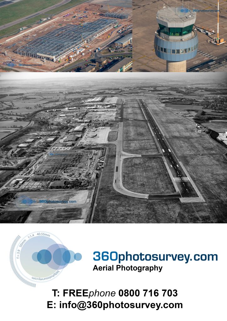
Magnificent Lincoln Cathedral from the air
Aerial construction project photographer 360photosurvey.com captured this aerial photo of the magnificent Lincoln Cathedral during our February 2019 aerial photoshoot of a nearby Bowmer and Kirkland construction project.
#aerialphotographer #aerialphotographerLincoln #aerialphotographerLincolnshire #constructionprojectphotographer
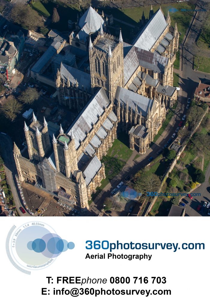
Liverpool docklands aerial photographer
BCEGI Moda development on the Liverpool docklands by construction project aerial photographer 360photosurvey.com
Liverpool`s Mersey waterfront has lain for many years in ruins from WW2 bombing and at long last new developments are starting to appear all along the river creating another but different boom.
#Aerialphotographer #aerialphotographerLiverpool #aerialphotographerMerseyside #aerialphotographerNorthWest #aerialphotographerMidlands #aerialphotographerEastMidlands #aerialphotographerYorkshire #constructionphotographer
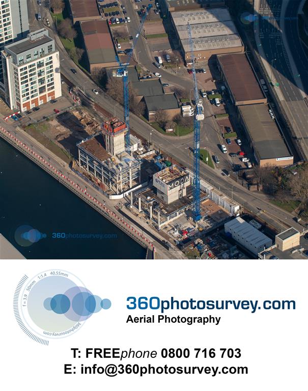
Prologis Fradley Development
Aerial photographer 360photosurvey.com photographed one of the latest distribution centres by specialist Prologis on the former RAF base at Fradley near Lichfield in Staffordshire. One of several big sheds constructed by big shed specialist contractor Winvic
The site bounds the route for HS2 railway
#aerialphotographerEastMidlands #aerialphotographerLichfield #aerialphotographerStaffordshire #aerialphotographer #HS2Staffordshire #Winvic #Prologis
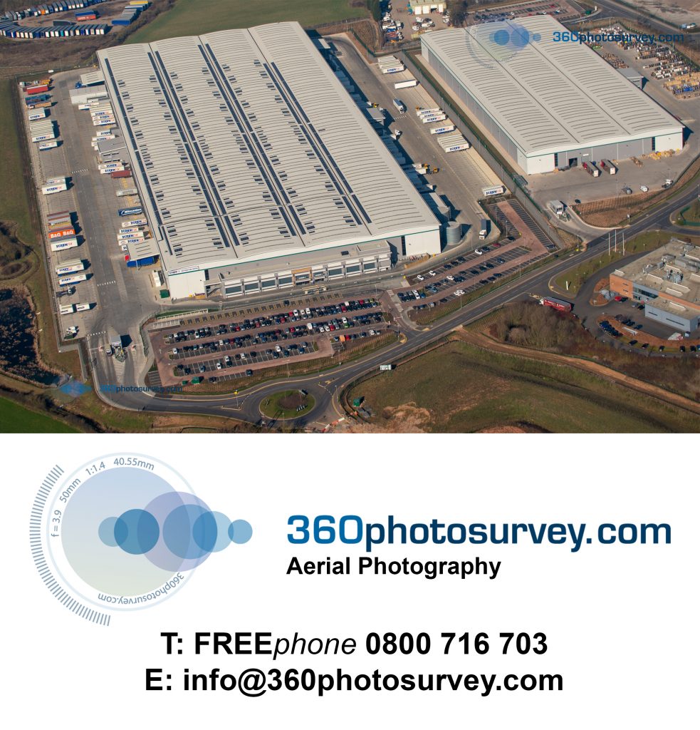
360photosurvey.com wins Manchester Airport aerial photography contract
Aerial photographer 360photosurvey.com has been appointed by Galliford Try Infrastructure to provide monthly aerial progress photography of their extensive work at Manchester Airport.
#AerialphotographerManchester #aerialphotographerManchesterAirport #aerialphotographerNorthWest #GalifordTryAviation

Liverpool landmark Everton Watertower
Liverpool landmark Everton Water Tower sold at auction.
Aerial photographer 360photosurvey.com flew over during our monthly (February 2019) aerial photoshoot of properties and construction projects within the Liverpool area photographing this iconic but redundant structure as it was sold at auction by Pugh Auctions on behalf of United Utilities.
Such fabulous potentential for conversion, with magnificent views of the City and surroundings, we await with interest to see the new owner`s proposals.
#aerialphotographerLiverpool #aerialphotographerNorthWest #aerialphotographer #Pughauctions #UnitedUtilitieswatertower
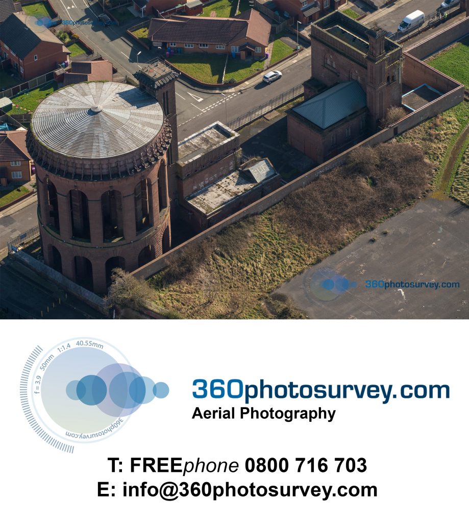
Aerial photoshoot at Manchester Airport
360photosurvey.com`s January 2019 monthly aerial progress photos of construction projects included Manchester Airport.
Using our high wing light aircraft, with our pro pilot and CAA fully licenced for commercial operations we provide fabulous images of our clients construction projects.
Typically for each site we provide circa 30 high resolution JPEG images on a USB memory stick and can also supply high resolution prints at all manner of size to suit client requirements.
At prices starting from £175+vat we cover the North West, Midlands, East Midlands and North Wales.
#aerialphotographerNorthWest #aerialphotographerMidlands #aerialphotographerEastMidlands #aerialphotographerNorthWales #aerialprogressphotos
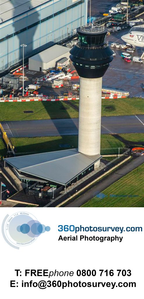
Demolition goliath munches its way through derelict building
Aerial photographer 360photosurvey.com`s drone recorded LOR Demolition Ltd goliath munching its way through a derelict industrial building in Northwich, Cheshire.
Moorland fire nearly engulfs major communications mast on Winter Hill
The extent of the moorland fire that very nearly engulfed the communications mast on Winter Hill is clearly shown in these aerial photos undertaken by aerial photographer 360photosurvey.com.
All credit to the emergency services in fighting this blaze.
Aerial photoshoot over Manchester`s “Kampus” development
Aerial photoshoot over Manchester`s `Kampus` project by 360photosurvey.com.
The development by Henry Boot Developments and Capital & Centric includes two Grade II Listed Warehouses, one of which, Minto & Turner is believed to be the oldest surviving warehouse in Manchester which had lain for 30 years in ever increasing dereliction – great to see it being finally brought back to life.
An aerial video over Manchester Airport`s new terminal construction site
An extract video from the Manchester Airport aerial photoshoot by Aerial photographer 360photosurvey.com of the major construction project developing the new terminal using our high wing aircraft.
Aerial photoshoot over Manchester Airport`s new terminal
Aerial photographer 360photosurvey.com latest aerial photoshoot included Manchester Airport`s new terminal building construction project showing it being well advanced. This image was one of 150 360photosurvey.com taken of this construction project during the photo shoot.
At a set fee of £175+vat per site you receive circa 30 high resolution JPEG images of your site/building – call now to arrange yours on Freephone 0800 716 703
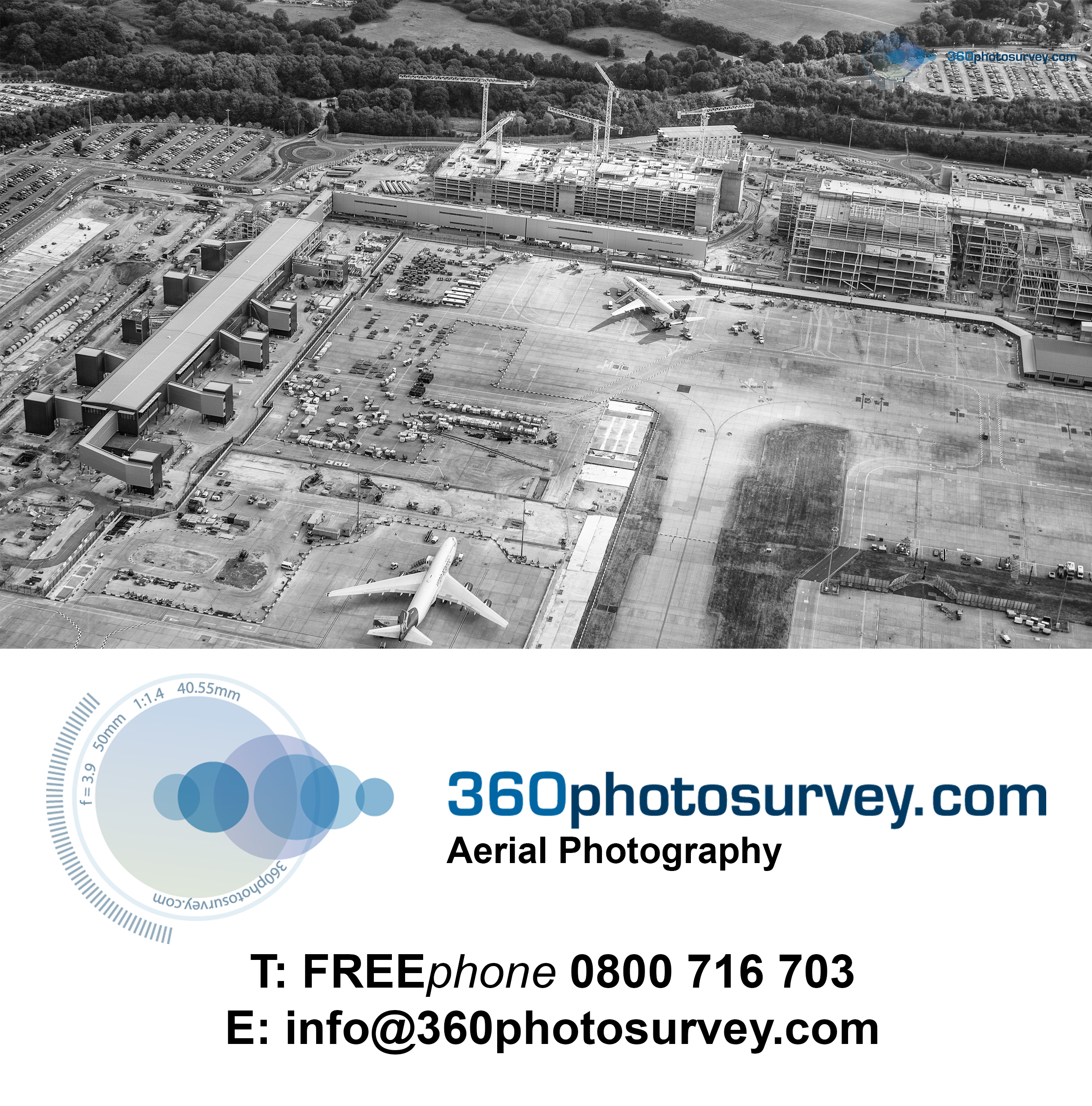
360photosurvey.com completes latest photo dilapidation survey in record time
360photosurvey.com has completed a photo dilapidation survey for Bouygues UK prior to construction works commencing on their Mount Pleasant project in London.
Providing a detailed photographic record of the highways, pavements and surrounding buildings, street furniture and trees 360photosurvey produced a high resolution still photographic record in excess of 6000 photos, together with a location plan identifying the position of the images in a record time of two working days from the survey.
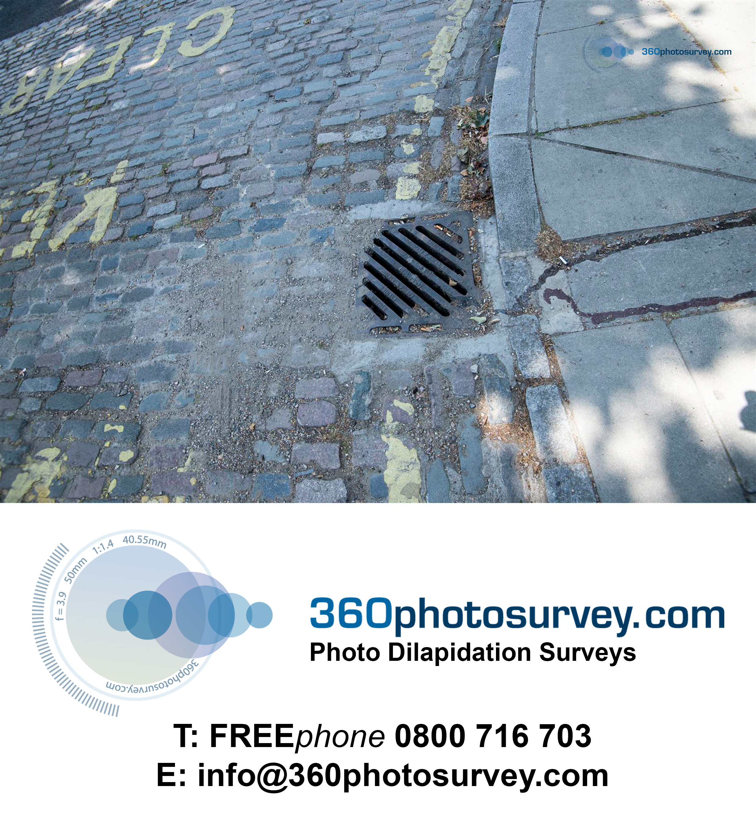
Photo dilapidation surveys London
Telescopic mast photo of the new Salford Crescent rail link
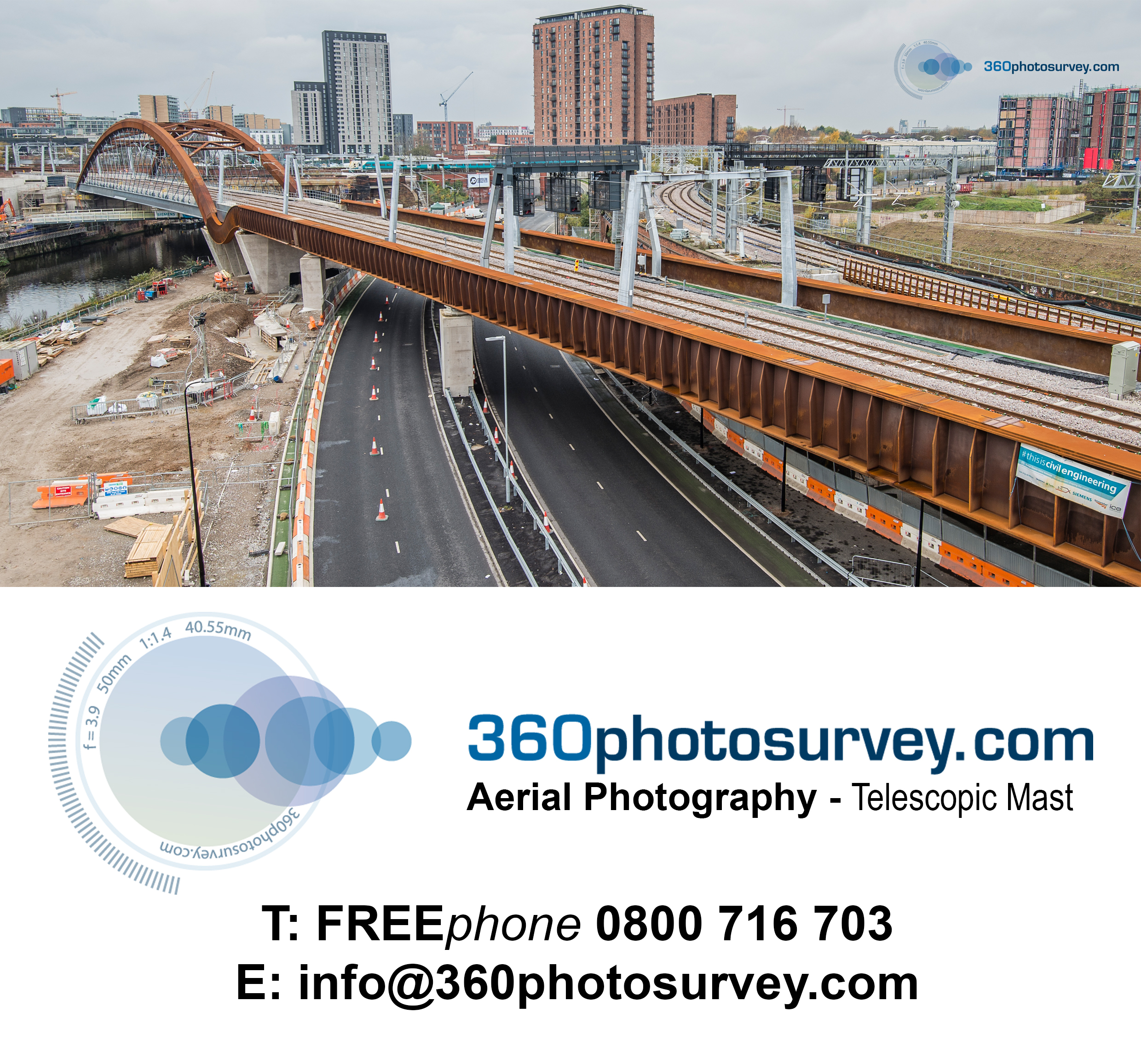
Aerial photographer Manchester
The “Giant Spectacular” is returning Liverpool
The “Giant Spectacular” is returning to Liverpool later this year and will also be visiting New Brighton Lighthouse on the Wirral for the first time. The Lighthouse recently featured in one of 360photosurvey.com`s aerial photo shoot of the Tall Ships departing along the Mersey on the Bank Holiday Monday.
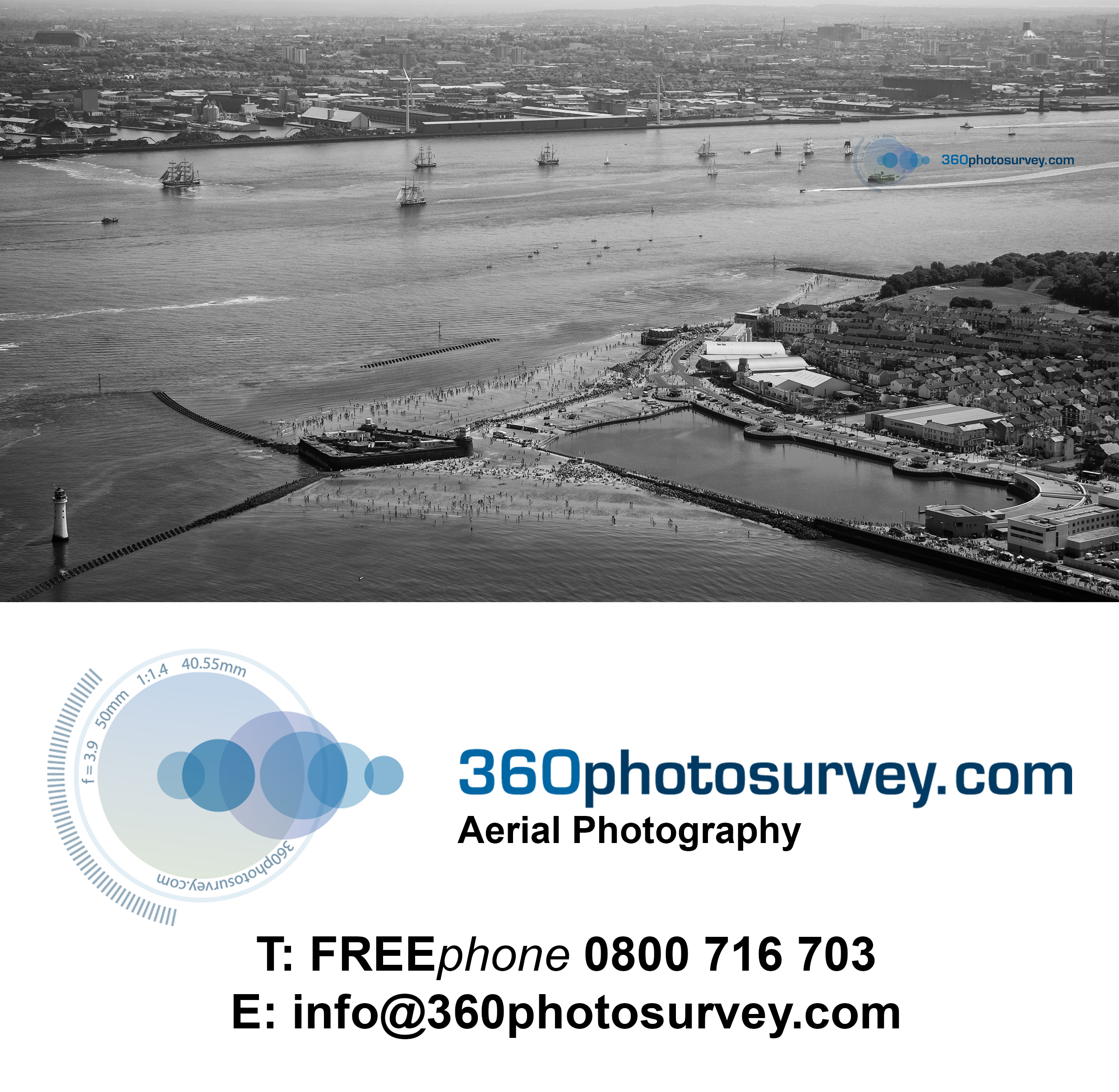
Aerial photographer Liverpool
Aerial photo of Dunham Massey
Aerial photo captured by Cheshire based aerial photographer 360photosurvey.com of Dunham Massey Hall, one of the jewels in the crown of the National Trust

Aerial photographer Cheshire
Highways aerial photographer
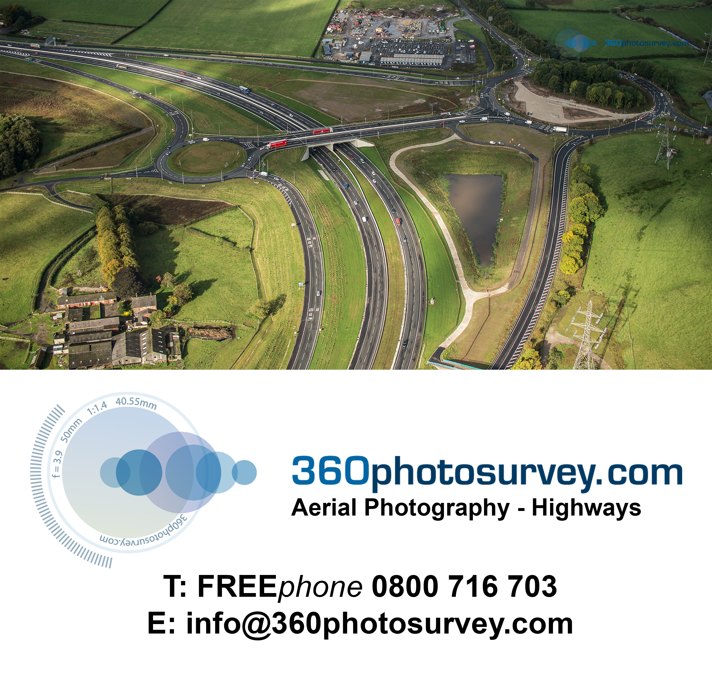
Highways aerial photographer
Listed Building photo condition surveys
Part of a recent photo condition survey of a grade II listed farm complex undertaken by 360photosurvey.com included a rare Cruck Barn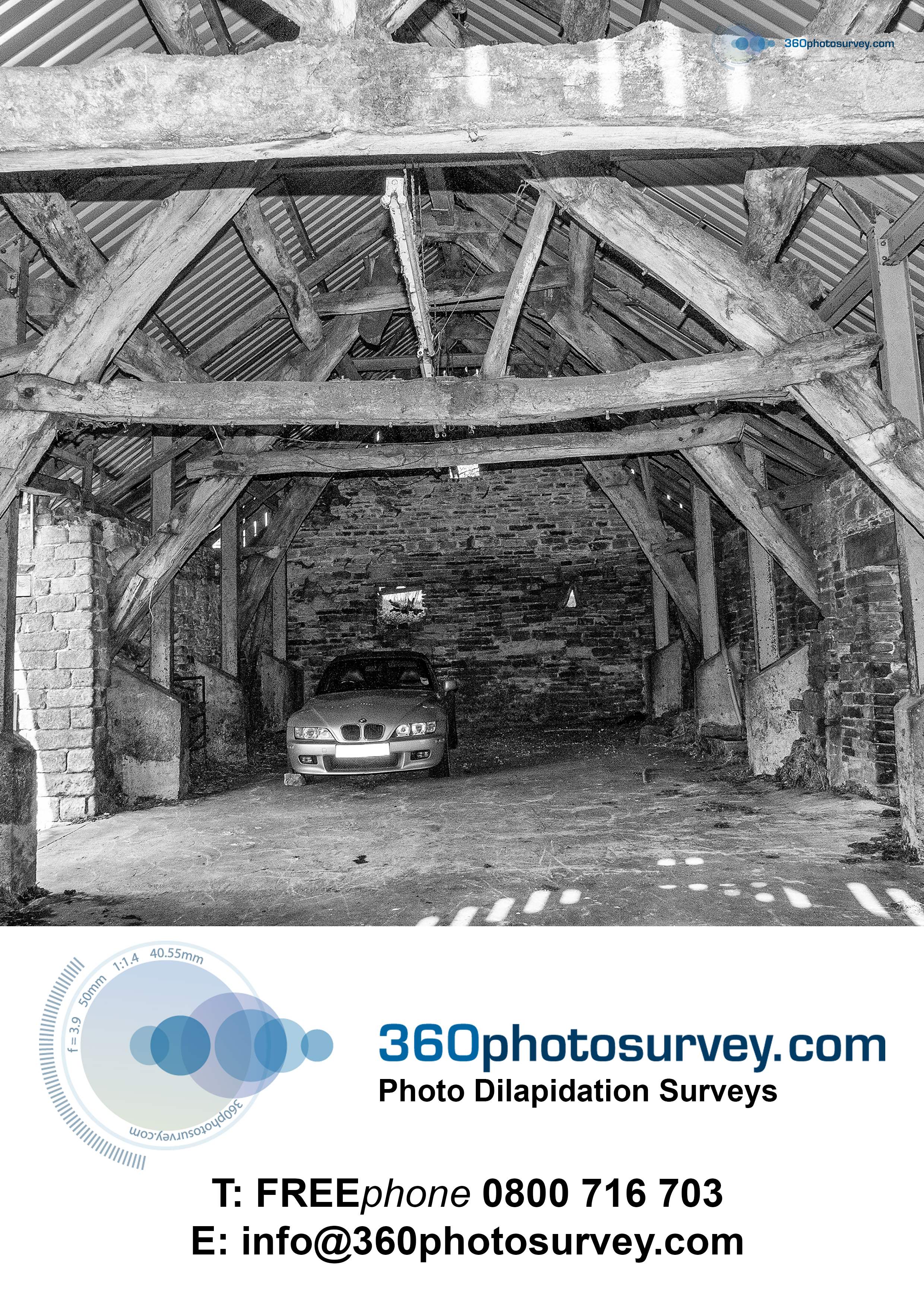
Aerial photographer 360photosurvey over Liverpool
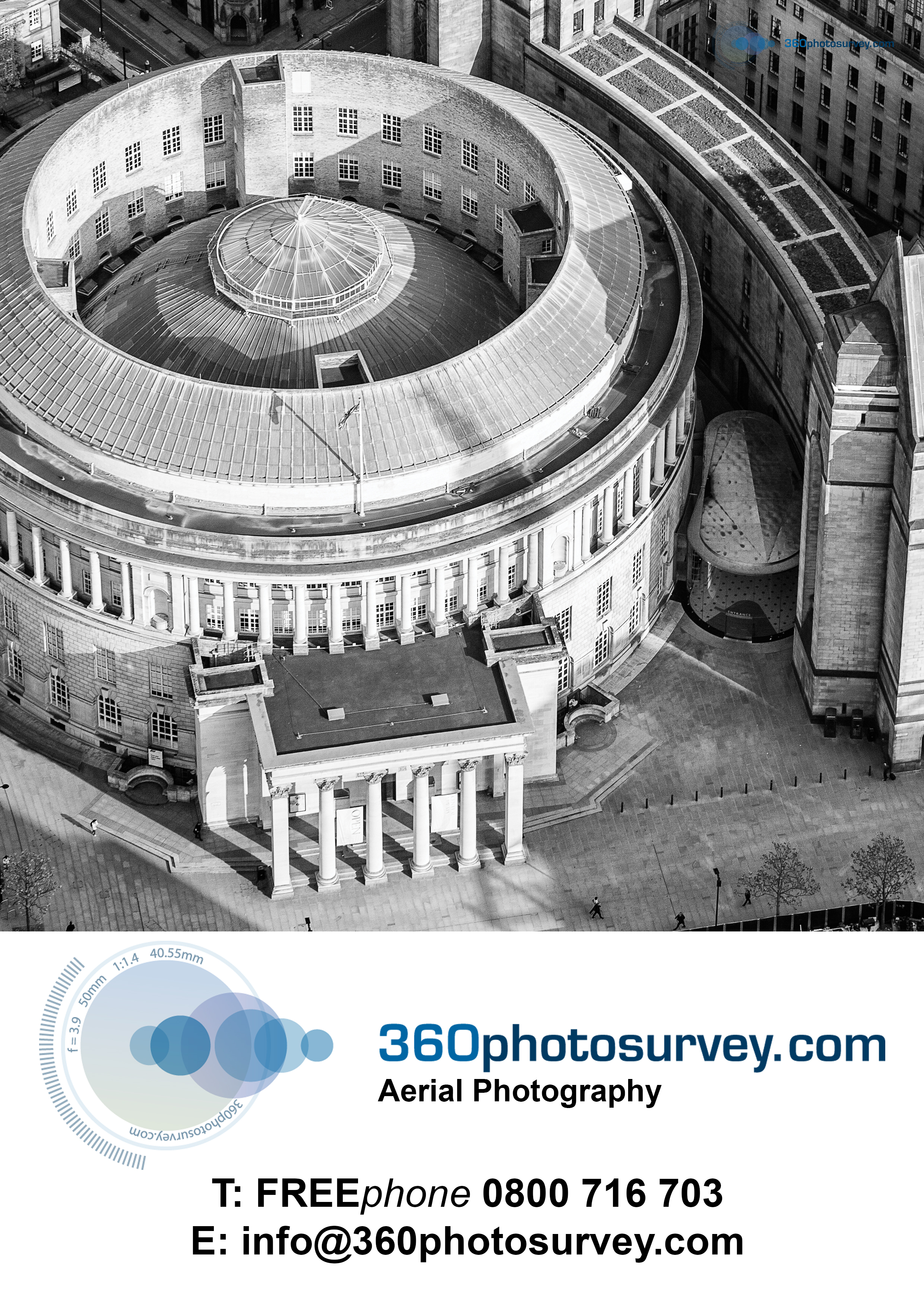
Aerial photographer
Photo dilapidation surveys
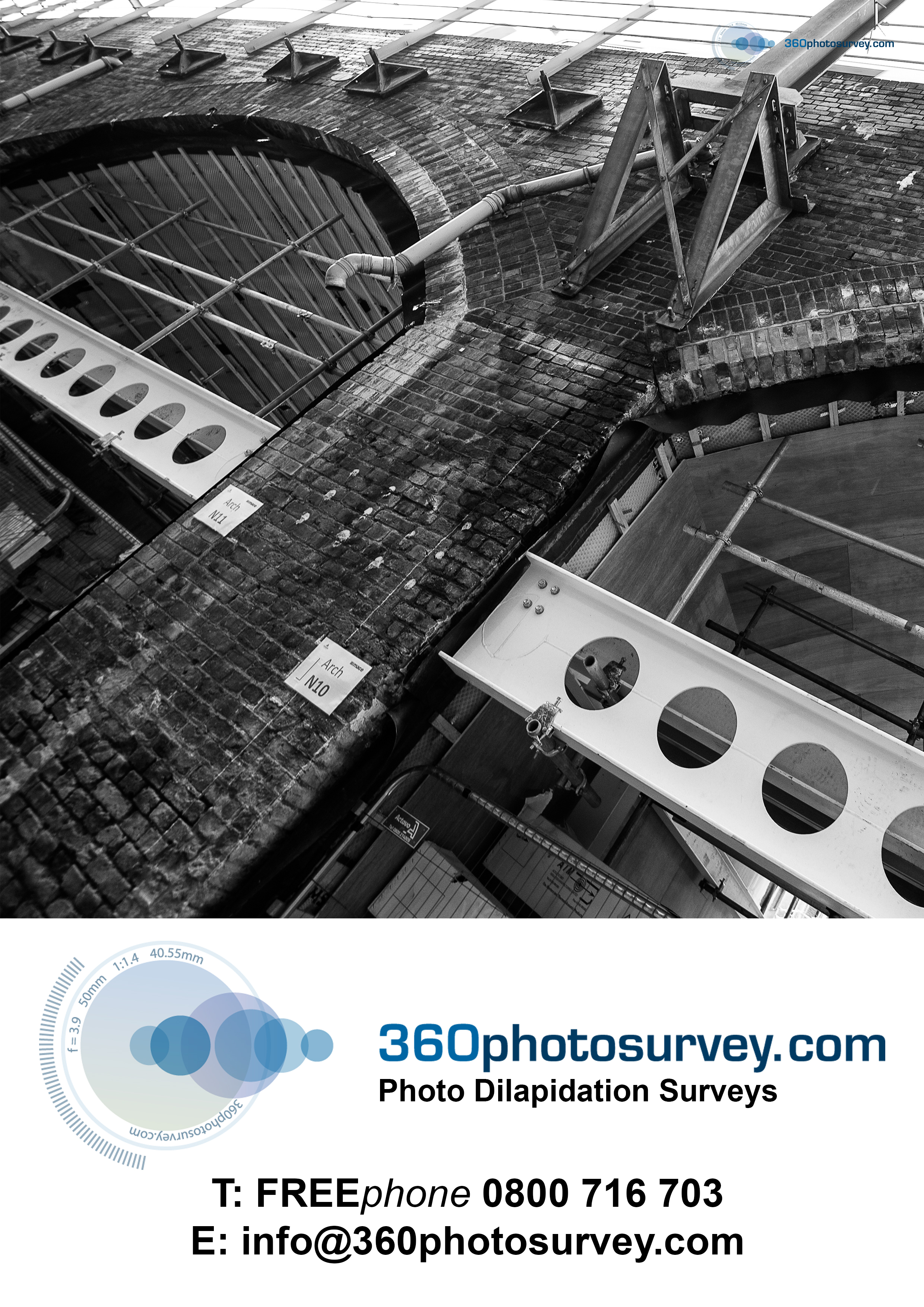
Photo dilapidation surveys
Aerial photographer

Aerial Photographer
Aerial/high level photoshoot for Estate Agent above Disley
360photosurvey.com have just completed an aerial/high level photoshoot of a property above Disley, near Stockport, Cheshire for an Estate Agent.
The client is really pleased with our high level images of the property giving a unique perspective of how the property sits within the landscape and the fabulous views.

Aerial and high level photographer
Tall Ships departed from Liverpool on Bank Holiday Monday
360photosurvey.com undertook an aerial photoshoot over the Tall Ships as they departed from Liverpool on Bank Holiday Monday 28th May 2018.
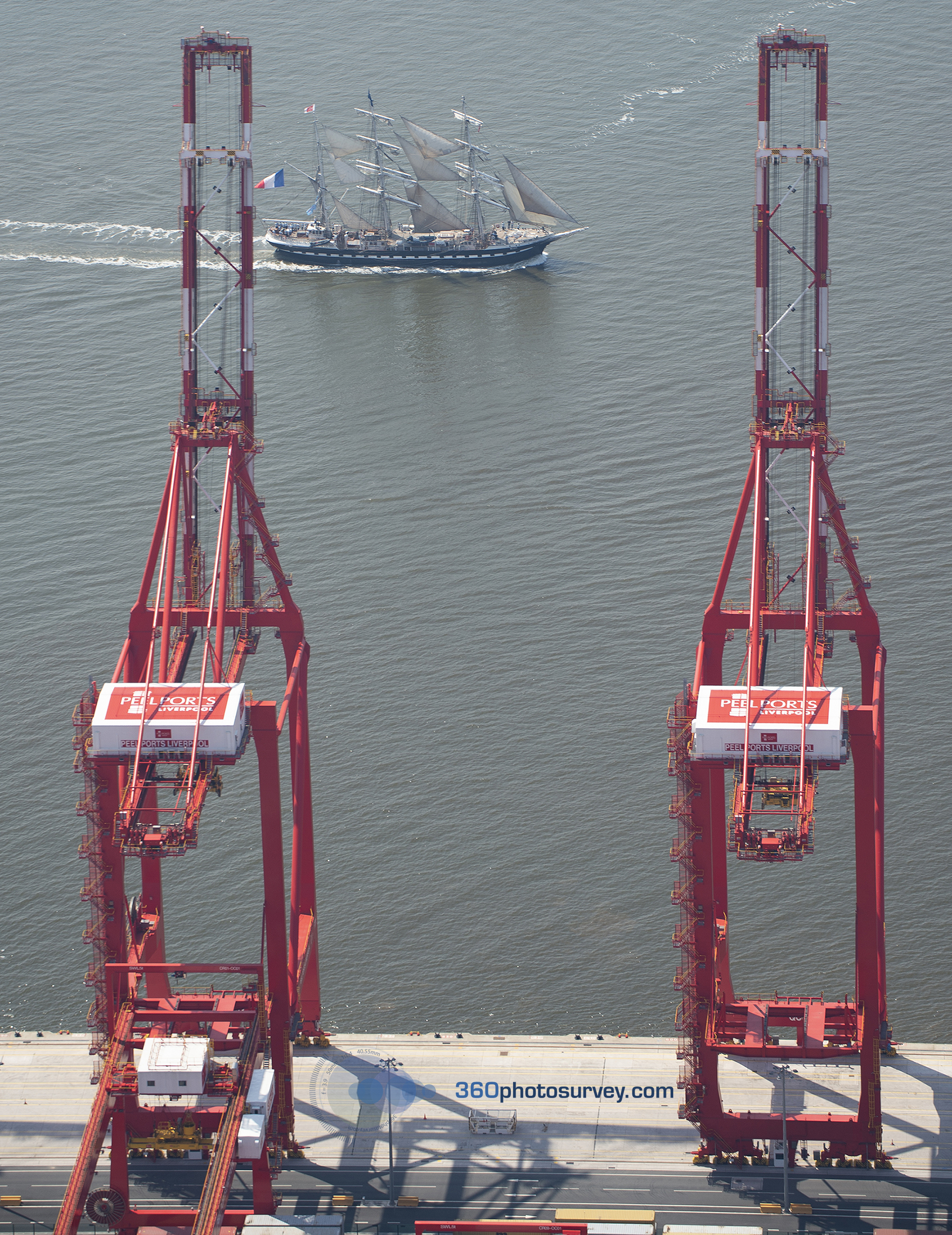
Aerial photo of Tall Ships leaving Liverpool passing Peel Ports red cranes
Using our light aircraft, we obtained a unique perspective of the event and these magnificent ships as they departed for Dublin on the next leg of the Tall Ships Race 2018.
For more information, or if you would like an aerial photography undertaken please call Freephone 0800 716 703 or email info@360photosurvey.com
- Light Aircraft
- Drones (CAA PfCO licenced)
- Vehicle mounted telescopic masts
Construction photography specialist opens new London office
Construction photo survey specialist 360photosurvey.com opens our Central London office to cater for an increasing workload within the Capital.
Recent projects within London include prestigious high-profile New build and Listed Building developments including the London Southbank redevelopment and the Camden Lock Development alongside the Regents Canal.
From our base near Manchester, 360photosurvey.com has been undertaking detailed photographic commissions of construction projects throughout the UK with some fabulous projects including Aberdeen`s new Port, Manchester Town Hall Transformation redevelopment in addition to some interesting work on the Isle of Man. The new London office provides a local presence for our growing number of London based clients whom include Main Contractors, Local Government and developers.
360photosurvey.com has over 30 years of experience providing a complete photographic service to our construction and property clients.
Our main area of work undertaking photo condition surveys and photo dilapidation surveys provide a detailed and definitive record of buildings and their surroundings prior to construction or demolition works commencing (frequently a requirement of planning permissions particularly on Listed Buildings) for which we have become a market leader with our surveys regularly exceed many thousands of high quality images and 360 degree photographic records enabling project teams to `virtually` walk through their buildings.
360photosurvey.com provides a professional, friendly fixed price service, tailoring our services to your specific requirements regularly undertaking work for clients at very short notice to meet tight project programs.
Call Chris on Freephone 0800 716 703 – we`ll be more than happy to discuss your requirements and advise how we can help.
360photosurvey.com London Office: 16 Upper Woburn Place, Euston, London, WC1H OAF
Specialist constructon project photo survey company opens new London Office
- Photo dilapidation surveys London
- Photo condition surveys London
- 360 photo surveys London
- Progress photography London
- Aerial photography London
- Time lapse London
- Construction project video London
- Architectural photography London
- Interior photography London
- London photographer
- Photographer London
Construction photo survey specialist to open new London office
Construction photo survey specialist 360photosurvey.com announces it is to open a new London office to cater for its increasing workload within the Capital.
Recent projects within London include a number of prestigious and high-profile New build and Listed Building developments.
- Photo dilapidation surveys London
- Photo condition surveys London
- Progress photography London
- Aerial photography London
- Time lapse London
- Construction project video London
- Architectural photography London
- Interior photography London
- Construction photographer London
- If your project requires a definitive photographic record prior to works commencing – please phone Freephone 0800 716 703 – we`ll be more than happy to discuss your requirements and advise how we can help.
London Road Fire Station and Mayfield Station set for redevelopment
360photosurvey.com captured this dramatic roof level image, looking across Manchester`s London Road Fire Station tower toward the forlorn and derelict Mayfield Station. Both have proposals in place for redevelopment to these fabulous Listed buildings.
View across roof top to London Road Fire Station tower with derelict Mayfield Station beyond
Highway photo conditions case study Manchester`s Cathedral Square
As part of the condition surveys required for Manchester`s grade 2 Listed Corn Exchange redevelopment, 360photosurvey undertook a detailed photographic condition survey of the roads and hard landscaping around the building on which construction traffic was due to utilize. The survey included both high quality still photographs and a 360o record enabling the project team to clearly identify location and zoom in to the area on their computers using our digital survey. This video illustrates how easy it was to identify locations on the site plan and then navigate in full 360o around the images, enabling the viewer to virtually walk around the whole area of the survey and providing a definitive record for the client, contractor and Local Authority Highways department records.
Highway photo condition survey for the Port of Aberdeen expansion project – case study
As part of the condition surveys required for the Port of Aberdeen expansion project prior to works commencing, 360photosurvey.com undertook an extensive photographic condition survey of the roads both within the site area in addition to the routes to be used by construction traffic to provide a definitive record. The survey included both high quality still photographs and a 360 degree record enabling the project team to clearly identify location and zoom in to the area on their computers using our digital survey. This video illustrates how easy it was to identify locations on the site plan and then navigate in full 360 degrees around the images, enabling the viewer to virtually walk around the whole area of the survey.
360photosurvey has now amassed a huge portfolio of images for sale on the Alamy website
360photosurvey has now amassed a huge portfolio of images for sale on the Alamy website
http://www.alamy.com/search/imageresults.aspx?qt=&imgt=1&ps=100&pn=7&cbstore=0#BHM=foo%3Dbar%26st%3D0%26sortby%3D2%26qt%3D%26qt_raw%3D%26qn%3Dchris%2520billington%26lic%3D3%26edrf%3D0%26mr%3D0%26pr%3D0%26aoa%3D1%26creative%3D%26videos%3D%26nu%3D%26ccc%3D%26bespoke%3D%26apalib%3D%26ag%3D0%26hc%3D0%26et%3D0x000000000000000000000%26vp%3D0%26loc%3D0%26ot%3D0%26imgt%3D1%26dtfr%3D%26dtto%3D%26size%3D0xFF%26blackwhite%3D%26cutout%3D%26archive%3D1%26name%3D%26groupid%3D%26pseudoid%3D%26userid%3D%26id%3D%26a%3D%26xstx%3D0%26cbstore%3D0%26resultview%3DsortbyPopular%26lightbox%3D%26gname%3D%26gtype%3D%26apalic%3D%26tbar%3D1%26pc%3D%26simid%3D%26cap%3D1%26customgeoip%3DGB%26vd%3D0%26cid%3D%26pe%3D%26so%3D%26lb%3D%26fi%3D0%26langcode%3Den%26upl%3D0%26cufr%3D%26cuto%3D%26howler%3D%26cvrem%3D0%26cvtype%3D0%26cvloc%3D0%26cl%3D0%26upfr%3D%26upto%3D%26primcat%3D%26seccat%3D%26cvcategory%3D*%26restriction%3D%26random%3D%26saveQry%3D%26editorial%3D1%26t%3D0%26edoptin%3D%26ps%3D100%26pn%3D7%26cbstore%3D0
Liverpool Bay wind turbines an aerial view
Aerial photographer 360photosurvey.com photoshoot of the Wind Turbines in Liverpool Bay
Salford Chord – an aerial view
Salford Chord, the long awaited rail link between Manchester Piccadilly and Victoria Stations has now been officially opened with trains due to commence using it in December 2017.
360photosurvey.coms telescopic mast with full remote control Pro Nikon DSLR cameral system captures some fabulous images that simply can not be captured using drones (although we do use drones, this particular photoshoot couldn`t use drones due to the proximity of the Public/Traffic)
Watson Homes latest development at the former home of Salford Reds
Watson Homes have completed their latest residential development at “The Willows” in Salford, Greater Manchester. The former home of Salford Reds Rugby Club was vacated by the club on their move to their new Stadium alongside the Manchester Ship Canal. North West based aerial photographer 360photosurvey.com were appointed to undertake regular aerial photography during the development using drones and vehicle mounted telescopic masts to provide aerial and high level images.
Photo dilapidation surveys – case study Manchester Town Hall transformation project
Photo dilapidation surveys – case study of the dilapidation survey undertaken of the Manchester Town Hall complex prior to major construction works commencing. The survey comprised in excess of 3 million photographs utilizing 360 degree technology linked from floor plans enabling the viewer to locate the room/space on the floor plan and then entering the 360 degree image from where to be able to fully look around and move between the 360 image locations. This particular survey utilized low resolution 360 degree images combined with high resolution still images linked via hotspots within the 360 images. 360 degree technology has radically improved since this survey was undertaken enabling extremely high resolution 360 images with the capability of zooming into study remarkably small details.
Photo condition survey – case study – London Southbank Centre
Photographic condition survey case study of London Southbank Centre – 360photosurvey.com undertook a detailed 360 degree photographic survey of the London Southbank Centre`s Hayward Gallery and Queen Elizabeth Hall prior to the buildings undergoing major construction works. The survey enabled the project team to virtually walk around and within these buildings, providing a definitive record of the building and their condition prior to the construction works commencing.
This video illustrates the ease at which the viewer can identify a location on the floor plans, entering the 360 degree photo at that location with the ability to both look around a full 360 degrees, but also enabling walking around and between rooms/spaces.
Manchester`s iconic Toastrack building gets a new brand
Manchester`s iconic Toastrack building in Fallowfield is currently undergoing a major redevelopment to convert the former University building into Apartments. North West based aerial photographer 360photosurvey.com were called in to provide aerial video for the project`s new branding video. Reproduced by kind permission of Noir Agency
Cheshire Aerial photographer captures perhaps last aerial photo of Warrington Market before demolition
Cheshire based aerial photographer 360photosurvey.com`s aerial photo of the `old` Warrington Market building, perhaps the last before demolition commenced. The market is now located in its temporary home visible in this image and which forms part of the impressive programme for the redevelopment of Warrington Town Centre.
360photosurvey.com specialises in aerial photography of construction and civil engineering projects – for more information call Chris on Freephone 0800 716 703
Cheshire based aerial photographer 360photosurvey.com captures the new Mersey Crossing road bridge
North West based aerial photographer 360photosurvey.com latest photography commission captures the new Mersey road crossing.
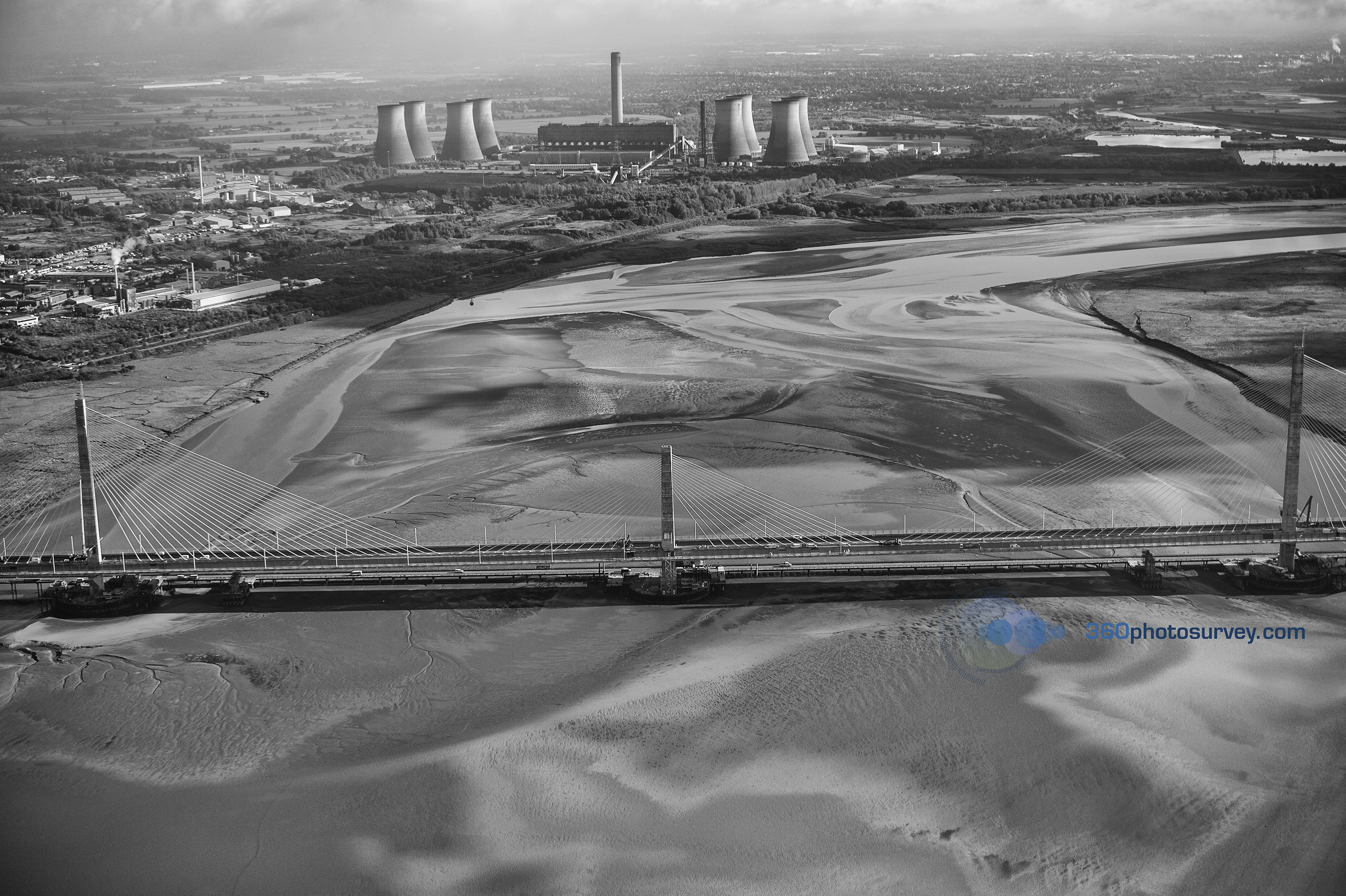
Aerial photographer Liverpool
Jodrell Bank in maintenance mode captured by 360photosurvey.com aerial photo
Cheshire`s iconic Jodrell Bank telescope is currently in maintenance mode with scaffolding clearly visible in this photo by Cheshire based aerial photographer 360photosurvey.com during our flight operation over the North West.
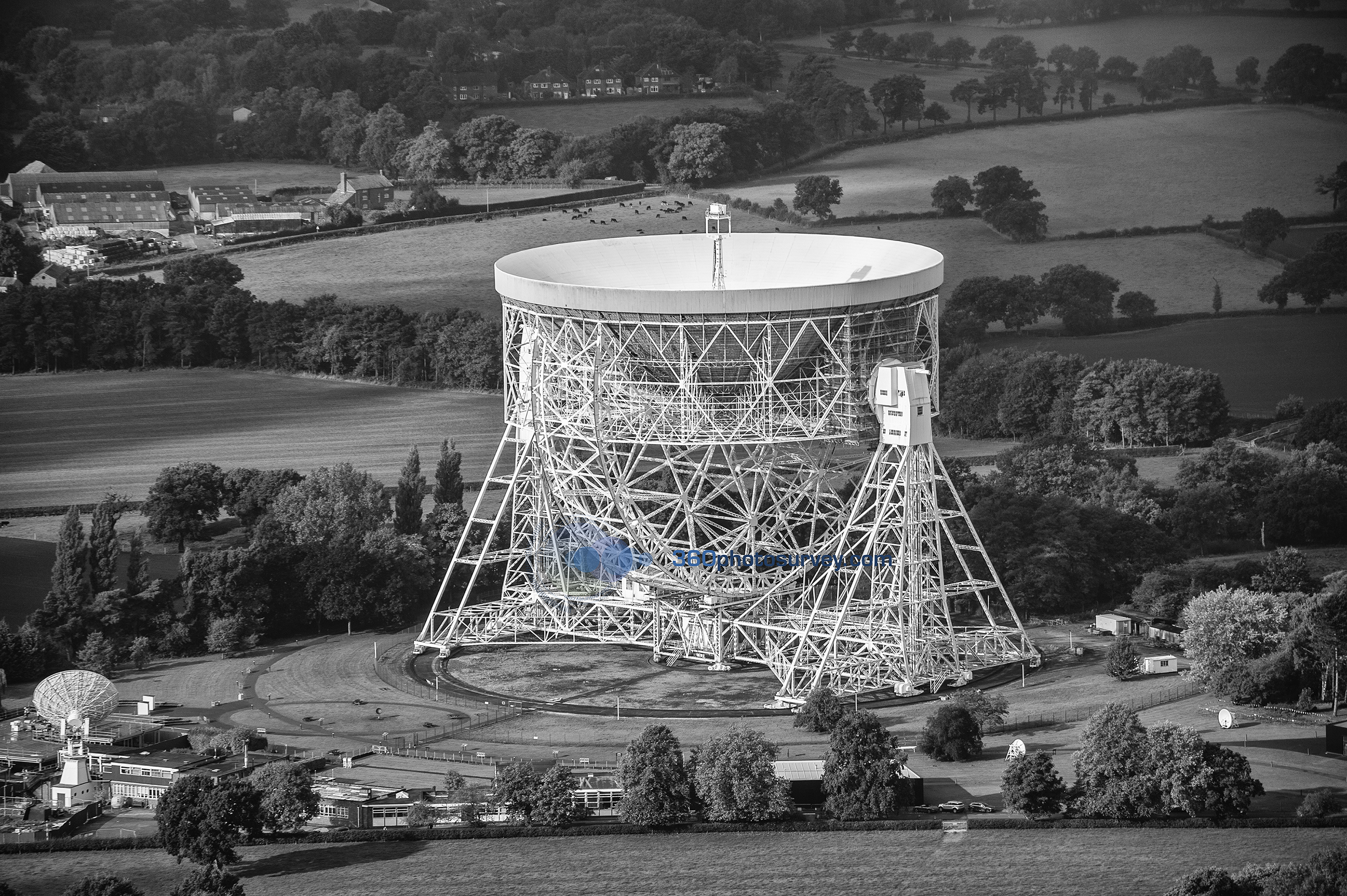
Aerial photographer Cheshire captures Jodrell Bank in maintenance mode
Call FREEphone 0800 716 703 if you require aerial photographs undertaken
Perhaps one of the last aerial photos of Liverpool Lime Street prior to closing for major refurbishment
Drone and aerial photographer 360photosurvey.com on its latest aerial photo shoot over Liverpool captures perhaps one of the last aerial images of Liverpool Lime Street station as it closes today for major refurbishment.
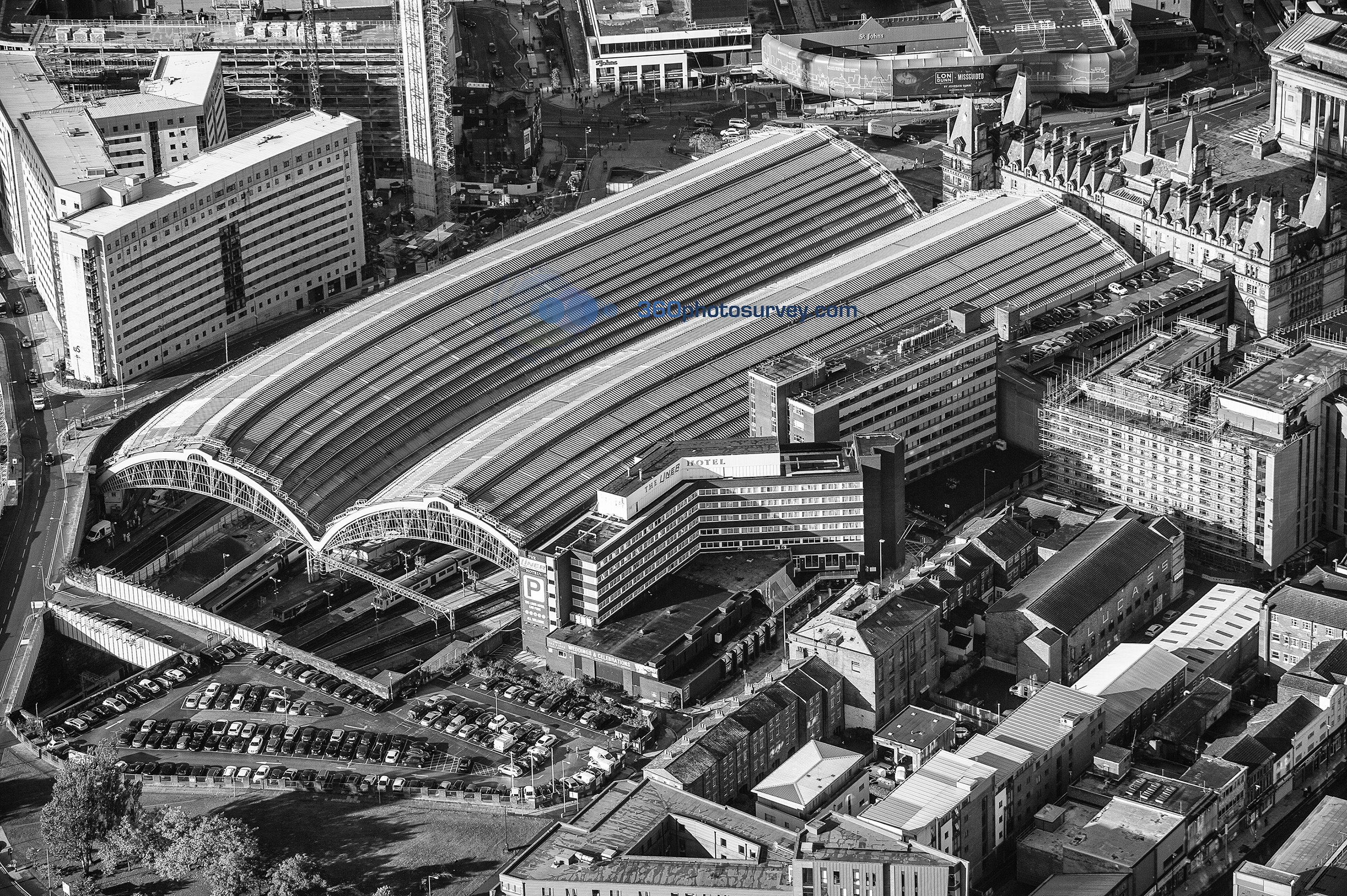
360photosurvey.com aerial photo of Liverpool Lime Street Station prior to closure for major refurbishment
360photosurvey.com undertakes aerial photographic commissions throughout the North West of the UK and beyond – call Chris on FREE-phone 0800 716 703 to discuss your requirements for aerial photography.
Manchester aerial photographer commissioned to capture iconic Toast Rack building
Construction & civil engineering aerial photographer 360photosurvey.com commissioned to undertake aerial photos of Manchester`s iconic Toast Rack building which is undergoing a major redevelopment.

Aerial photo of Toastrack Building Manchester by 360photosurvey.com (c) copyright 2017
Knutsford based 360photosurvey.com undertakes regular aerial photo commissions of construction and civil engineering projects through out the UK using fixed wing aircraft, helicopters and drones. Call Chris on FREE-phone 0800 716 703 to arrange aerial photos of your project.
Camden Lock Village project now well advanced
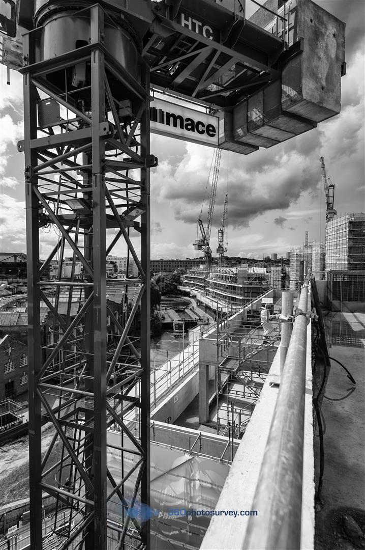 London – Architectural photographer 360photosurvey.com undertakes progress photo-shoot for Mace Group`s Camden Lock Village development, London.
Drone photography Salford
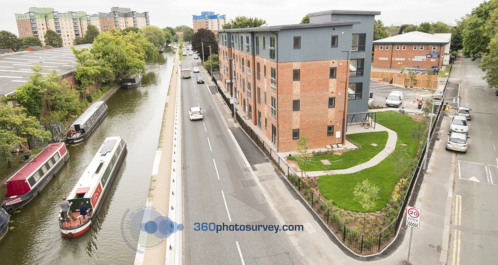
Drone photography Manchester
Drone photographer 360photosurvey.com was commissioned to undertake a series of high level aerial photographs for Watson Homes latest development in Patricroft, Salford.
Using our 18.5m telescopic mast mounted on 4×4 Landrover Discovery and using full wireless remote control of both pan/tilt + full camera settings of our pro Nikon DSLR we were able to quickly and efficiently capture a series of high level images around this project alongside the Bridgewater Canal and in so doing provided our client with a unique perspective of their latest development.
360photosurvey.com completes real estate photoshoot for Lambert Smith Hampton
Property photographer 360photosurvey.com has completed a photoshoot of a series of retail premises in the North West for real estate agents Lambert Smith Hampton.
To arrange for a photoshoot of your project call now on FREEphone 0800 716 703
Iconic Aberdeen Lighthouse undergoes detailed photographic dilapidation survey

Girdle Ness Lighthouse photo condition survey
360photosurvey.com completes a major photographic dilapidation survey of the iconic grade 1 Listed 1830`s Girdle Ness Lighthouse, Aberdeen, Scotland.
To arrange for a photo dilapidation survey of your project call now on FREEphone 0800 716 703
360photosurvey.com called in to undertake drone dangerous building survey
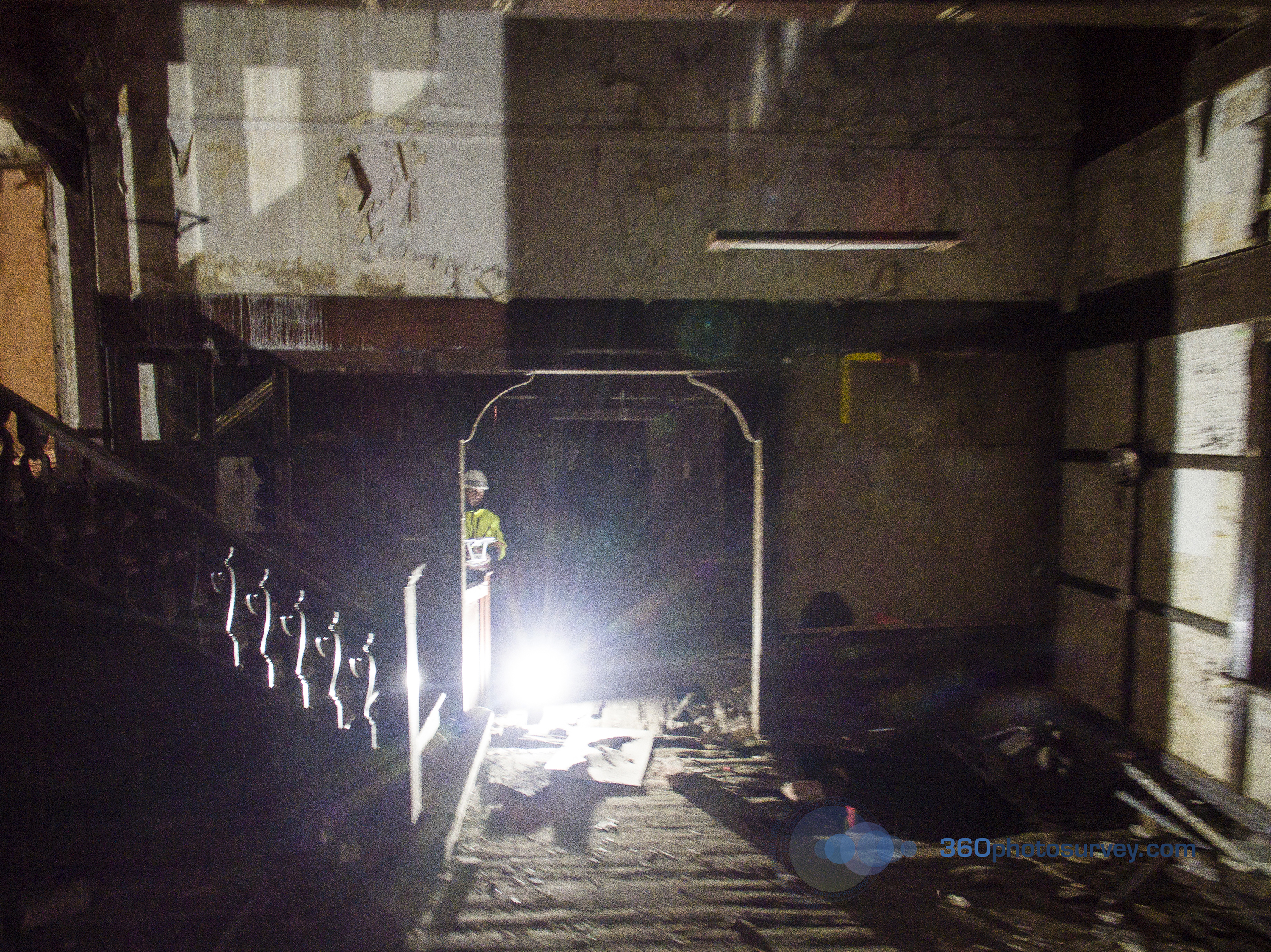
Drone surveys of dangerous building
360photosurvey.com were called into undertake an internal drone photo condition survey of Grade 2 listed Watling Gate Hall in Altrincham, Greater Manchester which has fallen into such serious disrepair that its floors are too dangerous to enable access into the building to establish the current conditions. The survey established that the once grand Arts and Crafts Hall had significantly deteriorated since 360photosurvey`s original detailed dilapidation survey of the premises back in 2013.
360photosurvey.com is increasingly been seen as the industry specialist not only in providing comprehensive and extremely detailed photographic surveys of buildings, but particularly with our can-do approach accessing buildings/areas others have advised our clients as being impossible. 360photosurvey undertakes commissions throughout the UK, Europe and beyond.
To arrange for a photo condition survey of your project call now on FREEphone 0800 716 703
First new homes completed on the former home of Salford Reds Rugby Club at The Willows
360photosurvey.com were commissioned to undertake promotional architectural photography by Watson Homes of its latest development `The Willows` (the former home of Salford Reds Rugby Club). 360photosurvey.com`s architectural photography picture shows the first phase of the completed homes
To arrange for a photoshoot of your project call now on FREEphone 0800 716 703

Completed new homes at The Willows
360photosurvey.com dilapidation survey of Network Rail viaducts at Camden Lock
360 photo dilapidation survey of Network Rail viaducts at Camden Lock, London by 360photosurvey.com.
To arrange for a photo dilapidation survey of your project call now on FREEphone 0800 716 703
Drone video over former Salford Reds rugby home ‘The Willows’
360photosurvey.com`s drone camera was commissioned to undertake aerial photography and video of Watson Homes latest development at the former home of Salford Reds rugby club `The Willows` in Salford, Greater Manchester.
To arrange for a drone photoshoot of your project call now on FREEphone 0800 716 703
Aerial photography (drone, aircraft, telescopic mast) – Progress photography – photographic dilapidation/condition surveys – video – time lapse – architectural & industrial photography
Derelict Manchester Station drone survey
360photosurvey.com were appointed to undertake a drone video survey of Manchester`s derelict Mayfield Station – a long forgotten asset in Manchester, adjacent to Manchester Piccadilly Railway Station…looking forward to the potential of this fabulous undeveloped site.
Aerial drone survey – 360photosurvey.com
When the Port of Salford project team needed to inspect the construction of a new outfall into the Manchester Ship Canal, the risk assesments for their team using a boat went into overdrive.
360photosurvey.com was called in to save the day, needing only to undertake our flight risk assessment protocols and without the need for any boats, life jackets or stand-by crews. Using our drone camera we undertook the full inspection, including hi-resolution close up images in around 30 minutes (including set up time) and with the great co-operation of the City Airport Air Traffic Control team too.
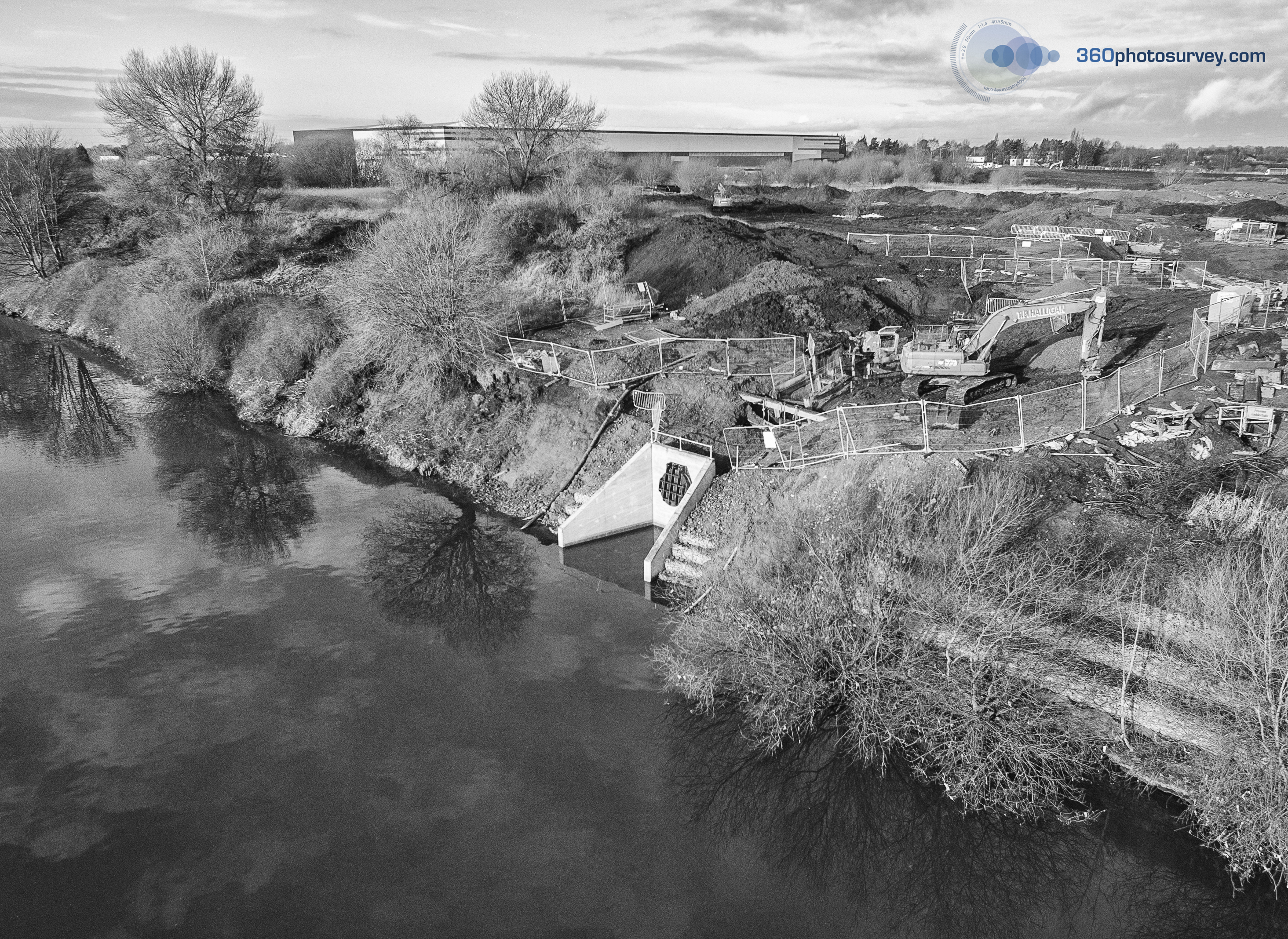
Aerial drone surveys
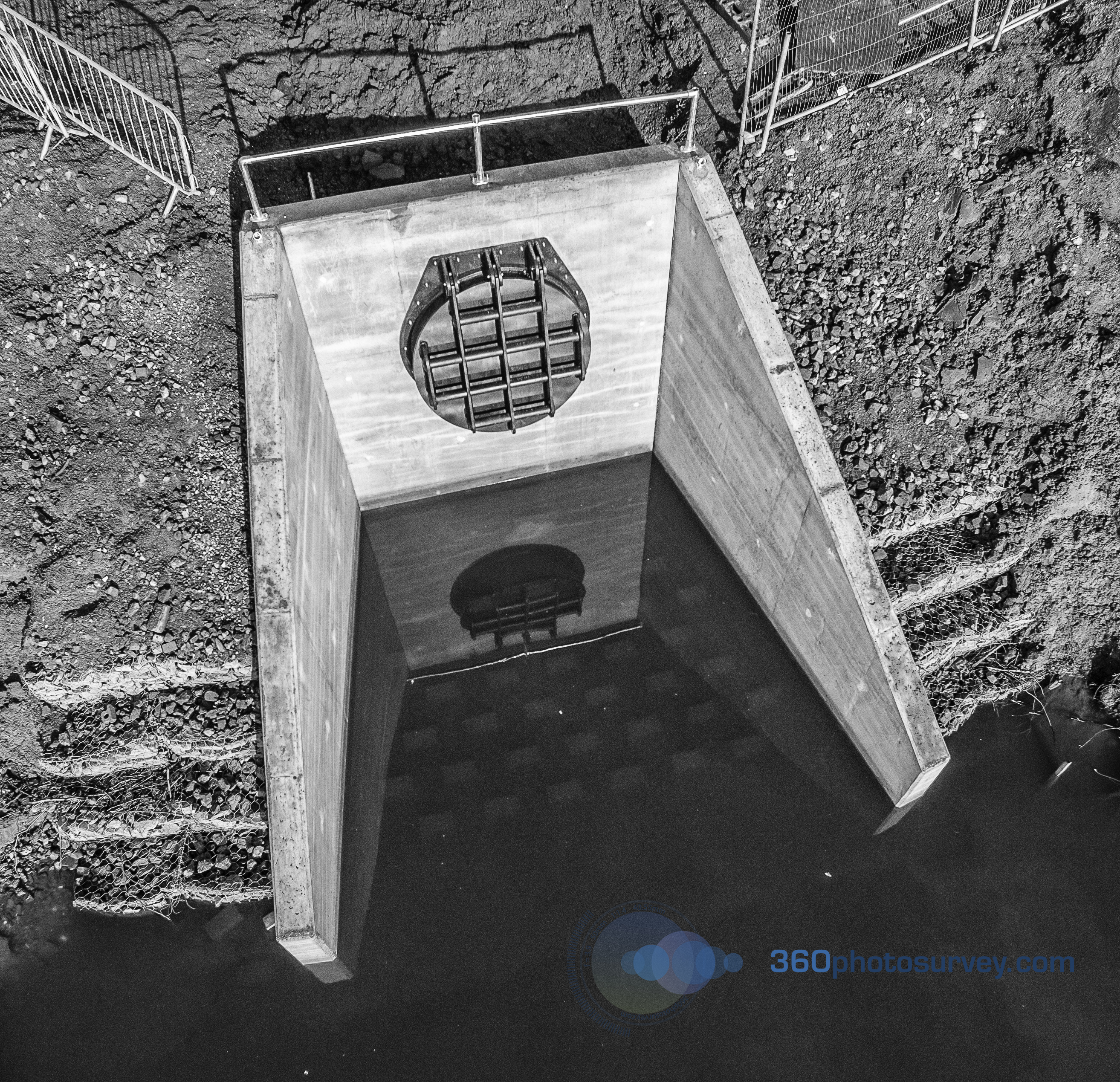
Aerial drone surveys
t: (Freephone) 0800 716 703
Manchester aerial photographer 360photosurvey.com latest aerial photos of Manchester Central Library and Library Walk
Manchester aerial photographer 360photosurvey.com latest aerial photos of Manchester Central Library and Library Walk.

Aerial photograph of Manchester Central Library and Library Walk Link May 2016
If you require aerial photography – Call Chris on FREEphone 0800 716 703 to see how we can help.
Aerial photographer Manchester
Manchester aerial photographer 360photosurvey.com panoramic aerial photo of Manchester Pomona dock where work has just commenced to redevelop this long forgotten derelict dockland in central Manchester.
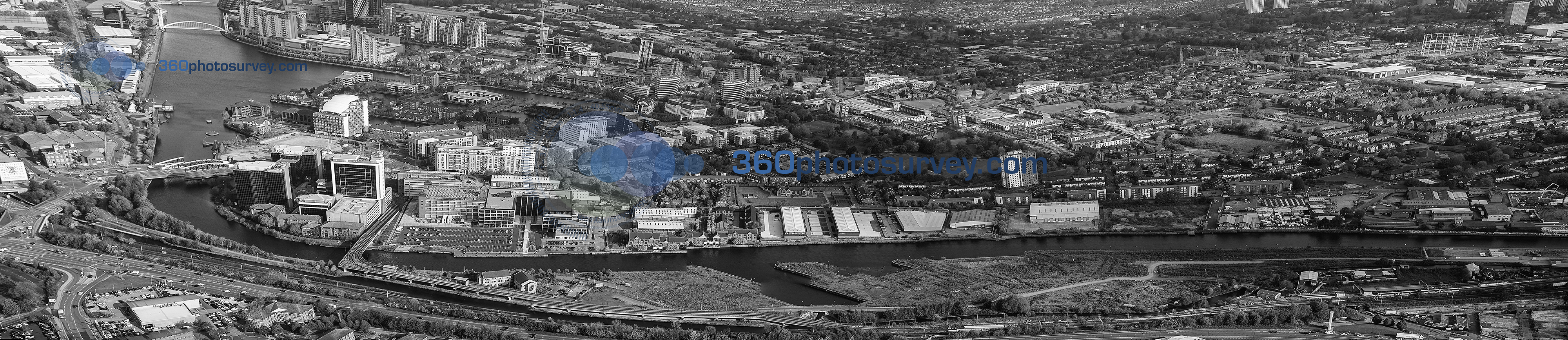
aerial photo of port of manchester with salford in the background awaiting redevelopment
This and other images are available to purchase in both colour & black and white – call for more information
Aerial photographer Manchester
Manchester aerial photographer 360photosurvey.com image of the newly refurbished Manchester Corn Exchange, Manchester Cathedral and the newly opened Exchange Square Metrolink station.
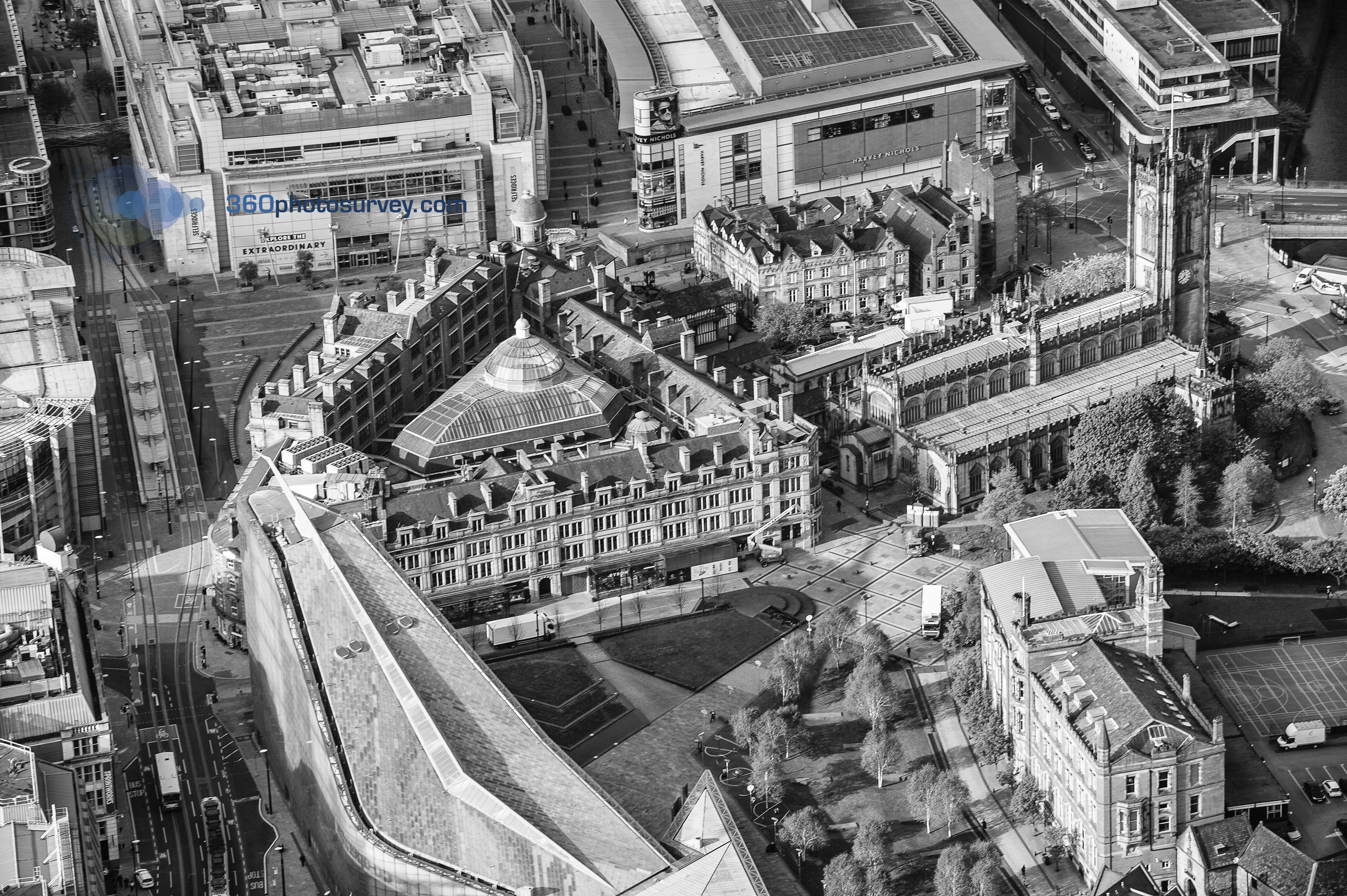
Aerial photo of Manchester Corn Exchange, Manchester Cathedral and Exchange Square Metrolink Station
Images in both colour and black & white available for purchase – call for more information
Last aerial photo of Barton Bridge before catastrophic structural collapse
Aerial photographer 360photosurvey.com captured what is believed to be the last aerial photos of Barton Lift bridge over the Manchester Ship Canal before its catastrophic structural collapse on 16th May 2016. Thankfully no one was injured.
This extract from the photoshoot shows the bridge deck in its raised position enabling ships to pass under.
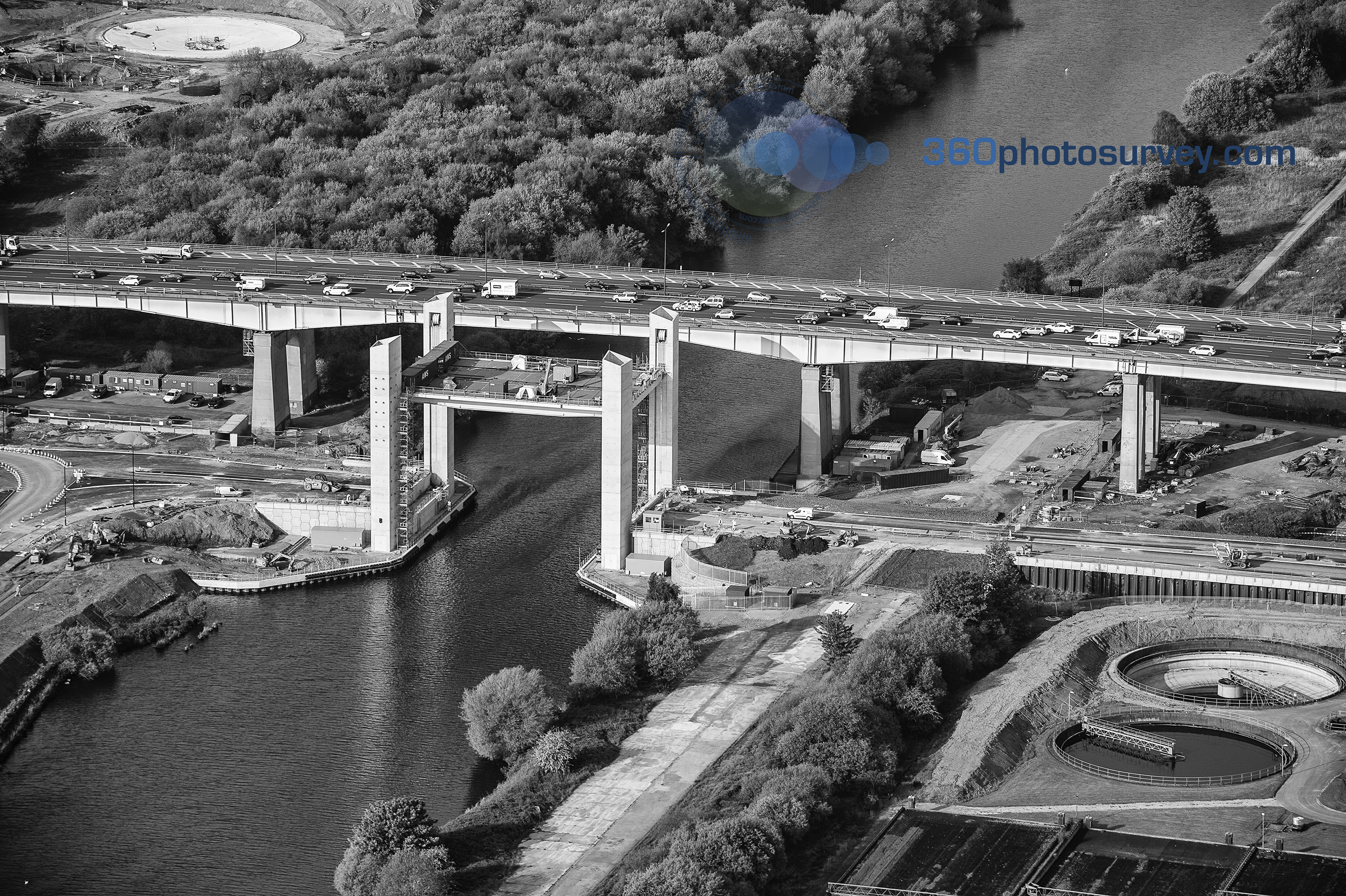
Aerial photo believed to be the last before catastrophic collapse of Barton lift bridge under construction over Manchester Ship Canal on 16th May 2016
Sun rays over Manchester
Sun rays over Manchester – an extract image from 360photosurvey.com aerial photoshoot over Manchester, UK. This and other images are available to purchase.
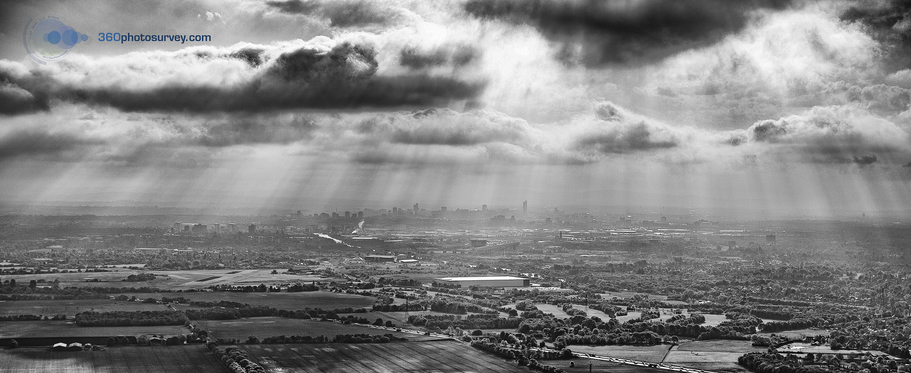
Aerial photo looking toward Manchester City Centre with sun rays beaming down between clouds
Leigh to Atherton Guided Busway
360photosurvey.com has undertaken a photo shoot of the new Atherton to Leigh guided bus route in Greater Manchester. An imaginative use for a long disused railway and appears to being well used.
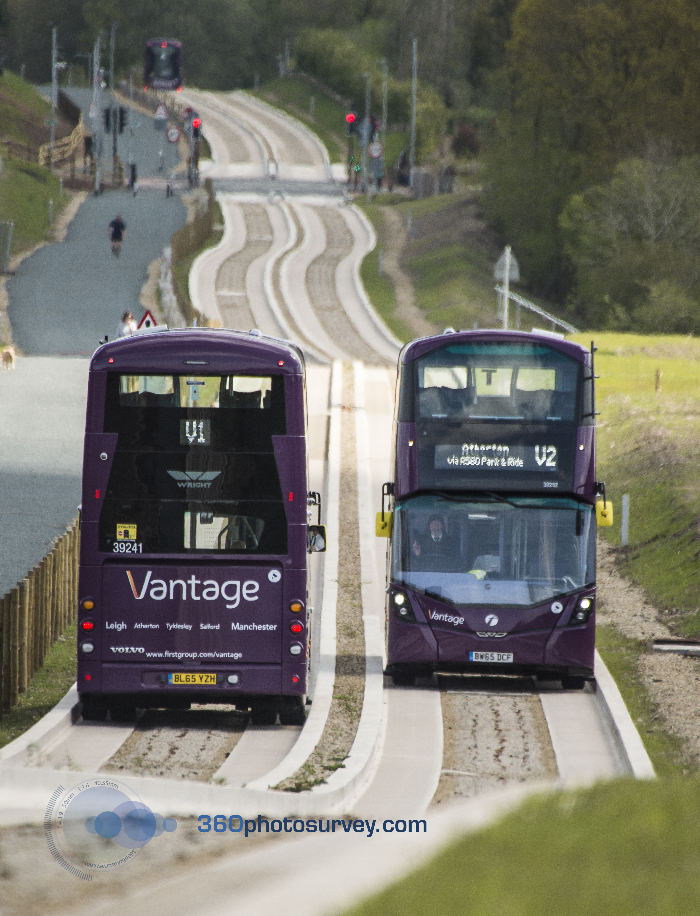
New Mersey Crossing rises from the river
360photosurvey.com photo shoot of the new Mersey road crossing between Widnes and Runcorn. This image shows one of the towers rising from the Mersey at low tide with the Fiddlers Ferry power station in the background.
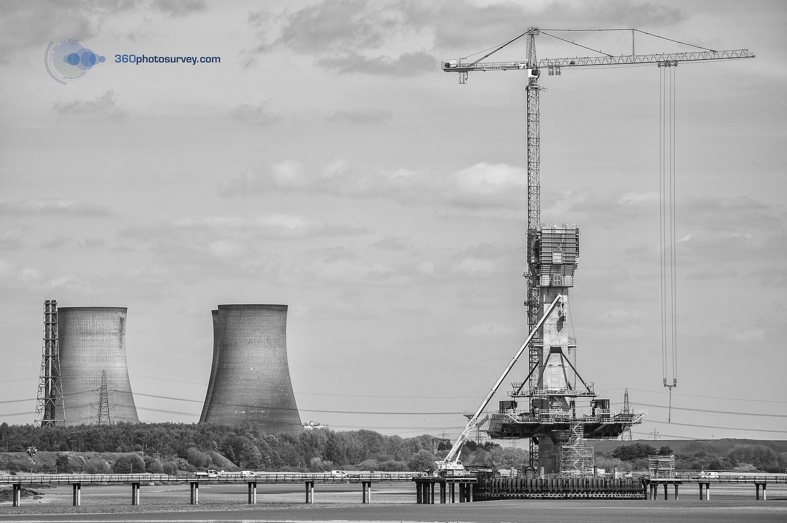
Jodrel Bank and Holmes Chapel viaduct
360photosurvey.com drone camera captured this scene of Jodrel Bank and the Holmes Chapel viaduct in Cheshire, UK
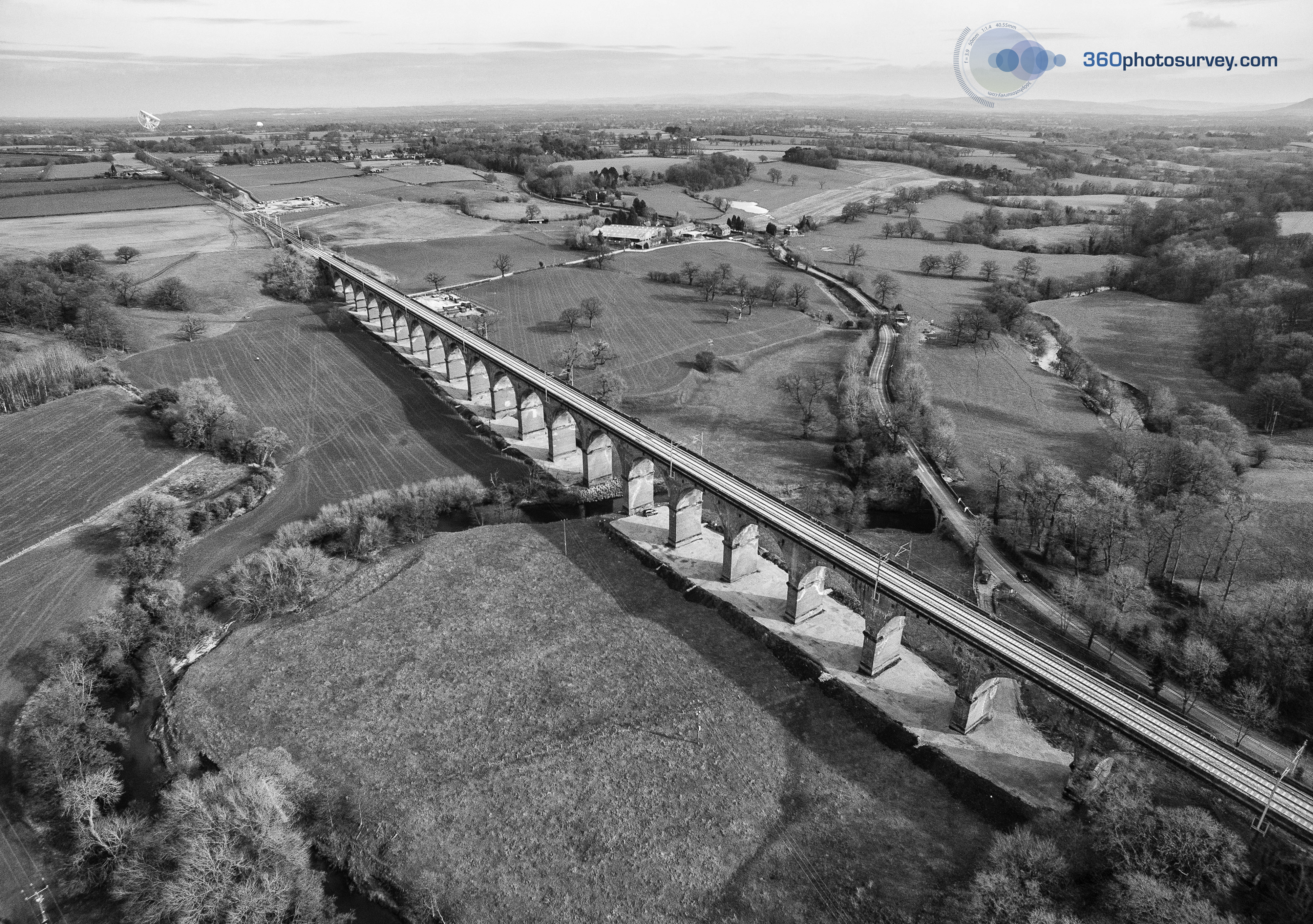
360photosurvey.com is becomes member of ARPAS-UK
360photosurvey.com is now a member of the Association of Remotely Piloted Aircraft Systems (ARPAS-UK)
Manchester Central Library Reading Room – an unusual view
360photosurvey.com drone video giving an unusual view within Manchester`s iconic Central Library Reading Room. With thanks to MCC & the Library Team.
Dilapidation Survey of London Southbank Centre
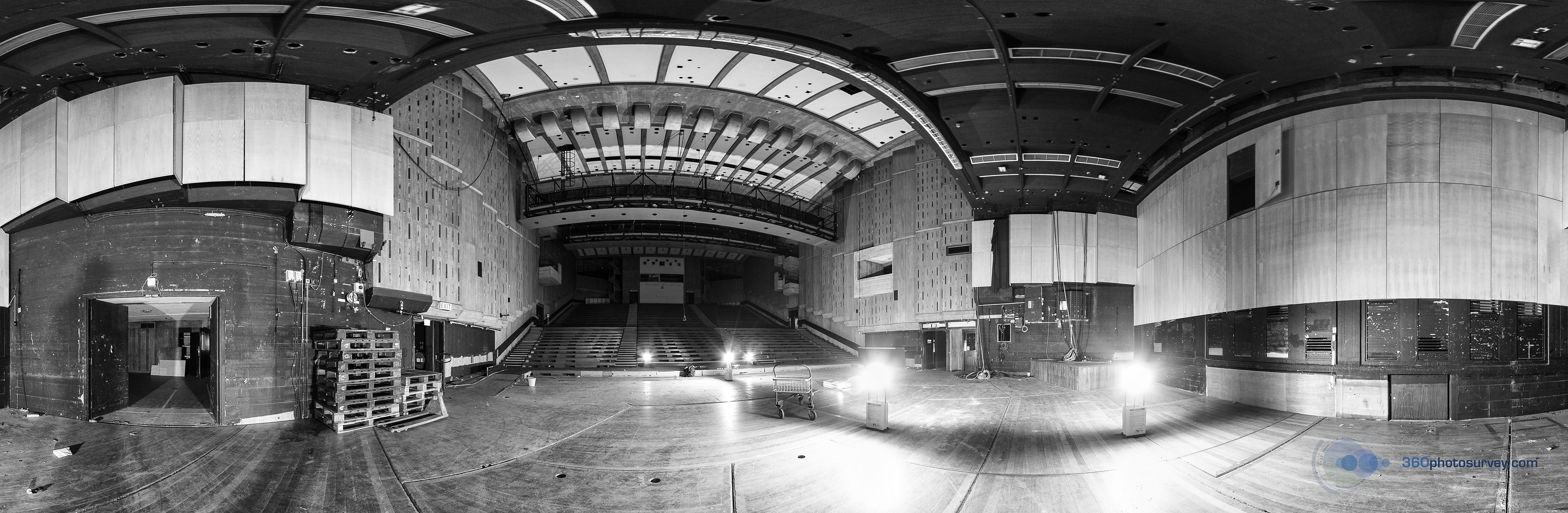
360photosurvey.com has completed another major photographic dilapidation survey; the iconic London Southbank Centre`s Queen Elizabeth Hall and Hayward Gallery prior to their undergoing major refurbishment works by Bam Construction.
With in excess of 40,000 individual images the photographic record was supplied in our 360 degree high resolution format enabling the project team to virtually walk around the whole complex on their computers without the need for any specialist software, greatly assisting the team by reducing the need for site visits by being able to view any item with the simple click of a mouse button – great for meetings remote from the site too.
360photosurvey.com utilised its drone camera system within the vast Queen Elizabeth Hall auditorium to record the high level areas.
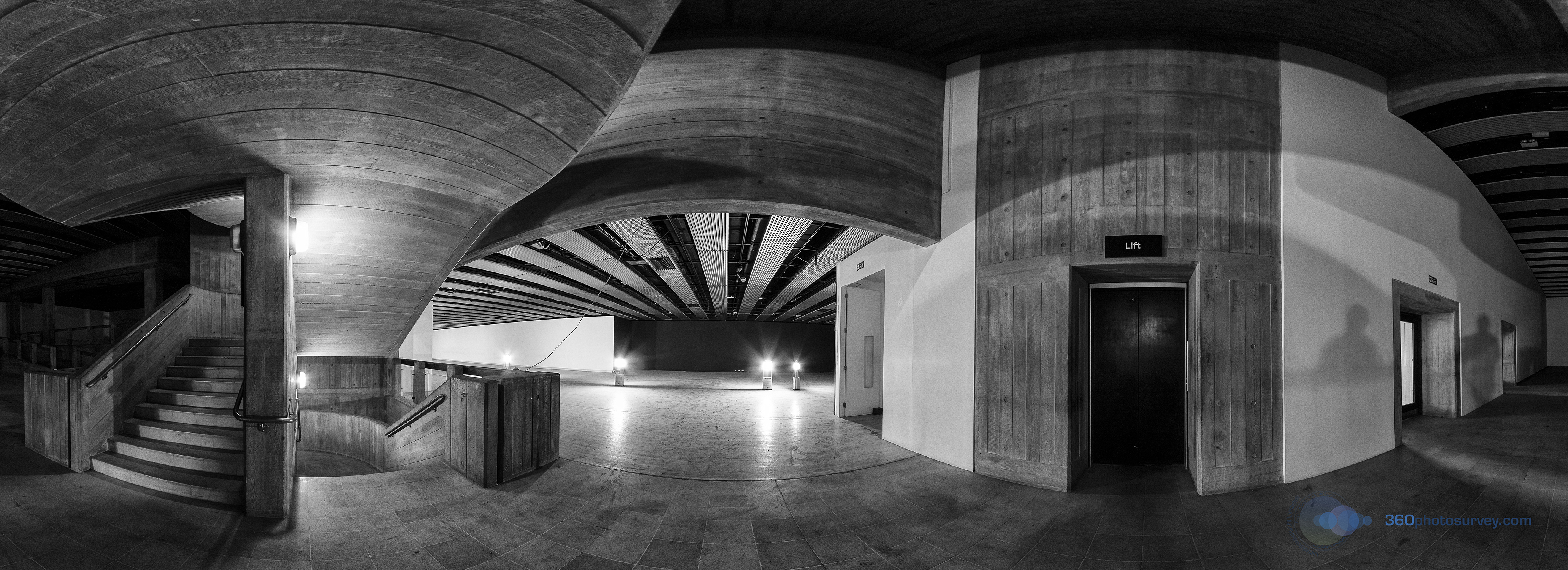
Transformers now working for Network Rail
360photosurvey.com captured the concrete pumping operation by Network Rail during their major engineering works on the West Coast mainline at Holmes Chapel in Cheshire.
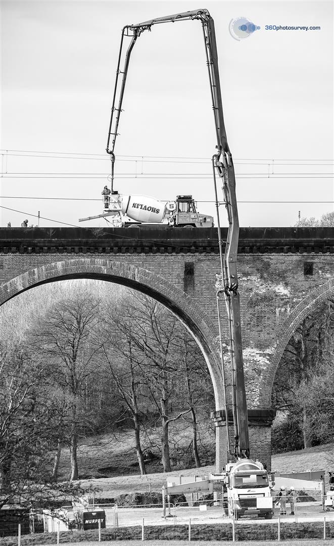
360photosurvey of London`s Southbank Centre refurbishment
360photosurvey.com has been appointed to undertake the 360 degree photographic dilapidation survey of London`s Southbank Centre Queen Elizabeth Hall and Hayward Gallery prior to the commencement of a major refurbishment project.
Aerial Progress for Peel Ports development at the Port of Salford
360photosurvey.com has undertaken its latest Aerial Progress Photo record of the Peel Ports development at the Port of Salford project using our Drone Camera system. In addition to external aerial images, the drone was also used within this huge building to provide the client with both still and video images.

Aerial photography marketing office development
Commercial Aerial Photographer 360photosurvey.com using our photo drone system to provide Apollo Office Parks with some amazing high resolution aerial photos to market their Wroxton Office Park in Oxfordshire.
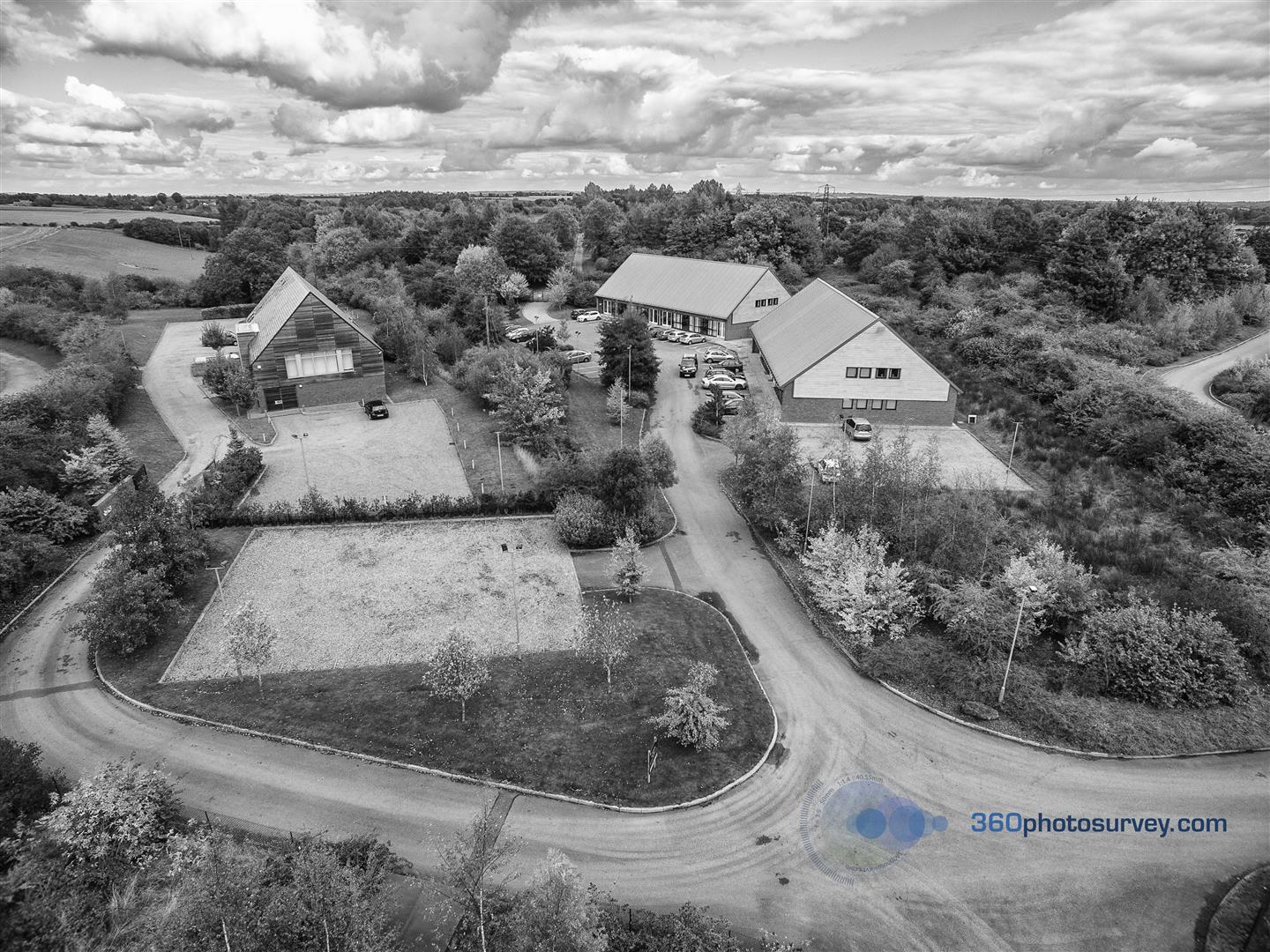
Railway viaducts dilapidation survey
360photosurvey.com has completed another huge photographic dilapidation survey – The Network Rail viaducts in Camden, London crossing the Camden Lock Village development site. The survey comprised both a 360 degree virtual tour and extensive still images providing a comprehensive record of the structures conditions before development commences on this prestigious project.
360photosurvey.com undertakes aerial progress photography for Peel Ports Development at the Port of Salford
360photosurvey.com undertakes aerial progress photographs of the Peel Ports development at the Port of Salford project using our Hi-resolution drone camera system showing the progress of this prestigious project with some stunning aerial images.
360photosurvey achieves CAA certification for commercial drone photography
360photosurvey.com is delighted to confirm having obtained CAA certification for its drone camera system licencing it to undertake commercial aerial photography.
Photographic Dilapidation Survey London
360photosurvey.com undertakes extensive photographic dilapidation survey of redevelopment site in London for the Camden Lock Village development
Historic Building Photographic Report
360photosurvey.com undertakes detailed Historic Building Photographic Report in support of Planning Application for development of a heritage site on the Isle of Man
Luxury house developer uses 360photosurvey to produce photographic survey and virtual tour of farm site
Luxury home developer appointed 360photosurvey.com to undertake a detailed photographic survey of a grade 2 farm. The survey comprised both still images and virtual tour of this remote site enabling the design team to virtually walk around the whole farm and through the buildings. The survey was a resounding success with the architects enabling them to pick up far more than had been envisaged and avoided the need for the design team to undertake further time consuming and costly site visits to this remote location. Included within the survey panoramic images were GPS tagged enabling the CGI model maker to accurately insert models of the development into the images.
360photosurvey – RIBA Affiliate Member
360photosurvey.com is delighted to announce that Chris Billington has become an RIBA Affiliate Member.
Manchester Central Libary re-opens virtual tour
 Prior to undergoing major building works at Manchester Central Library, 360photosurvey were commissioned to undertake a comprehensive photographic dilapidation survey of the building including a 360 degree virtual tour enabling people to walk around the whole building virtually and providing a definitive record for the project. In addition, we also produced an extensive photographic progress record of the project during its construction phase which includes some amazing images. This vast collection of images (circa 3 million) is to be incorporated into the North West Archives enabling the public to see how the building used to be before this extensive revamp of Central Library which opened today (22nd March 2014) to rave reviews. Congratulations to the project team from all at 360photosurvey.com
You can walk around an extract of this virtual tour of Manchester Central Library at www.360photosurvey.com.
We`re now also on Find a Photographer
Aerial Photography for property & construction projects
360photosurvey.com provides a range of aerial photographic services for property and construction projects ranging from aerial progress photos taken at regular stages during the project programme through to images for promotional use and publication.
Projects
Some of our recent projects:
- Manchester Town Hall Complex Refurbishment Grade 2*
Listed Building – Dilapidation Survey - Manchester Town Hall Grade 1 Listed Building
Photographic Survey - BMW Mini Plant, Swindon
DDA/Equality Act Access Audit
Acknowledgements
Thanks to the following for their assistance/permission to include images within this website.
- Liverpool Museum images – courtesy National Museums Liverpool
- Manchester Town Hall Complex images – courtesy Manchester City Council and Laing O`Rourke PLC
- Manchester Central Library drawings – courtesy Manchester City Council and Ryder Architecture
Taken using our pro Nikon cameras with high powered lenses from our full size fixed wing aircraft (NOT a drone – which would be in breach of CAA regulations being within the air exclusion zone of HMP Prison Durham) during our 22nd June flight operation.
#aerialphotographerCONSTRUCTIONPROJECTS #aerialphotographerNORTHEAST #aerialphotographerUK #youcantdothatwithadrone
Construction Project aerial photographer